

Strengthening El Niño has a stronger presence in the new winter outlook
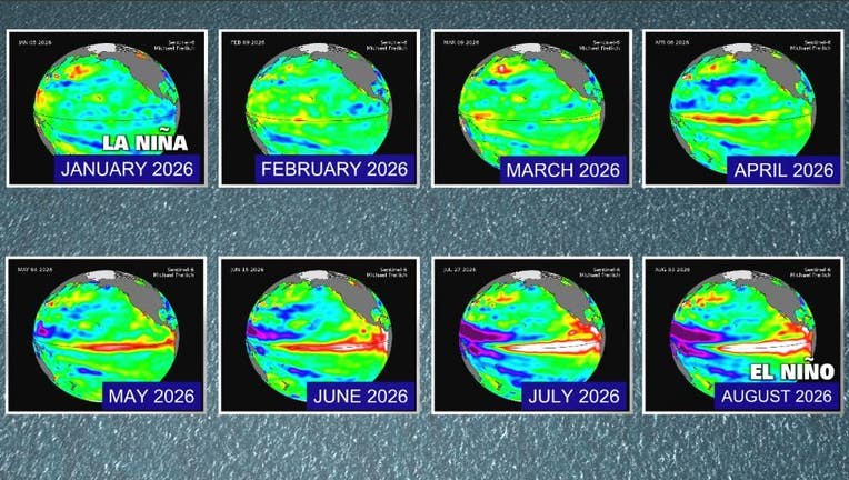
This graphic shows the rapid changes in the Equatorial Pacific (El Niño Region). Back in January of 2026 there were La Niña conditions (water temperatures cooler than average). El Niño conditions developed over the summer (brighter colors). El Niñ
OAKLAND, Calif. - On Thursday, The Climate Prediction Center posted a new set of forecast maps for the upcoming winter. The new guidance, which is updated every month, is painting a much wetter weather picture for most of California. The new forecast is consistent with a ‘Very Strong’ El Niño in the background.
What we know:
The older version, which was issued on July 16, only had a higher than normal chance of rainfall in Southern California. Equal chances for above normal/below normal precipitation blanketed most of the state.
The August 16 update is now telling a very different weather story. The new set of forecast maps for December–February has boosted the probability for above normal rainfall in the Bay Area. The highest chance for above normal rainfall is still focused in Southern California.
The key driver behind this big shift is the strengthening El Niño in the tropical Pacific. The current El Niño event has the potential to be the strongest on record in late 2026.
A few takeaways from latest update from the Climate Prediction Center:
-From late fall through winter, El Niño impacts are expected to increase slowly at first before quickly ramping up during the core winter months and especially late winter.
-Probabilities for above normal precipitation were increased significantly to above 50 percent across much of coastal California.
What's next:
The next precipitation outlook will be issued on September 17.