

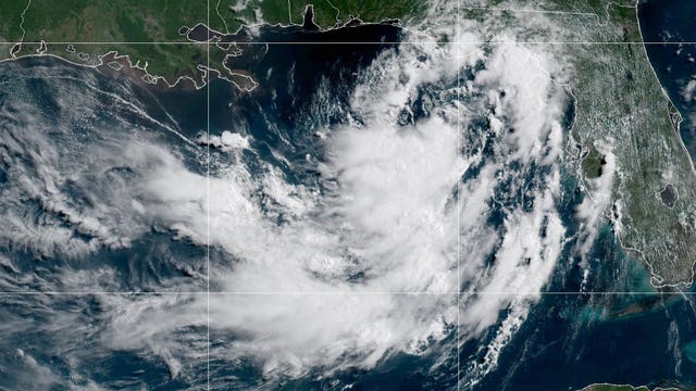

Tropical Storm Bertha moves across northern Gulf toward Texas
AN UPDATED VERSION OF THIS STORY HAS BEEN MOVED HERE.
AN UPDATED VERSION OF THIS STORY HAS BEEN MOVED HERE.
Temps to remain on toasty side
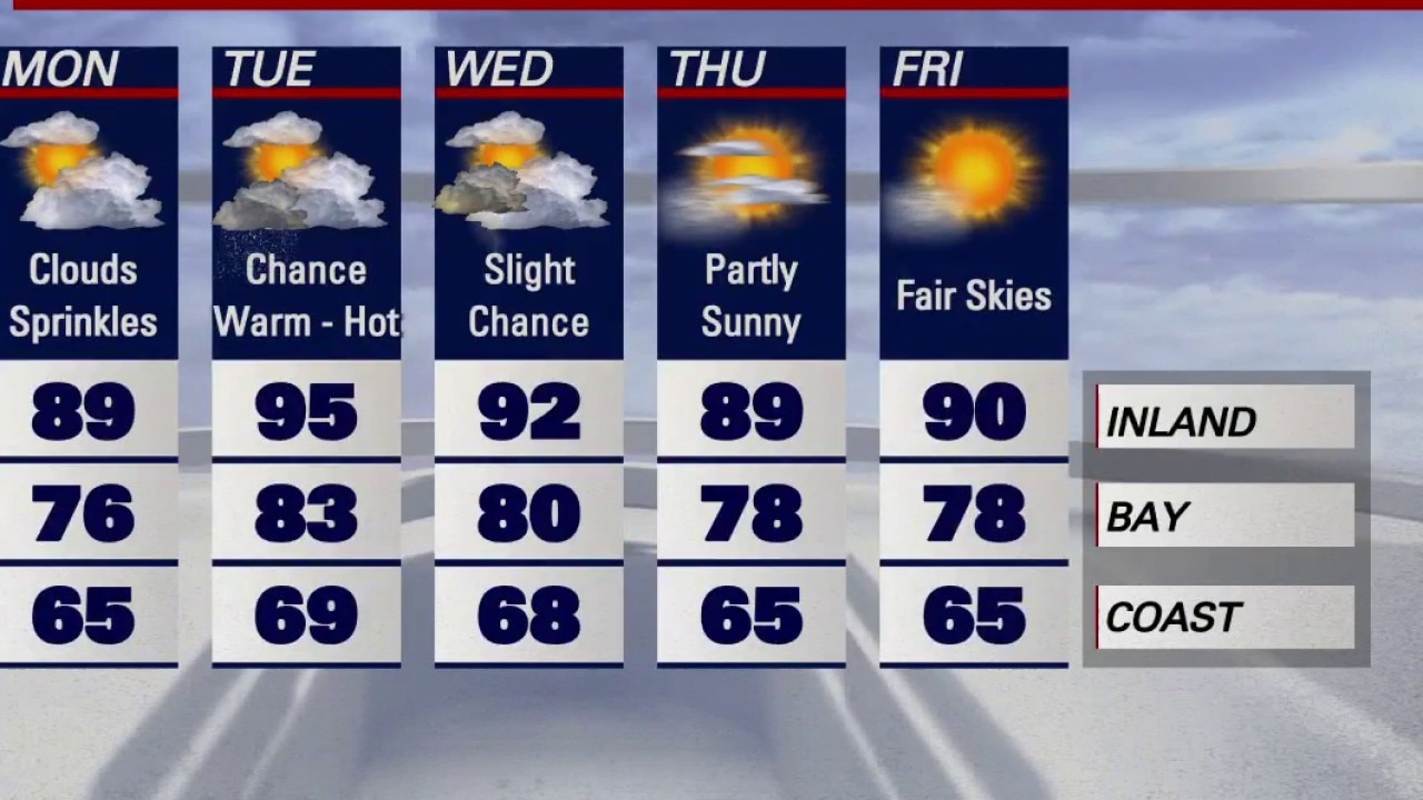
KTVU meteorologist Rosemary Orozco said temperatures are expected to climb throughout the week, with highs reaching the 90s in some areas.
KTVU meteorologist Rosemary Orozco said temperatures are expected to climb throughout the week, with highs reaching the 90s in some areas.
Watching a tropical storm
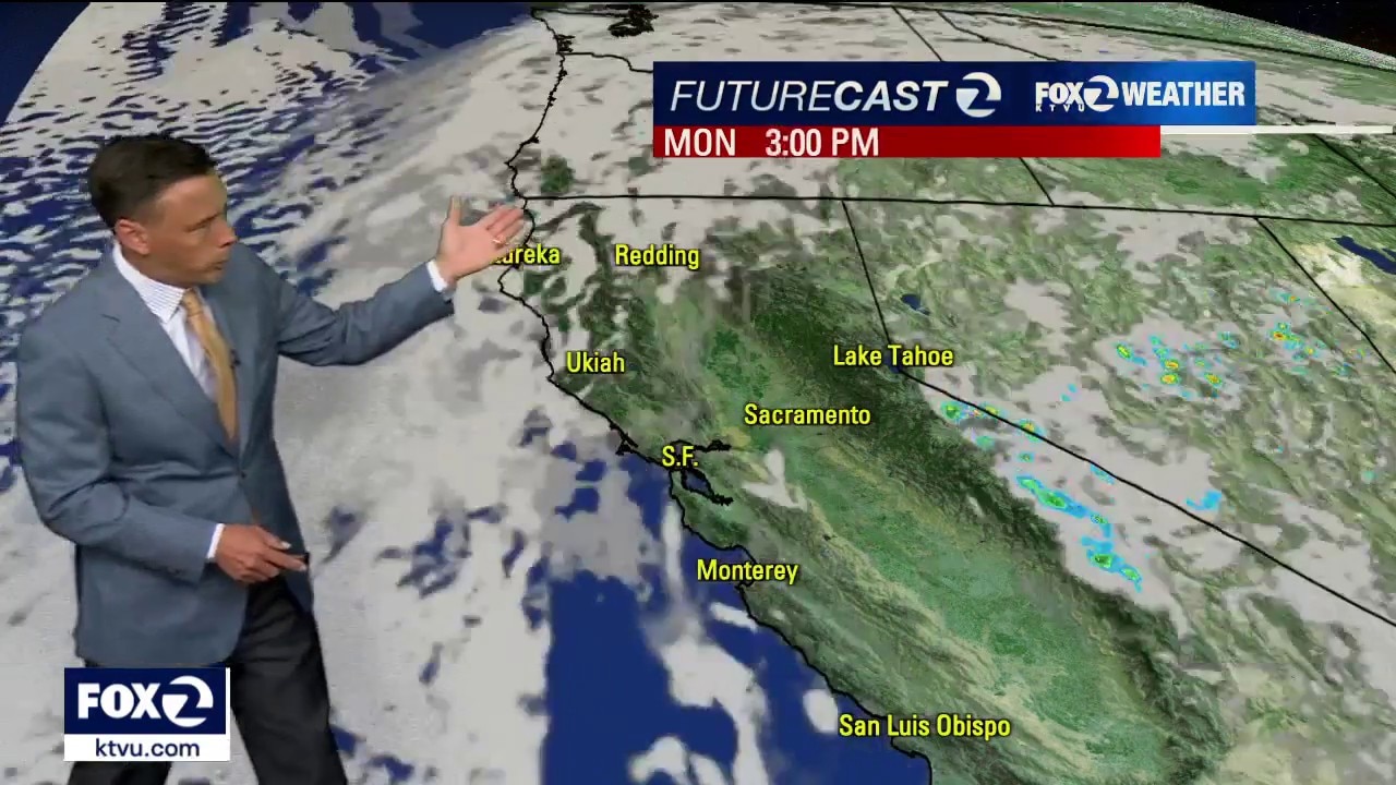
Tropical Storm Elida will weaken in the Pacific over the next few days. The associated moisture is expected to stream into the Bay Area. Your Monday forecast features partly to mostly cloudy skies. There is the slight chance of showers/thunderstorms. The thunderstorm potential bears watching. Any lightning strike could lead to fire starts. Highs should range from the low 60s to the upper 80s.
Tropical Storm Elida will weaken in the Pacific over the next few days. The associated moisture is expected to stream into the Bay Area. Your Monday forecast features partly to mostly cloudy skies. There is the slight chance of showers/thunderstorms. The thunderstorm potential bears watching. Any lightning strike could lead to fire starts. Highs should range from the low 60s to the upper 80s.
Sticky summer day
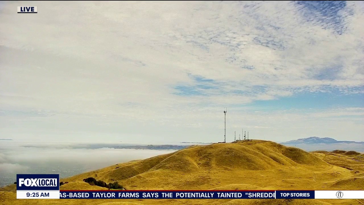
The Bay Area is getting another taste of the tropics as moisture from the Tropical Storm Elida combines with Southwest monsoon moisture. Expect warmer, muggier conditions through midweek, along with periods of low, mid, and high-level clouds. Afternoon highs will range from 60s at the coast to upper 80s inland. While widespread rain isn't expected in the Bay Area, isolated thunderstorms are possible over the Sierra and Northern California.
The Bay Area is getting another taste of the tropics as moisture from the Tropical Storm Elida combines with Southwest monsoon moisture. Expect warmer, muggier conditions through midweek, along with periods of low, mid, and high-level clouds. Afternoon highs will range from 60s at the coast to upper 80s inland. While widespread rain isn't expected in the Bay Area, isolated thunderstorms are possible over the Sierra and Northern California.
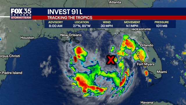

Tropical Depression 2 forms in the Gulf, NHC says
Tropical Depression 2 forms in the Gulf, NHC says
Tropical Depression 2 forms in the Gulf, NHC says
Heat and humidity gradually return
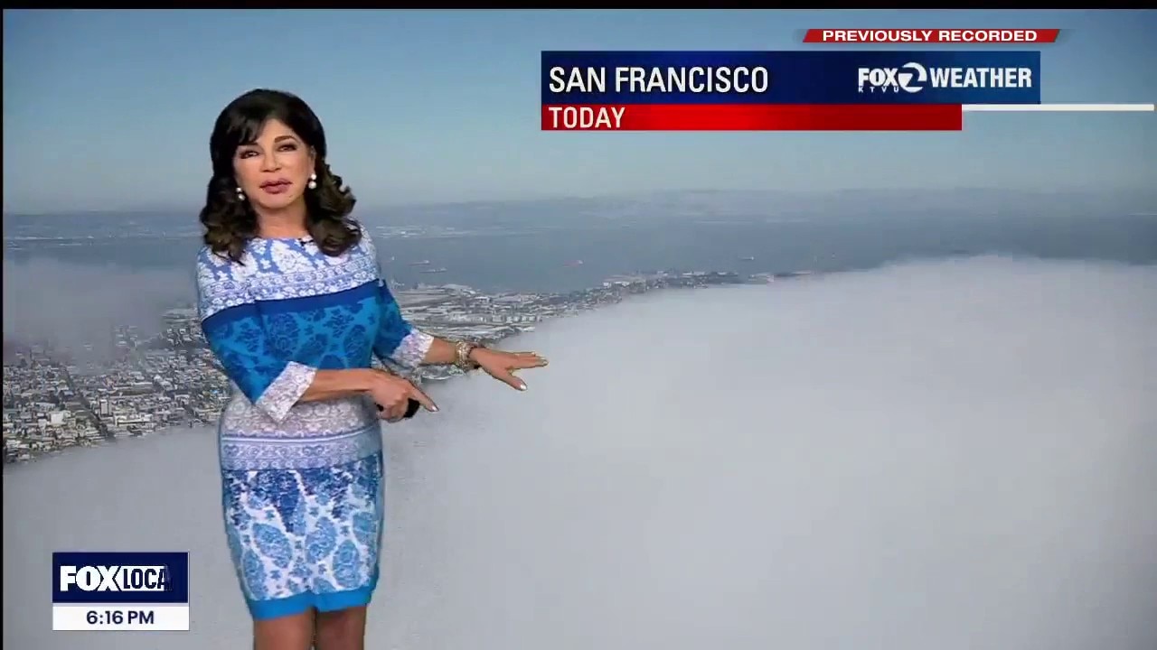
Tonight: Low clouds and fog return to the coast and bays overnight, while inland skies stay mostly clear. Comfortable overnight temperatures with a light ocean breeze. Sunday: Seasonable weather continues with morning clouds near the coast giving way to afternoon sunshine. Inland valleys warm into the 80s and low 90s, while beaches remain cool. to you increasing high clouds. Monday: A gradual warming trend begins. High pressure starts to build, bringing slightly hotter afternoons inland while the coast stays comfortable with afternoon sea breezes. Clouds streaming from the south from tropical storm Elida. Tuesday: The warmest day of the stretch. Inland temperatures climb into the 90s, with a few spots approaching the upper 90s. Humidity also begins to increase, (influenced by tropical storm Elida), making it feel a bit stickier, though the marine influence keeps coastal communities much cooler.
Tonight: Low clouds and fog return to the coast and bays overnight, while inland skies stay mostly clear. Comfortable overnight temperatures with a light ocean breeze. Sunday: Seasonable weather continues with morning clouds near the coast giving way to afternoon sunshine. Inland valleys warm into the 80s and low 90s, while beaches remain cool. to you increasing high clouds. Monday: A gradual warming trend begins. High pressure starts to build, bringing slightly hotter afternoons inland while the coast stays comfortable with afternoon sea breezes. Clouds streaming from the south from tropical storm Elida. Tuesday: The warmest day of the stretch. Inland temperatures climb into the 90s, with a few spots approaching the upper 90s. Humidity also begins to increase, (influenced by tropical storm Elida), making it feel a bit stickier, though the marine influence keeps coastal communities much cooler.


Will Canada wildfire smoke affect FIFA World Cup Final match?
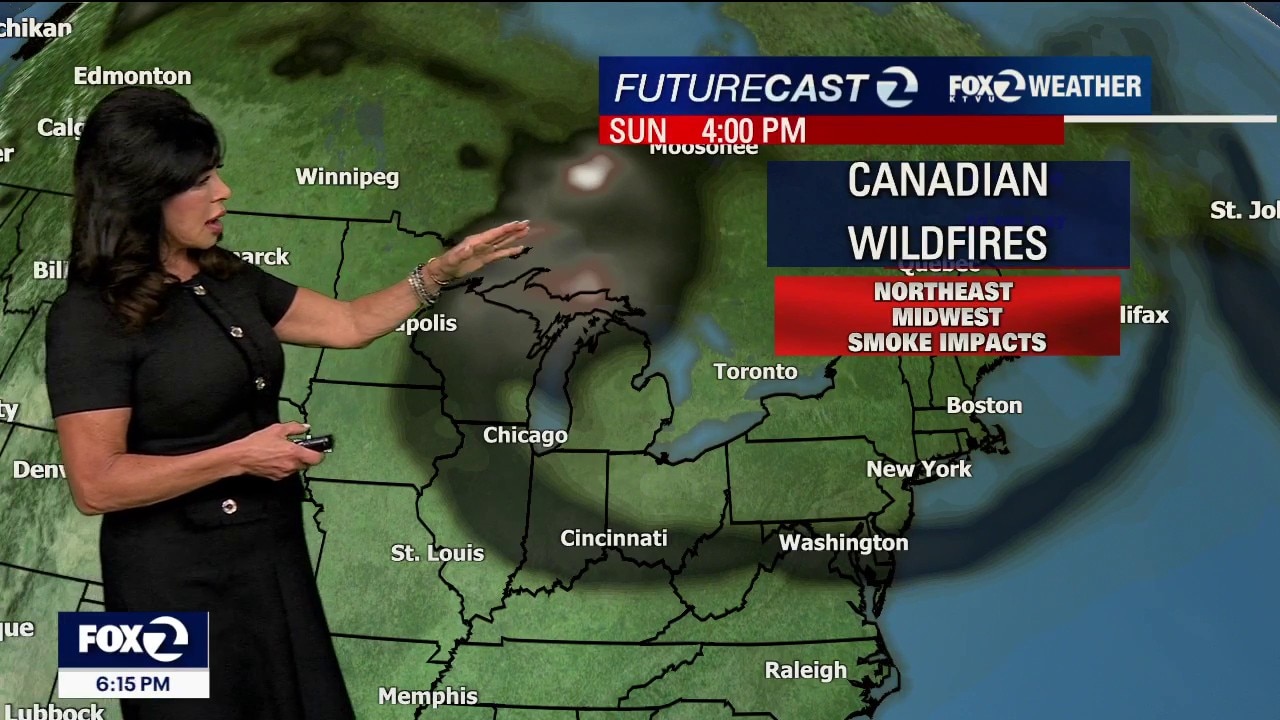
Smoke from hundreds of wildfires burning across Canada has spread into portions of the Midwest and Northeast, creating hazy skies and poor air quality from Chicago to New York City.
Smoke from hundreds of wildfires burning across Canada has spread into portions of the Midwest and Northeast, creating hazy skies and poor air quality from Chicago to New York City.
Tropical vibes are back in the Bay Area
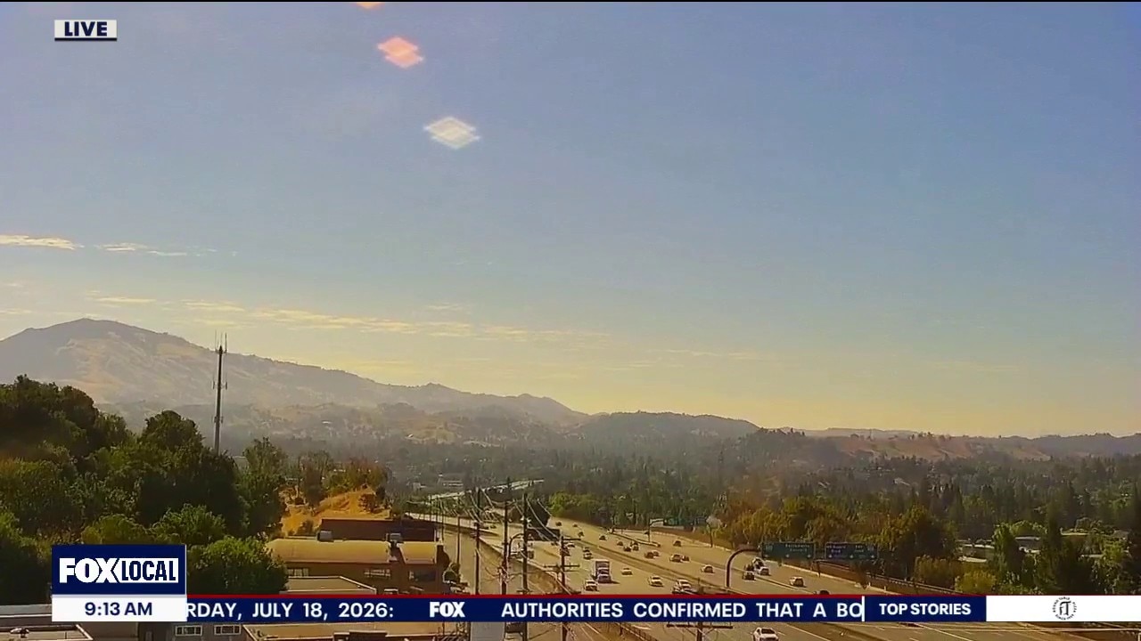
Happy weekend everyone! A combination of low clouds at the coast and tropical style clouds for all will be joining us. The threat of thunderstorms are slim to none this time around. Afternoon highs range from 60s at the coast to upper 80s inland.
Happy weekend everyone! A combination of low clouds at the coast and tropical style clouds for all will be joining us. The threat of thunderstorms are slim to none this time around. Afternoon highs range from 60s at the coast to upper 80s inland.
Tracking smoke, a tropical storm, higher humidity and temperatures!
1. Weekend Weather Guide The Cool Down A deeply entrenched storm trough has pulled in a strong marine layer, dropping temperatures up close to 10 seasonal normal averages. Cool for some, refreshing for others! The Trend: Highly comfortable, cool and humid conditions will remain locked in place straight through early next week. 2. Microclimate Fog Timeline (Saturday – Sunday) Tonight: The marine layer has grown to a sturdy 1,200 feet deep . Thick coastal stratus will rush back inland this evening, reaching well inland into the far East Bay and North Bay valleys by early Saturday morning. Saturday Afternoon: Clouds will make their typical, orderly retreat back to the immediate beaches by mid-to-late morning. Saturday afternoon will feature beautiful, mostly sunny skies with below-average temperatures Through Sunday Night: Expect a complete "rise and repeat" of the overnight fog intrusion with increasing high clouds from Elida streaming in. Beautiful evening sunset inland! Will watch for the chance of dry lightning or tstorms into Tuesday.
1. Weekend Weather Guide The Cool Down A deeply entrenched storm trough has pulled in a strong marine layer, dropping temperatures up close to 10 seasonal normal averages. Cool for some, refreshing for others! The Trend: Highly comfortable, cool and humid conditions will remain locked in place straight through early next week. 2. Microclimate Fog Timeline (Saturday – Sunday) Tonight: The marine layer has grown to a sturdy 1,200 feet deep . Thick coastal stratus will rush back inland this evening, reaching well inland into the far East Bay and North Bay valleys by early Saturday morning. Saturday Afternoon: Clouds will make their typical, orderly retreat back to the immediate beaches by mid-to-late morning. Saturday afternoon will feature beautiful, mostly sunny skies with below-average temperatures Through Sunday Night: Expect a complete "rise and repeat" of the overnight fog intrusion with increasing high clouds from Elida streaming in. Beautiful evening sunset inland! Will watch for the chance of dry lightning or tstorms into Tuesday.


7.3 earthquake strikes off coast of southern Mexico, prompts tsunami warning
The National Weather Service issued a tsunami threat warning, but said there was no threat to any California communities.
The National Weather Service issued a tsunami threat warning, but said there was no threat to any California communities.


Texas Hill Country recovers from flooding that killed 2 as heavy rain continues elsewhere
A long recovery begins after historic South Central Texas rains trigger widespread Texas Hill Country flooding, leaving two dead in Kerr and Uvalde counties.
A long recovery begins after historic South Central Texas rains trigger widespread Texas Hill Country flooding, leaving two dead in Kerr and Uvalde counties.
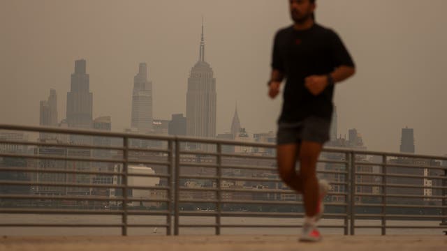

What is Code Purple air quality? What Code Orange, Red and Purple mean
Air quality alerts can change quickly during wildfire smoke events. Here’s what Code Orange, Code Red, Code Purple and Code Maroon mean, and when you should limit time outside.
Air quality alerts can change quickly during wildfire smoke events. Here’s what Code Orange, Code Red, Code Purple and Code Maroon mean, and when you should limit time outside.
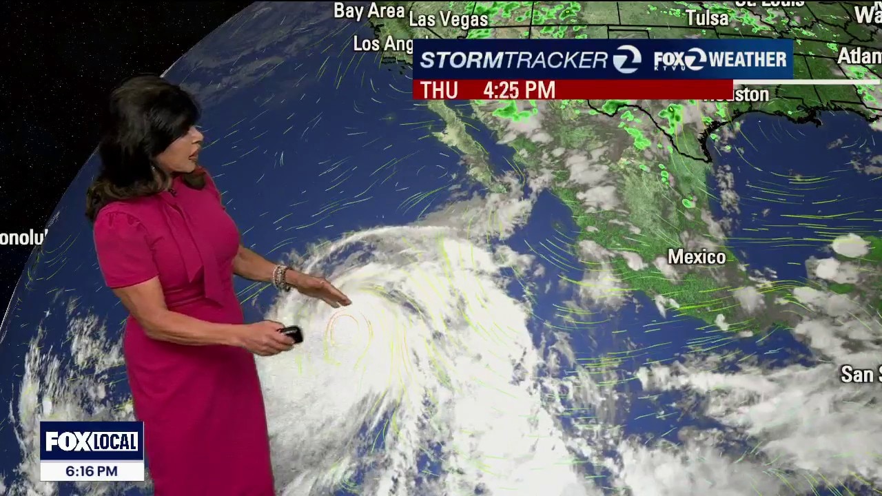
Fog and Friday Freshness
• Sunday sky watching: Tropical moisture from Hurricane Elida (well offshore and not a direct threat to California) combines with monsoon moisture to increase mid and high clouds Sunday into early next week. At this point, the forecast favors more clouds rather than rain, since the atmosphere still lacks enough instability for thunderstorms.
• Sunday sky watching: Tropical moisture from Hurricane Elida (well offshore and not a direct threat to California) combines with monsoon moisture to increase mid and high clouds Sunday into early next week. At this point, the forecast favors more clouds rather than rain, since the atmosphere still lacks enough instability for thunderstorms.


Texas flooding: 2 reported deaths in catastrophic Hill Country flooding
Catastrophic flash flooding across the Texas Hill Country has left two people dead, Gov. Abbott reported Thursday.
Catastrophic flash flooding across the Texas Hill Country has left two people dead, Gov. Abbott reported Thursday.


'More water than last year’s flood': Texas Hill Country dealing with another devastating flood
A 65-year-old man died after historic Texas Hill Country flash flooding triggered rescues and evacuations across Kerr, Uvalde, and Kendall counties following more than 28 inches of rain.
A 65-year-old man died after historic Texas Hill Country flash flooding triggered rescues and evacuations across Kerr, Uvalde, and Kendall counties following more than 28 inches of rain.
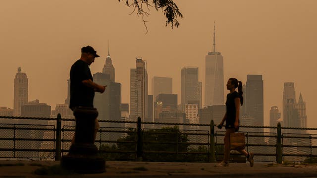

Map: See where wildfire smoke is thickest across US
Heavy smoke from Canadian wildfires spread across large parts of the United States on Thursday, blanketing areas from the Great Lakes to portions of the East Coast.
Heavy smoke from Canadian wildfires spread across large parts of the United States on Thursday, blanketing areas from the Great Lakes to portions of the East Coast.
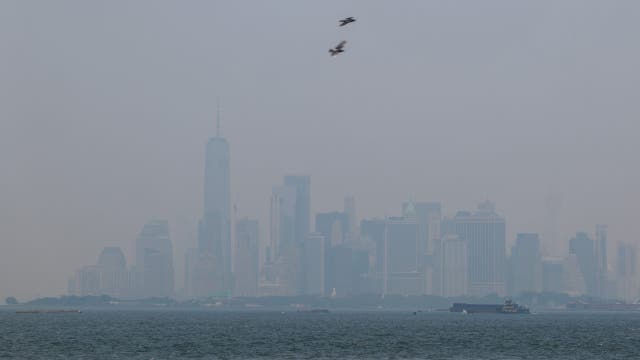

Map: Where are the Canada wildfires burning?
According to the Canadian government, there are more than 850 active wildfires across Canada as of Thursday. Winds are carrying the smoke southeast from Ontario down to the Midwest and Northeast.
According to the Canadian government, there are more than 850 active wildfires across Canada as of Thursday. Winds are carrying the smoke southeast from Ontario down to the Midwest and Northeast.

Cooler but high fire danger remains
A massive weather transition begins tonight as the current interior heat wave is replaced by an expanding, 1,500-foot marine layer by the weekend. This shift brings relief from hot temperatures, but introduces a brand-new wildfire lightning watch for early next week. Thursday Forecast • The Big Drop: The extreme heat wave officially ends tomorrow. A deep Pacific Northwest storm trough is moving toward the coast, forcing a surge of cooler ocean air inland.. • The Numbers: Temperatures across the interior will drop significantly, falling right back to comfortable, mid-July seasonal averages. Thursday's span from 63 at the Coast to 90 Inland.. Critical Fire Danger & Weekend Wind • Tonight's Threat: Elevated fire weather conditions remain critical across the interior and higher terrain through Thursday night. Mountain ridges are enduring roasting heat up to 20 degrees above normal, paired with bone-dry humidity.. • The Wind: Strong, punchy afternoon and evening onshore winds will remain breezy through Friday, howling through mountain passes like the Altamont Pass and Salinas Valley. Avoid any outdoor activity that could spark a flame. Winds 10-20 mph with occasional gusts to 30 mph.. Long-Range Outlook: Renewed Lightning Watch Next Week: A strong onshore wind pattern will lock in through the weekend, deepening the marine fog layer to a steady 1,500 feet. Expect near-to-below-normal temperatures and gray morning overcast that retreats to the beaches by lunchtime. • The Tropical Shift: We are monitoring a heavy pulse of tropical monsoon moisture surging north around a high-pressure system. • Dry Lightning Threat: While the heaviest threat of severe thunderstorms has shifted slightly eastward over the Sierra Nevada for Sunday and Monday, a thick deck of mid-to-high level tropical clouds will stream over the Bay Area. Any high-based storm that develops over the parched local hills will trigger dangerous dry lightning strikes capable of sparking sudden wildfires
A massive weather transition begins tonight as the current interior heat wave is replaced by an expanding, 1,500-foot marine layer by the weekend. This shift brings relief from hot temperatures, but introduces a brand-new wildfire lightning watch for early next week. Thursday Forecast • The Big Drop: The extreme heat wave officially ends tomorrow. A deep Pacific Northwest storm trough is moving toward the coast, forcing a surge of cooler ocean air inland.. • The Numbers: Temperatures across the interior will drop significantly, falling right back to comfortable, mid-July seasonal averages. Thursday's span from 63 at the Coast to 90 Inland.. Critical Fire Danger & Weekend Wind • Tonight's Threat: Elevated fire weather conditions remain critical across the interior and higher terrain through Thursday night. Mountain ridges are enduring roasting heat up to 20 degrees above normal, paired with bone-dry humidity.. • The Wind: Strong, punchy afternoon and evening onshore winds will remain breezy through Friday, howling through mountain passes like the Altamont Pass and Salinas Valley. Avoid any outdoor activity that could spark a flame. Winds 10-20 mph with occasional gusts to 30 mph.. Long-Range Outlook: Renewed Lightning Watch Next Week: A strong onshore wind pattern will lock in through the weekend, deepening the marine fog layer to a steady 1,500 feet. Expect near-to-below-normal temperatures and gray morning overcast that retreats to the beaches by lunchtime. • The Tropical Shift: We are monitoring a heavy pulse of tropical monsoon moisture surging north around a high-pressure system. • Dry Lightning Threat: While the heaviest threat of severe thunderstorms has shifted slightly eastward over the Sierra Nevada for Sunday and Monday, a thick deck of mid-to-high level tropical clouds will stream over the Bay Area. Any high-based storm that develops over the parched local hills will trigger dangerous dry lightning strikes capable of sparking sudden wildfires


Hotter nights are costing you sleep: Here's how much
Hotter nights are making it harder for people around the world to get a good night's sleep. A new analysis reveals which cities are impacted the most.
Hotter nights are making it harder for people around the world to get a good night's sleep. A new analysis reveals which cities are impacted the most.
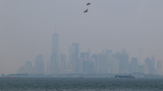

Wildfire smoke chokes skies in Midwest and Northeast
Smoke from wildfires in Canada and Minnesota is blanketing multiple northern states with smoke and ash, leaving millions of people exposed to dangerous levels of air pollution.
Smoke from wildfires in Canada and Minnesota is blanketing multiple northern states with smoke and ash, leaving millions of people exposed to dangerous levels of air pollution.