Red Flag warning takes effect in more Bay Area counties

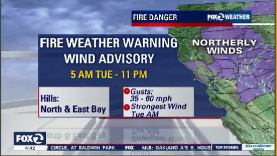
Fire weather warning and wind advisory for most of the Bay Area
Fire weather warning and wind advisory for most of the Bay Area
OAKLAND, Calif. - Hot temperatures are expected to continue in the Bay Area Tuesday, with a slight cooling trend throughout the rest of the week, according to the National Weather Service. Widespread haze will persist through Tuesday night.
San Francisco will be sunny with highs in the mid-80s, before cooling to the high 50s at night. Winds will reach 9 to 16 mph, with occasional gusts as high as 21 mph.
Walnut Creek continues to be sunny and hot Tuesday, with a high near 104. Night skies will be clear with lows in the low 60s. Winds throughout the day will be 6 to 15 mph with gusts reaching 25 mph.
Santa Clara will be sunny with highs in the mid-90s and lows in the low 60s. Six to 14 mph winds are expected throughout the day, with gusts up to 21 mph.
Sonoma will reach highs over 100, before dropping to the upper 50s at night. Strong, 24 to 32 mph winds are expected throughout the day and night, with gusts as high as 44 mph.
Red Flag warnings remain in effect until 8 a.m. Wednesday for Sonoma, Napa, Marin, Contra Costa, Alameda Counties, and through noon for parts of Solano County. A Red Flag warning in San Mateo and Santa Clara Counties go from 10 a.m. Tuesday to 8 a.m. Wednesday.
Bay City News contributed to this report.