

Bay Area storm timeline: Coldest system of the season sweeps through

Rain pummels Bay Area: How long the storm conditions will continue
Heavy rain has arrived across the Bay Area. Rosemary Orozco explains how long the storm conditions will stick around and what to expect on the roads this week.
OAKLAND, Calif. - A dynamic weather system rolled through the Bay Area this week, bringing heavy rain, a potent cold front, and thunderstorms to the region.
Forecasters describe the system as the coldest storm of the season, with unsettled conditions expected to linger through much of the week.
Here is the storm timeline for the remainder of the week:
Tuesday
What we know:
Intense rain moved east Tuesday afternoon, leaving cold and unsettled scattered showers in its wake.
The National Weather Service reported approximately 500 lightning strikes between Tuesday morning and noon as isolated thunderstorms persisted.
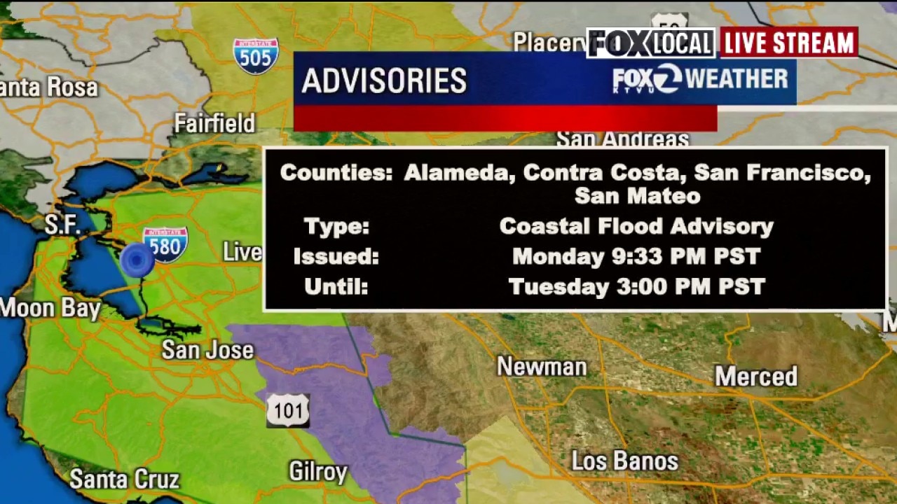
Brief downpours triggered localized flooding across San Francisco, Alameda, and Contra Costa counties. A flood advisory for low-lying areas remained in effect through 1 p.m. Stronger storm cells produced small hail, while a storm surge combined with spring tides created coastal flooding for areas adjacent to the San Francisco Bay.
Moderate to heavy rain impacted the East Bay, specifically along Highway 24 from Orinda to the Interstate 680 corridor, including Alamo and San Ramon. Heavy showers also stretched across the East Bay Hills along Highway 4, affecting Antioch, Discovery Bay, and Brentwood.
Storm series rolls through Bay Area
A series of wet weather systems are rolling through the Bay Area bringing heavy rain.
The system is fueled by cold air dropping out of the Gulf of Alaska. As this air moves over the relatively warmer Pacific Ocean, it creates an unstable environment and plummeting temperatures. Snow levels have dropped to near 3,000 feet, with a rain-snow mix reported on Mount Saint Helena, Mount Hamilton, and Mount Diablo. Winter weather advisories are in place for Lake County and the Santa Clara Hills.
While the most intense activity occurred Tuesday morning, the front continues to move east, shifting its energy toward the Sierra Nevada, where snow is expected to pile up.
Wednesday
What's next:
Scattered showers will continue into Wednesday as the cold air mass settles over the region. Overnight lows are expected to drop into the upper 20s and low 30s in inland areas. A cold weather advisory has been issued for the North Bay hills and valleys from midnight until 9 a.m. Wednesday.
Thursday
The forecast calls for lingering morning showers followed by a brief reprieve. While most of the day will remain dry, there is a slight chance of rain.
Friday and the weekend
Unsettled weather remains a threat through the end of the week. Friday carries a slight chance of rain, with precipitation becoming more likely on Saturday. Another round of wet weather is possible Sunday and into early next week.
The Source: This story was written based on information from Meterologist Rosemary Orozco and the National Weather Service.