

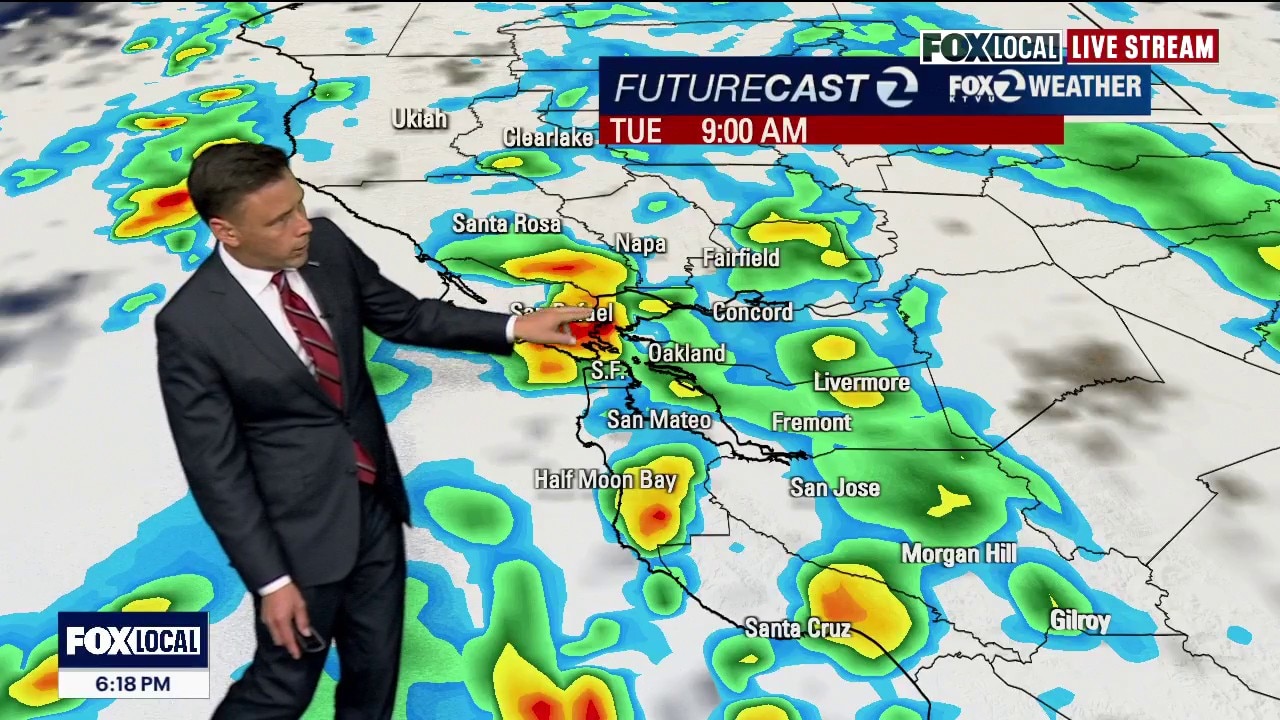
Broad band of steady rain moving through Bay Area
Chance of thunderstorms
A cold April storm will continue to impact the Bay Area. Showers are expected to move across region Tuesday morning. Thunderstorm chances will also be increasing. Some of the storm cells could produce hail. The shower threat will remain in the Wednesday forecast. Sunshine returns later in the week.
OAKLAND, Calif. - A broad band of steady rain on Tuesday is moving through the region, bringing widespread rainfall to the San Francisco Bay Area, Monterey Bay, and nearby inland counties.
Scattered showers
The heaviest, most consistent rain is gradually shifting eastward, with lighter, scattered showers beginning to follow behind it in coastal areas like western Sonoma County and Point Reyes.
What's next:
The rain is expected to continue overnight but should clear out of the Bay Area by the Wednesday morning commute, making way for improving conditions.
Overnight temperatures will be cool, generally in the mid-40s to mid-50s, while daytime highs range from the upper 50s to mid-60s in lower elevations and cooler 40s to low 50s in higher terrain.