


Clouds, cool, few showers
Today will see clouds, cool weather and possible showers. Temps in the 50s.
Today will see clouds, cool weather and possible showers. Temps in the 50s.


A stretch of unsettled weather is on the way
Mostly cloudy, cool and breezy tonight ahead of a new storm that will bring light showers to the bay area on Tuesday. Additional wet weather is slated for Wednesday and Thursday.
Mostly cloudy, cool and breezy tonight ahead of a new storm that will bring light showers to the bay area on Tuesday. Additional wet weather is slated for Wednesday and Thursday.


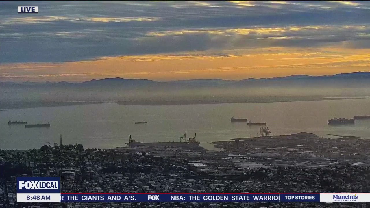
Cool, low clouds
Today will be cool and cloudy. Highs in the low 60s.
Today will be cool and cloudy. Highs in the low 60s.


Potpourri of weather for your Sunday
Happy Sunday Everyone. Scattered showers, slight risk of thunderstorms and rain, snow mix over Mt. Hamilton this morning hour. The wet weather will taper off to pop showers, a slight risk of thunderstorms and rainbows for the afternoon. Wishing you an enjoyable day. ~Rosemary
Happy Sunday Everyone. Scattered showers, slight risk of thunderstorms and rain, snow mix over Mt. Hamilton this morning hour. The wet weather will taper off to pop showers, a slight risk of thunderstorms and rainbows for the afternoon. Wishing you an enjoyable day. ~Rosemary


Showers back in the forecast
Our recent warm stretch is now history. The weekend started off with cooler temperatures, Now, we are tracking a cooler system that will boost shower chances in the Sunday forecast. A bit of instability could also lead to some scattered thunderstorms, The forecast remain cool and unsettled for much of the upcoming week. Have a great Sunday! -Mark
Our recent warm stretch is now history. The weekend started off with cooler temperatures, Now, we are tracking a cooler system that will boost shower chances in the Sunday forecast. A bit of instability could also lead to some scattered thunderstorms, The forecast remain cool and unsettled for much of the upcoming week. Have a great Sunday! -Mark


Winter is back!
Cloudier, much cooler and a chance of showers increasing today into Sunday. Afternoon highs today will range from upper 50s to upper 60s. Have a great day ~ Rosemary
Cloudier, much cooler and a chance of showers increasing today into Sunday. Afternoon highs today will range from upper 50s to upper 60s. Have a great day ~ Rosemary


Rain returns this weekend
Low clouds will resurface Saturday morning. Partly cloudy skies are expected later in the day. Rain chances will be increasing Saturday evening. A cool system will produce showers in the Sunday forecast. There is the chance of a few thunderstorms as well. A High Surf Advisory is in effect this weekend.
Low clouds will resurface Saturday morning. Partly cloudy skies are expected later in the day. Rain chances will be increasing Saturday evening. A cool system will produce showers in the Sunday forecast. There is the chance of a few thunderstorms as well. A High Surf Advisory is in effect this weekend.


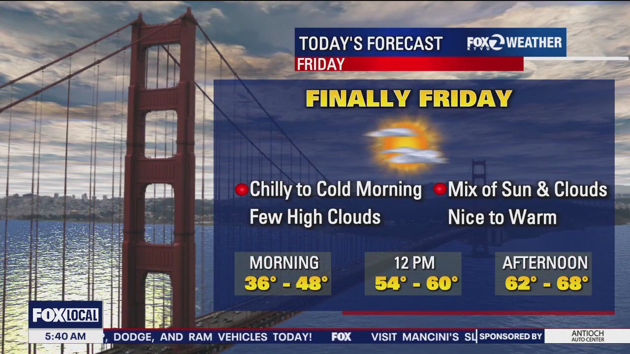
Cooler temperatures on Friday
Your Friday forecast features partly cloudy skies and cooler temperatures. Showers chances will be increasing Saturday evening - Sunday.
Your Friday forecast features partly cloudy skies and cooler temperatures. Showers chances will be increasing Saturday evening - Sunday.


Mild, breezy
Today will be mild and breezy, with temps in the 70s.
Today will be mild and breezy, with temps in the 70s.


Warm forecast
The Bay Area warm stretch continues! Above average temperatures will highlight our Thursday forecast. Partly sunny skies are expected. Highs should range from the upper 60s to the upper 70s. Rain chances will be increasing Sunday.
The Bay Area warm stretch continues! Above average temperatures will highlight our Thursday forecast. Partly sunny skies are expected. Highs should range from the upper 60s to the upper 70s. Rain chances will be increasing Sunday.


Warm, 70s
Today will be warm with temps in the 70s.
Today will be warm with temps in the 70s.


Afternoon highs peak in the 70s Wednesday
Patchy fog and chilly temps. will kick off Wednesday, followed by the warmest afternoon of the week. An increase in clouds arrives later in the week with a chance for showers on the weekend.
Patchy fog and chilly temps. will kick off Wednesday, followed by the warmest afternoon of the week. An increase in clouds arrives later in the week with a chance for showers on the weekend.


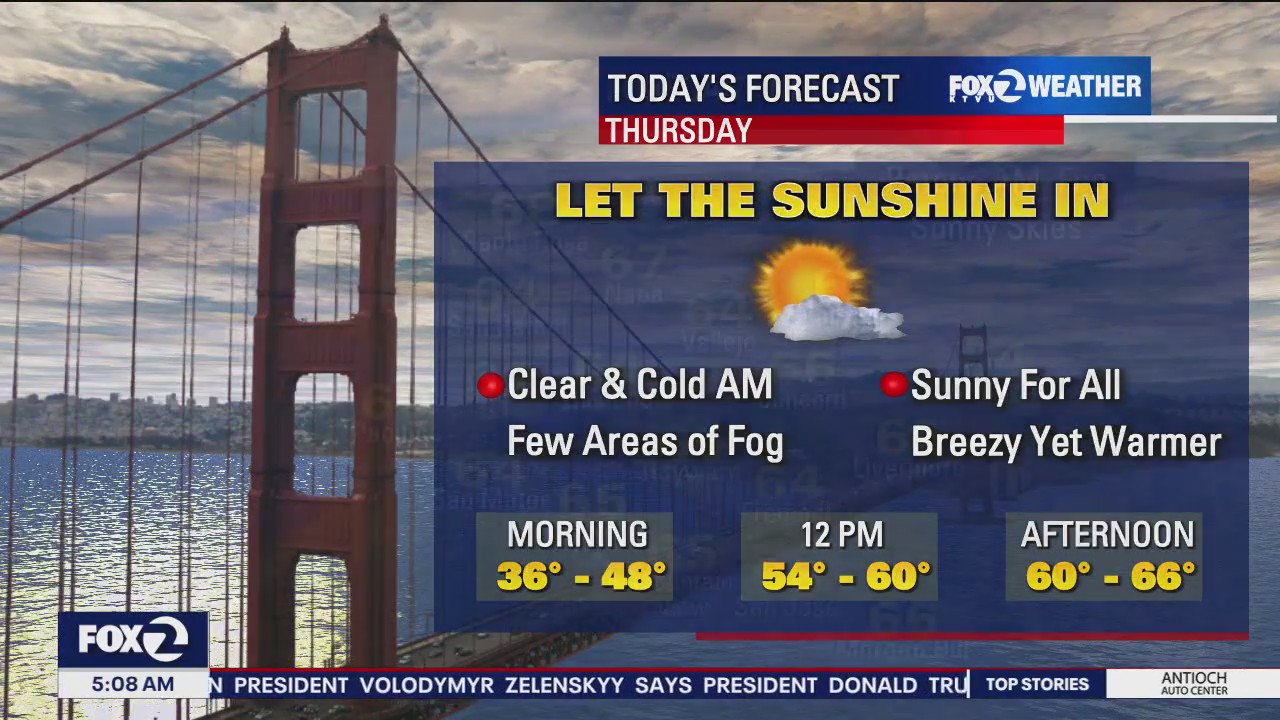
Fog lifts, then sun
After morning fog, the sun will peer through.
After morning fog, the sun will peer through.


Warmer afternoons on the way
Following a partly cloudy, chilly start to your Tuesday, afternoon highs will soar into the upper 60s to low 70s for the afternoon. Closer to the coast we do have an alert for increased rip currents and sneaker waves until early Wednesday morning.
Following a partly cloudy, chilly start to your Tuesday, afternoon highs will soar into the upper 60s to low 70s for the afternoon. Closer to the coast we do have an alert for increased rip currents and sneaker waves until early Wednesday morning.


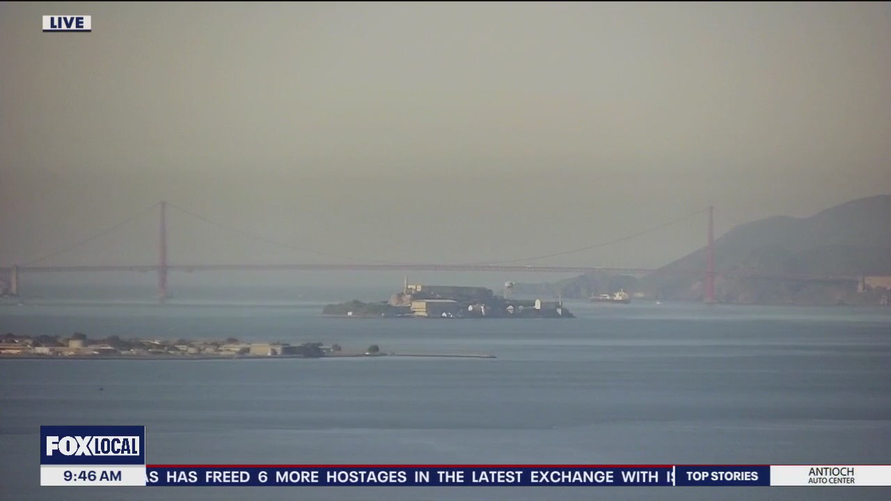
Mostly cloudy
Today will be mostly cloudy with temps in the 60s.
Today will be mostly cloudy with temps in the 60s.

Spring preview continues
It's a partly sunny, warmer start, with a few passing showers joining us as well. Afternoon highs will soar into the upper 60s - low 70s under a mix of sun and clouds. Happy Sunday ~ Rosemary
It's a partly sunny, warmer start, with a few passing showers joining us as well. Afternoon highs will soar into the upper 60s - low 70s under a mix of sun and clouds. Happy Sunday ~ Rosemary


Sunday clouds
An Atmospheric River will remain anchored to the north of the Bay Area. Your Sunday forecast mostly cloudy skies. There is the slight chance of a few sprinkles in the North Bay. The mild stretch continues. Highs should range from the low 60s to the low 70s.
An Atmospheric River will remain anchored to the north of the Bay Area. Your Sunday forecast mostly cloudy skies. There is the slight chance of a few sprinkles in the North Bay. The mild stretch continues. Highs should range from the low 60s to the low 70s.

Spring is in the air
Spring vibes to join our weekend vibes. Cool mornings will turn to unseasonably mild afternoons. Upper 60s to low 70s under partly sunny skies can be expected for today. A slight chance of light showers is possible in the north bay tonight.
Spring vibes to join our weekend vibes. Cool mornings will turn to unseasonably mild afternoons. Upper 60s to low 70s under partly sunny skies can be expected for today. A slight chance of light showers is possible in the north bay tonight.

Mix of sun and clouds
There will be a mix of sun and clods with temps in the 60s.
There will be a mix of sun and clods with temps in the 60s.

Sunny, warmer
Today will be sunny and warm.
Today will be sunny and warm.