

Bay Area weather: Cold storm brings steady rain, thunderstorm threat
Rainy, windy conditions in the Bay could last until next week
The pair of storm systems bearing down on the Bay Area is prompting coastal flood advisories, wind advisories and winter storm warnings.
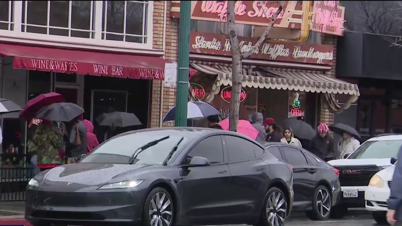
OAKLAND, Calif. - After long stretches of dry weather this winter, a cold storm swept across the Bay Area, bringing steady rain, gusty winds and the threat of minor flooding.
Storm system moves in
What we know:
Chief Meteorologist Mark Tamayo spoke with Dylan Flynn, lead forecaster at the National Weather Service’s San Francisco Bay Area office. As an area of low pressure wobbles in the Pacific, bands of moisture are expected to move into the region. Flynn said the entire Bay Area will continue to receive steady rainfall.
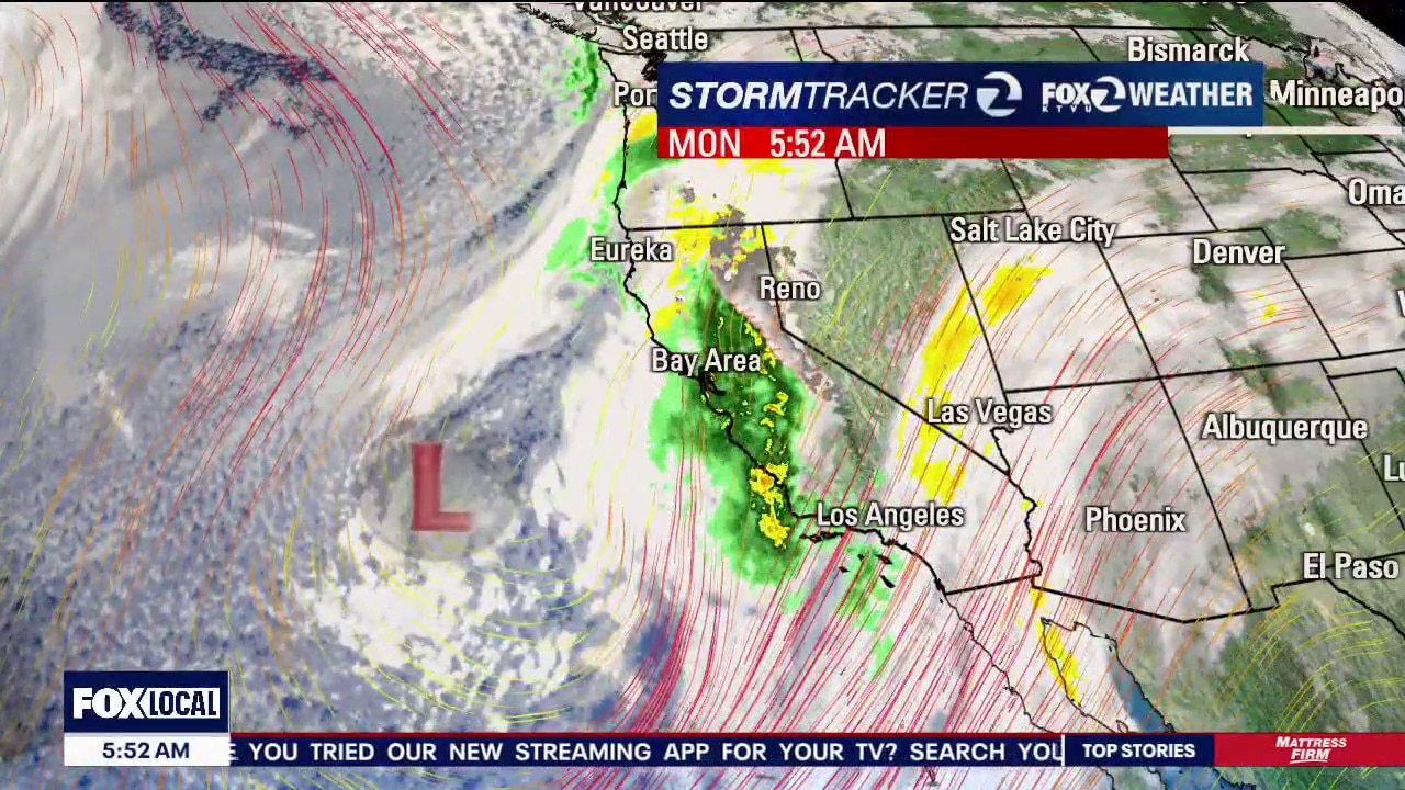
Pair of storm systems bearing down on the Bay Area
Scattered rains are expected throughout the Bay for most of the coming week.
The most active day, with the potential for thunderstorms, is expected to be Tuesday. Compared with the severe weather event last Christmas, the tornado threat with this system is on the lower end of the spectrum.
Featured

Nancy Guthrie: TMZ receives another email demanding money in exchange for suspect's identity
TMZ says they've received another email from a man demanding money in exchange for the identity of the person responsible for the alleged kidnapping of Nancy Guthrie.
Flooding concerns
Why you should care:
During this stormy stretch, the National Weather Service expects to issue several flood advisories for minor, nuisance flooding as rain moves through the area.
Forecasters are also monitoring the potential for flooding due to king tides Monday and Tuesday, which could exacerbate coastal and bayshore impacts.
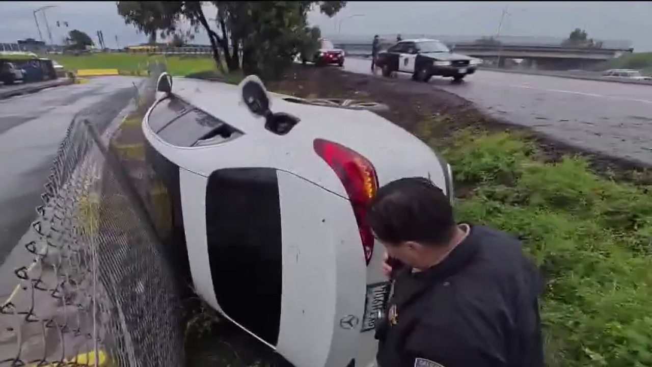
Wet roads across Bay Area lead to crashes as CHP urges drivers to slow down
The CHP says slick conditions and standing water are contributing to spinouts and collisions as another round of rain moves through the Bay Area.
In Sonoma County, the Sonoma Creek overflowed into Schellville, just south of the town of Sonoma. This is where two major Wine Country commuter and tourist routes – Highways 12 and 121 intersect and in winter, often sees flooding when intense rains fall.
"Everything works fine until the tide comes in," said David Deming, a Sonoma County resident. "Tide comes in, it comes up about six feet, pushes all the water back into Schellville here and that's been going on here. I been here since '72. It's just something that's gonna keep happening."
North of Santa Rosa, tributaries of the Russian River will be swollen as more waves of rain arrive.
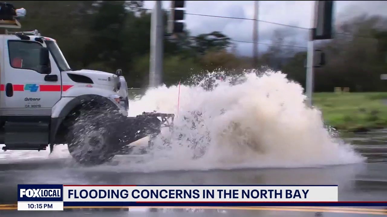
Flooding concerns in the North Bay
There are flooding concerns associated with this latest round of rain in the North Bay.
CHP urges drivers to slow down
A solo crash on northbound Interstate 880 near the 66th Avenue on-ramp around 4 p.m. Monday highlighted the risks on slick roads. CHP officers placed flares along the roadway and directed traffic around the scene as drivers moved through the area cautiously. Authorities said the driver was able to safely get out of the vehicle. It's unclear whether anyone was injured.
Officials say incidents like this are becoming more common during the latest round of storms.
"As these storms have rolled through, and as we look ahead to the storms coming in, I don’t anticipate we’re going to slow down at all," said Sgt. Andrew Barclay of the CHP Golden Gate Division. "One of the biggest things we need people to do right now is slow down out there on these wet roads. So for us, it’s been a lot of vehicle spinouts, a lot of our typical wet weather crashes, but also a lot of debris that’s washing into the roadways, flooding in certain areas."
CHP is urging drivers to make sure their vehicles are ready for winter conditions, including checking tire tread and ensuring windshield wipers are functioning properly.
Tow companies say they’ve also seen an increase in calls as drivers encounter flooded streets and mechanical issues caused by water.
"People drive through the water," said Jabalie Altes, an operator with Ted & Joe’s Towing in Alameda. "They don’t realize how bad it is to drive through standing water, even if it’s a matter of inches. When you drive your car through it, it splashes up, and it gets all the electrical components wet, and it might shut off on you, and then now you're stuck in anywhere from six inches to a foot of water."
Cold air, snow and surf
Cold air is expected to filter into the Bay Area as the system moves through.
Winter weather advisories have been issued for Lake County and the mountains of the Central Coast south of Monterey. Other parts of the Bay Area could see accumulating snow in hills above 3,000 feet.
Surf is also expected to build later in the week as the unsettled weather pattern continues.
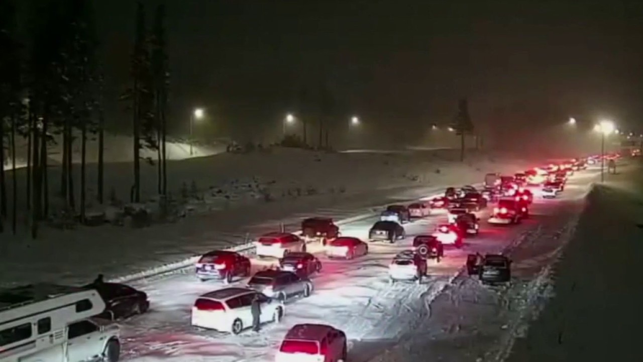
Powerful snow storm slam the Sierra
The storm, which created slick conditions on roadways up to Tahoe, is also blanketing area ski resorts with much needed snow.
Delays and cancellations at SFO
The wet weather is causing trouble for travelers at Bay Area airports. As of 10 p.m., FlightAware reported more than 300 delays and five cancellations at SFO International Airport. The travel hub was on a delay program for most of the President's Day holiday with an average of just under a half hour of delays for flights.
The airport is advising people picking up travelers to call ahead to check flight status. Some advice: while departing flights may be delayed, they still recommend travelers arrive early.

Rain causes delays and cancellations at SFO
The rain is causing trouble for travelers at SFO International Airport on Monday. Flight Aware reports 233 delays and four cancellations.
"The reason for that is, if your flight may be delayed by a couple of hours, there may be one going to the same destination that was scheduled to leave a couple hours earlier. They might, the airline might, have room on that flight. So, we still recommend that you get here early for your outbound," said Rob Rotiski, San Francisco International Airport duty officer.
For some travelers, the biggest hitch was getting soaked just getting to the airport.
"I was sleeping in the car and then I realized we're here and it was just pouring outside. Which was pretty surprising," said Ming Jia of Boston. "You know, I'm not from California and I don't have a car. So, seeing Cali in this state, is a really unique experience."
The Source: This storm was written based on information from Chief Meteorologist Mark Tamayo, the National Weather Service, and reporting by KTVU's Christien Kafton and Tom Vacar.