

Major Sierra snow storm: Here's when not to be on the road
Major Sierra snow storm ahead
The Bay Area made it through a first round of mini-storms this week, and residents should prepare for another, bigger one starting over the long President's Day weekend.
TAHOE, Calif. - The Bay Area made it through a first round of mini-storms this week, and residents should prepare for another, bigger one starting over the long President's Day weekend.
The National Weather Service is now focused on a potent, cold weather system that has the potential to produce major snowfall.
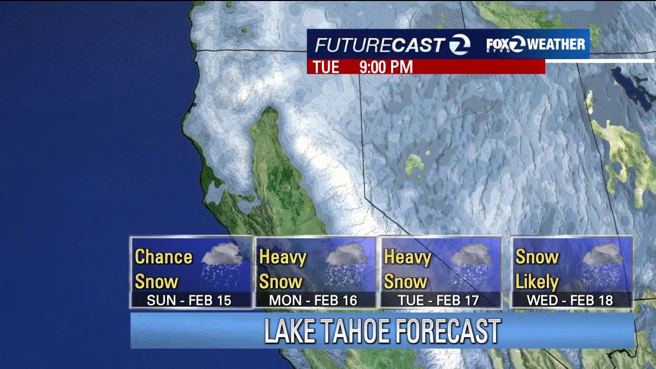
If you're planning a trip to the Sierra, everything should be free and clear Thursday through Saturday.
But Sunday is a different matter when meteorologists predict a good chance of snow.
The snow intensity is expected to ramp up Monday, and then continue for a good portion of next week.
Major snow storm expected to hit Sierra as skiers flock to Tahoe for President's Day Weekend
Tahoe area resorts like Heavenly Mountain Resort are expecting prime conditions after the storm. The expected snow sent customers flocking to California Ski Company in Berkeley, which said it was beginning to sell out of rentals.
How much snow is in the forecast?
Early estimates from a couple of forecast models show a big rise in snow accumulations.
By 4 p.m. on Feb. 20, prediction models are showing that there could be up to five feet at higher elevations.
Also, this incoming storm is going to bring in really cold air.
Snow levels have been hovering between 6,000 and 7,000 feet during recent storm events.
But as the cold air moves in, snow levels may drop to an elevation of roughly 3,500 feet, which means that snow could be accumulating in areas that normally get rain, meaning there will likely be closures on Interstate 80 and Highway 50.
The National Weather Service in Reno has advice for visitors planning to make the trip over the Sierra summits next week: "Consider adjusting travel plans and make sure to stay up to date on the forecast by checking back as confidence increases and details get ironed out."