

Timeline: Treacherous weather targeting San Francisco Bay Area

San Francisco Bay Area weather: 2% chance of tornado
NOAA says there is a 2% chance of a tornado in the San Francisco Bay Area on Christmas Eve and Christmas Day.
OAKLAND, Calif. - Santa is going to have a heck of a time delivering his toys this Christmas.
The National Weather Service is forecasting a wet and windy one this holiday.

Rain causes downed trees, utility poles to fall in North Bay
A tree fell on a house in Guerneville and a utility pole fell down in Bodega Bay. The power went out in Forestville.
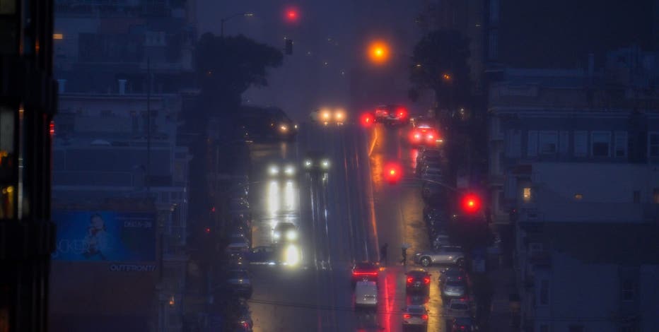
Tuesday
- Winds in Half Moon Bay were gusting up to nearly 40 mph as of 6:49 p.m.
- Flooding caused some roads in Sonoma County to shut down, including the area of Green Valley and Sullivan roads in Sebastopol.
- The North Bay is expected to feel the brunt of Tuesday night's storm. Santa Rosa Fire Department had a team out clearing debris.
- The FAA said weather conditions were causing travel disruptions Tuesday night. FlightAware reported 439 delays and 25 cancellations at San Francisco International Airport. San Jose Mineta Airport reported 68 delays and two cancellations, while Oakland International Airport reported 63 delays and no cancellations.
- Spotty showers moved through the Bay Area during the day, while winds in the North Bay increased in the late afternoon and evening.
- According to a National Weather Service forecast, as of 4:34 p.m. winds were already exceeding 25 mph in the North Bay.
- Forecast models showed wind gusts spreading overnight, beginning around 5 to 6 p.m., with gusts potentially reaching 40 to 60 mph through the night.
- A flood watch remains in effect for the Bay Area through Friday night. Meteorologists anticipate moderate to heavy rain, which could cause rapid rises in creeks and streams.
- The National Weather Service issued a high wind warning from 4 p.m. Tuesday until 4 a.m. Wednesday for the East Bay and San Francisco Bay Shoreline, the Santa Clara Valley and Eastern Hills, and the Santa Cruz Mountains.
- Southeast winds between 20 and 30 mph with gusts up to 65 mph expected.
Featured
Live updates: Tracking the Bay Area Christmas storm
Rain fell in the Bay Area early Wednesday morning, causing trees to fall up north and streets to flood in Menlo Park, and half an inch of rain to fall in Los Gatos.
Wednesday — Christmas Eve
- As of 1:30 p.m. 24,000 PG&E customers around the Bay Area are without power as another storm system moves in.
- The National Weather Service said there is a threat of thunderstorms with severe wind gusts and a 2% chance of a tornado along portions of the Bay Area and Central Coast.
- Snow develops late Tuesday in Sierra Tahoe and becomes widespread early Wednesday morning.
- South wind gusts of 45 mph or higher expected near the San Francisco International Airport from 1 a.m. to 7 a.m.
- Snow levels start high (around 7,000–7,500 feet) early in the day, meaning rain or a rain/snow mix near lake level at first.
- By afternoon and evening, colder air moves in, allowing snow levels to drop to near lake level (6,200 ft).
- Winds increase, especially along ridgelines, with gusts 40–60 mph, creating areas of blowing snow and reduced visibility.
- Travel conditions deteriorate rapidly late afternoon through the evening.
Thursday — Christmas Day
- Periods of heavy snow in Sierra Tahoe continue through Christmas Day.
- Snow levels remain near or below lake level, keeping snow ongoing across the basin.
- Strong winds persist, especially at higher elevations, with near-blizzard conditions possible at times.
- Very difficult to impossible travel over mountain passes.
Tahoe storm
- Winter Storm Warning: Begins 10 p.m. Tuesday
- Worst Travel: Wednesday afternoon through Christmas Day
For more on snow conditions, click here.