


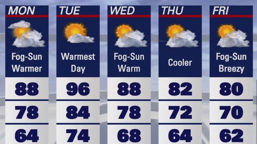
Warmer Friday
Warmer temperatures will highlight the Friday forecast. Patchy low clouds return by sunrise. Mostly sunny skies are expected later in the day. Highs should range from the low 60s near the coast to the upper 80s inland. Stronger winds could lead to elevated fire danger later in the weekend.
Warmer temperatures will highlight the Friday forecast. Patchy low clouds return by sunrise. Mostly sunny skies are expected later in the day. Highs should range from the low 60s near the coast to the upper 80s inland. Stronger winds could lead to elevated fire danger later in the weekend.


Partly sunny and breezy around Bay Area
Here's the latest forecast from the KTVU weather team.
Here's the latest forecast from the KTVU weather team.

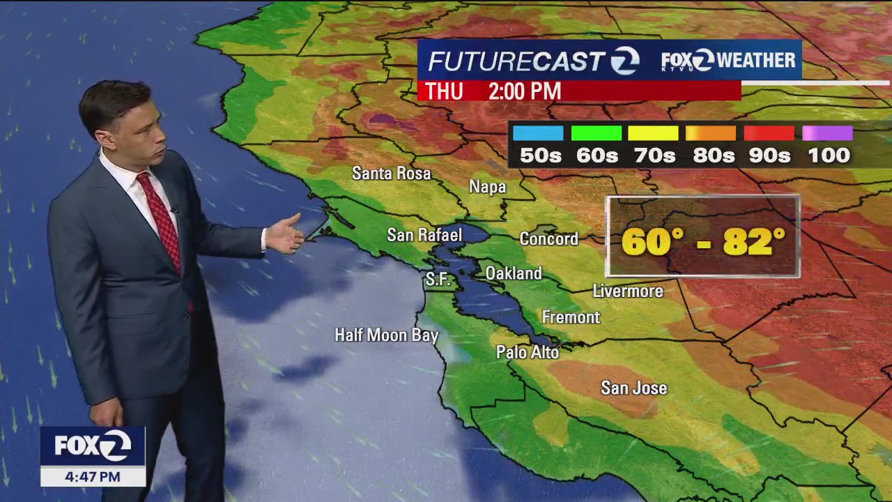
Cool Thursday with breezy conditions expected
Wind is picking up a bit across the Bay Area, bringing in cooler conditions. KTVU Meteorologist Steve Paulson shares the latest forecast.
Wind is picking up a bit across the Bay Area, bringing in cooler conditions. KTVU Meteorologist Steve Paulson shares the latest forecast.

Cooling continues
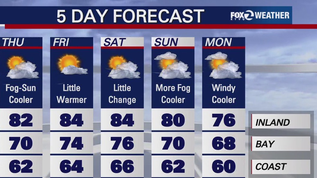
This week's hot stretch has come to an end. The cooling trend will highlight our Thursday forecast. Low clouds will resurface near the coast and bay during the morning hours. Partly sunny skies are expected during the afternoon. Highs should range from the low 60s near the coast to the low 80s inland.
This week's hot stretch has come to an end. The cooling trend will highlight our Thursday forecast. Low clouds will resurface near the coast and bay during the morning hours. Partly sunny skies are expected during the afternoon. Highs should range from the low 60s near the coast to the low 80s inland.

Sunny but cooler
Today will not be as hot. Afternoon highs will range from the 60s to high 80s.
Today will not be as hot. Afternoon highs will range from the 60s to high 80s.


Cooling on the way
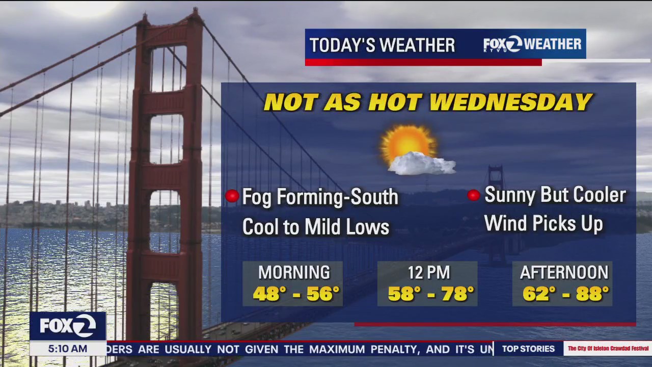
After a warm to hot Tuesday, some relief is on the way! Patchy fog returns first thing Wednesday morning. Our cooling trend begins under mostly sunny skies. Highs should range from the low 60s near the coast to the upper 80s well inland. The cooling continues in the Thursday forecast.
After a warm to hot Tuesday, some relief is on the way! Patchy fog returns first thing Wednesday morning. Our cooling trend begins under mostly sunny skies. Highs should range from the low 60s near the coast to the upper 80s well inland. The cooling continues in the Thursday forecast.

Hot inland
It's going to be hot inland with temps reaching the high 90s.
It's going to be hot inland with temps reaching the high 90s.

Heat Advisory for inland areas for Tuesday
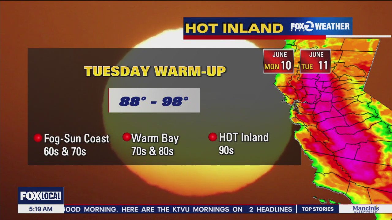
A summer-like micro climate pattern will take center stage on Tuesday with cool to mild temperatures along the coast and extremely hot temps. inland. A cool down begins on Wednesday.
A summer-like micro climate pattern will take center stage on Tuesday with cool to mild temperatures along the coast and extremely hot temps. inland. A cool down begins on Wednesday.

Another hot week on tap
The Bay Area has more hot weather in store this week.
The Bay Area has more hot weather in store this week.

Drizzle to warm
Today will start off with fog and drizzle and become warmer in the afternoon with highs in the 80s.
Today will start off with fog and drizzle and become warmer in the afternoon with highs in the 80s.

Afternoon sunshine and slightly warmer temperatures expected for the afternoon
Cloudy skies will turn mostly sunny by noon today with afternoon highs ranging from low 60s at the coast to low 80s inland.
Cloudy skies will turn mostly sunny by noon today with afternoon highs ranging from low 60s at the coast to low 80s inland.

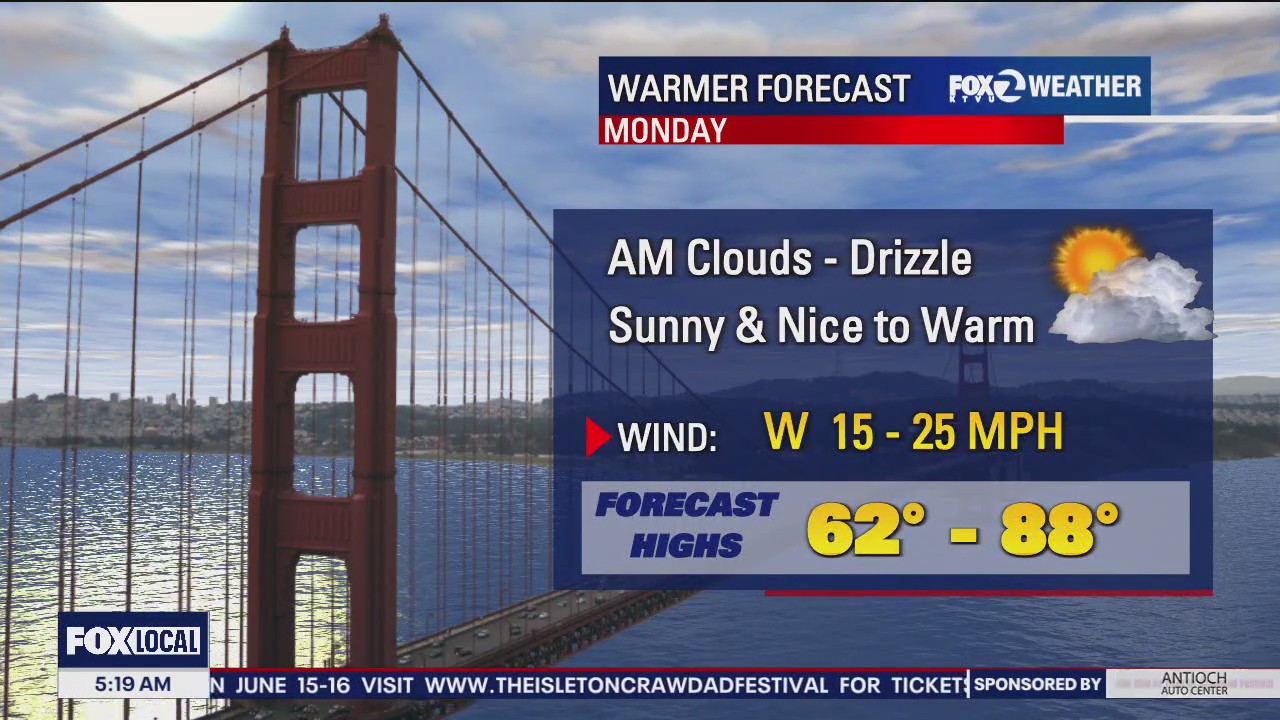
Temperatures warming up again
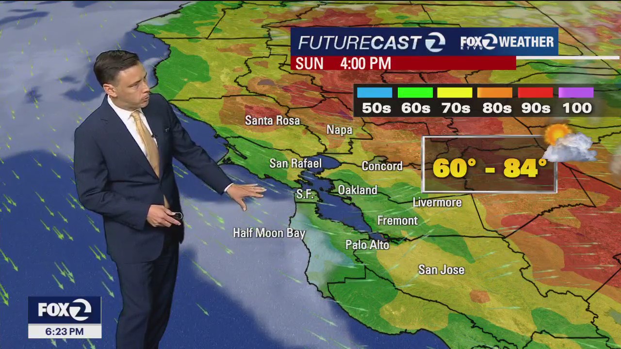
No big changes in your Sunday forecast. Patchy morning fog will clear to near the shoreline during the afternoon. Highs should range from the low 60s near the coast to the low 80s inland. Our next warming trend begins Monday. The hottest locations will approach the upper 90s by Tuesday.
No big changes in your Sunday forecast. Patchy morning fog will clear to near the shoreline during the afternoon. Highs should range from the low 60s near the coast to the low 80s inland. Our next warming trend begins Monday. The hottest locations will approach the upper 90s by Tuesday.

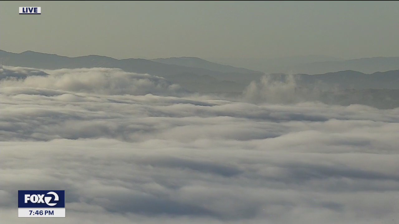
Cool to mild pattern in place for your weekend.
Good Day Bay Area. Following our morning clouds and fog, we will be joined by high clouds this afternoon and temperatures slightly below average.
Good Day Bay Area. Following our morning clouds and fog, we will be joined by high clouds this afternoon and temperatures slightly below average.

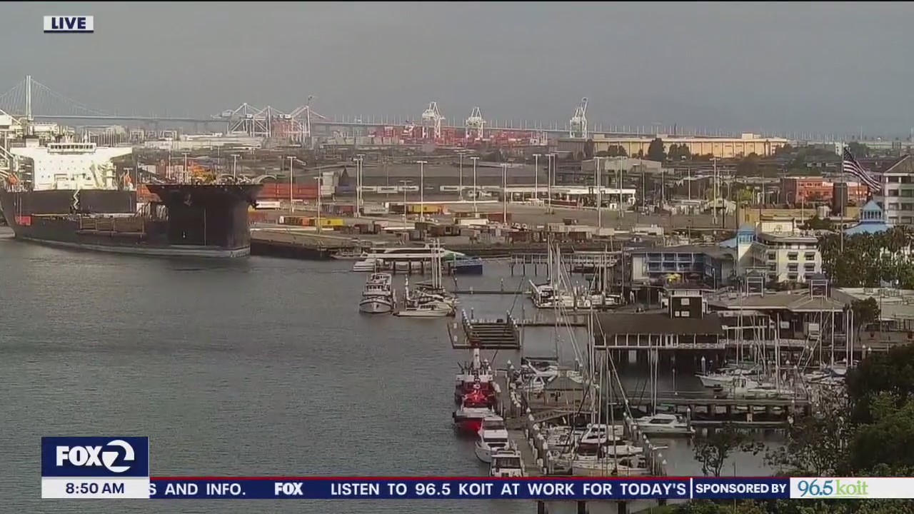
Additional cooling
Good Day Bay Area. A notable drop in temperatures for many today with additional cooling expected for Saturday. We will be joined by partly cloudy, partly sunny, breezy conditions.
Good Day Bay Area. A notable drop in temperatures for many today with additional cooling expected for Saturday. We will be joined by partly cloudy, partly sunny, breezy conditions.


Cooler, breezy
Today will be cooler and breezy with temps ranging from the 50s to 80s.
Today will be cooler and breezy with temps ranging from the 50s to 80s.


Cooling begins
Today will cool down a bit and temps will range from the 60s to 90s inland.
Today will cool down a bit and temps will range from the 60s to 90s inland.


Cooling trend begins
Our hot stretch will soon be coming to an end. Patchy fog returns to the coast Thursday morning. Highs should range from the low 60s near the coast to the low 90s inland. The cooling continues in the Friday forecast.
Our hot stretch will soon be coming to an end. Patchy fog returns to the coast Thursday morning. Highs should range from the low 60s near the coast to the low 90s inland. The cooling continues in the Friday forecast.


Extreme temps around the Bay Area
The Bay Area saw extreme heat on Wednesday with some parts reaching over 100 degrees.
The Bay Area saw extreme heat on Wednesday with some parts reaching over 100 degrees.


Still hot
Steve Paulson says today will still be hot with temps reaching up to 102 inland.
Steve Paulson says today will still be hot with temps reaching up to 102 inland.


Heat stretch lingers into Wednesday
The warm to hot weather pattern sticks around for one more day. Temperatures will soar in the Wednesday forecast under mostly sunny skies. Highs should range from the low 70s near the coast to near 100 degrees well inland. Our next cooling trend begins Thursday.
The warm to hot weather pattern sticks around for one more day. Temperatures will soar in the Wednesday forecast under mostly sunny skies. Highs should range from the low 70s near the coast to near 100 degrees well inland. Our next cooling trend begins Thursday.