

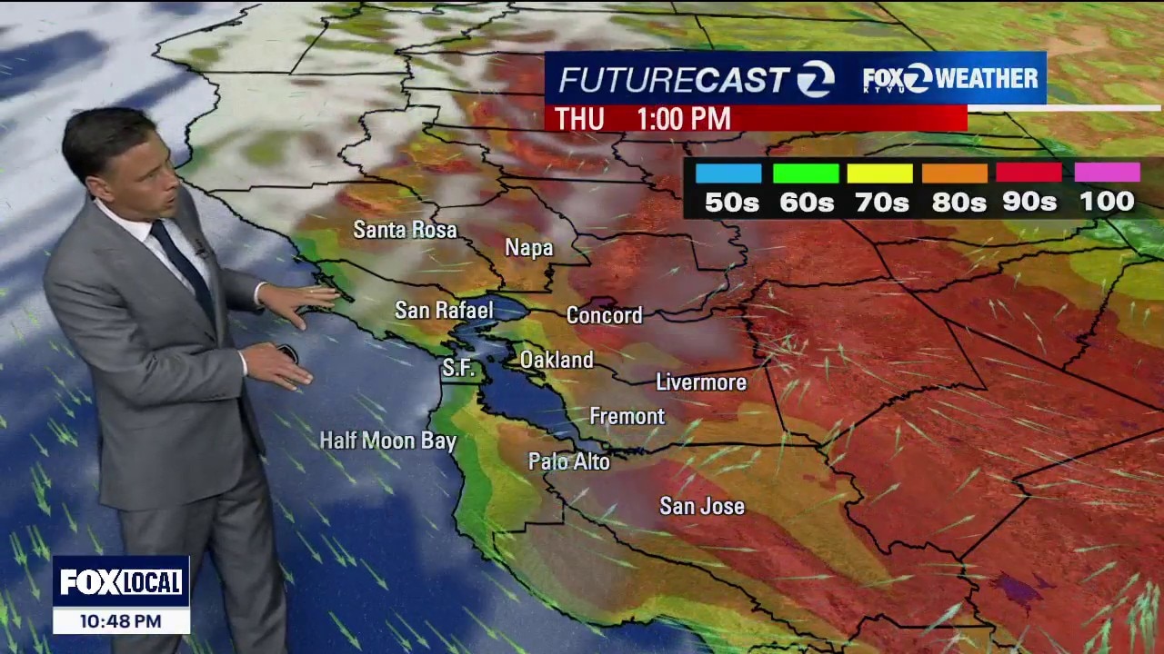
Last warm to hot day
Thursday is day 2 of 2 of the warm to hot stretch. Highs should range from the upper 60s near the coast to the low 90s inland.
Thursday is day 2 of 2 of the warm to hot stretch. Highs should range from the upper 60s near the coast to the low 90s inland.
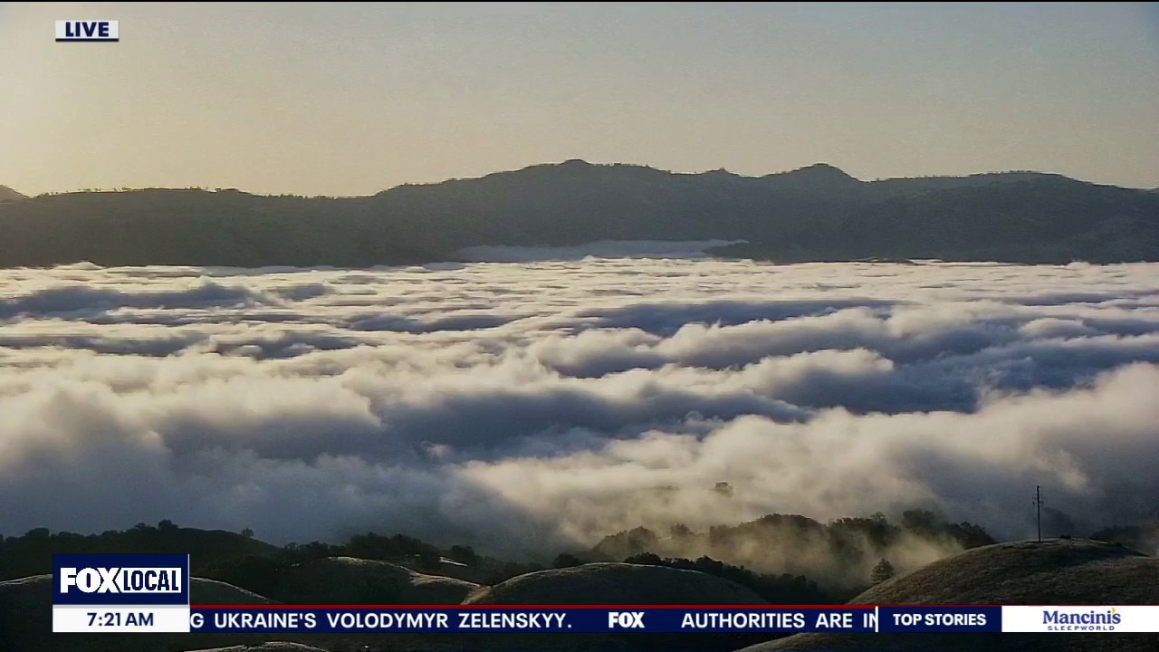
Summer and fall sharing the day
Happy Tuesday! We are making a transition to warmer weather today with the Autumnal Equinox arriving at 5:05pm. The heat up continues Wednesday and Thursday, pushing inland temperatures into the upper 80s to low 90s, while coastal areas remain in the 70s. The heat is short-lived with cooler weather returning Friday through the weekend.
Happy Tuesday! We are making a transition to warmer weather today with the Autumnal Equinox arriving at 5:05pm. The heat up continues Wednesday and Thursday, pushing inland temperatures into the upper 80s to low 90s, while coastal areas remain in the 70s. The heat is short-lived with cooler weather returning Friday through the weekend.
Tuesday starts in summer and ends in fall
Tuesday is a transition day with gradual warming. Afternoon highs will be near to slightly below average ranging from 60s at the coast to low 80s inland. Autumnal Equinox is 5:05p Pacific time. By Wednesday and Thursday, a brief warmup will push inland temperatures into the upper 80s to low 90s, while coastal areas remain in the 70s. The heat won't last. Another cooldown and below normal temperatures return Friday through the weekend.
Tuesday is a transition day with gradual warming. Afternoon highs will be near to slightly below average ranging from 60s at the coast to low 80s inland. Autumnal Equinox is 5:05p Pacific time. By Wednesday and Thursday, a brief warmup will push inland temperatures into the upper 80s to low 90s, while coastal areas remain in the 70s. The heat won't last. Another cooldown and below normal temperatures return Friday through the weekend.
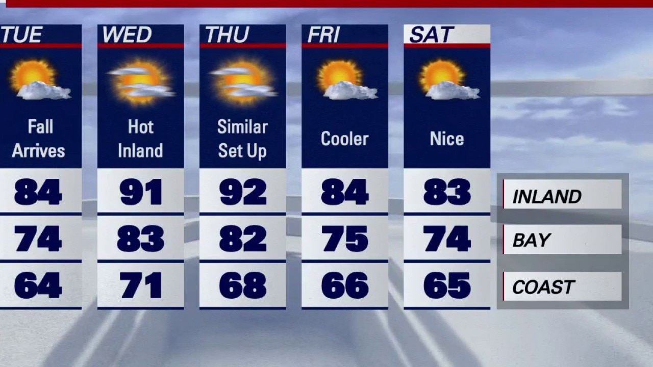
Temperatures to tick up around Bay Area as fall arrives
Fall arrives Tuesday, and temperatures around the Bay Area are expected to warm up.
Fall arrives Tuesday, and temperatures around the Bay Area are expected to warm up.
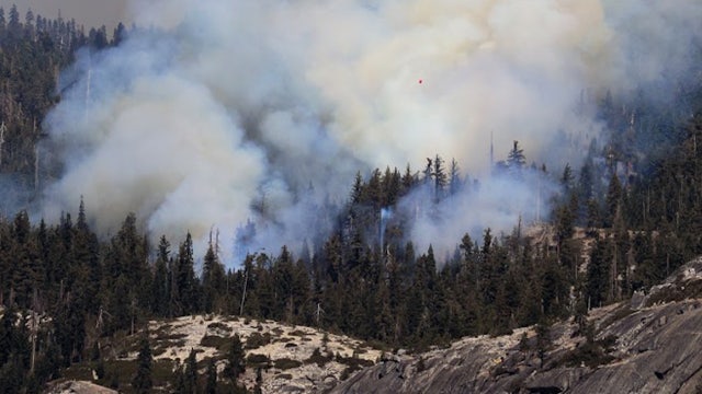

2 pilots killed in crash while battling wildfire in Yosemite National Park
Two pilots who were helping to battle the Dome Fire in Yosemite National Park were killed on Sunday when their helicopter crashed.
Two pilots who were helping to battle the Dome Fire in Yosemite National Park were killed on Sunday when their helicopter crashed.
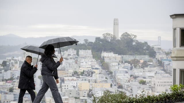

State of emergency declared ahead of 'historic' El Niño expected in California
Gov. Gavin Newsom issued a state of emergency to boost available resources ahead of this winter's El Niño, expected to bring “historic" storm conditions to California.
Gov. Gavin Newsom issued a state of emergency to boost available resources ahead of this winter's El Niño, expected to bring “historic" storm conditions to California.
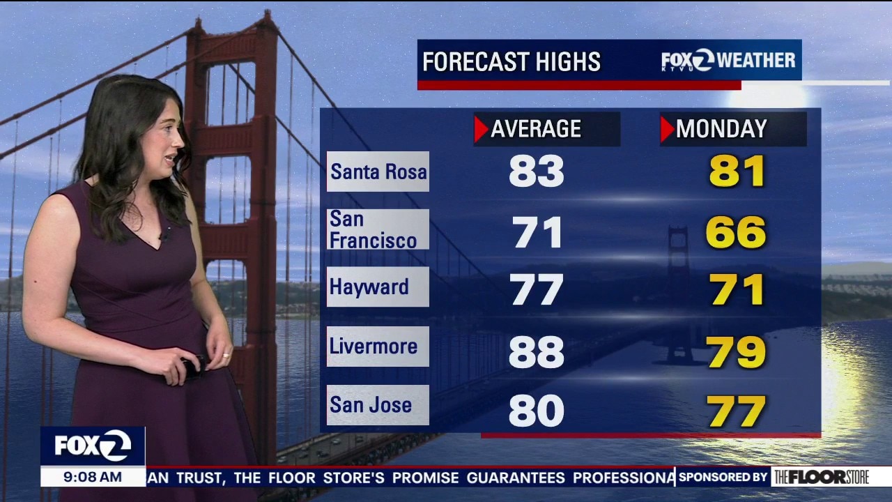
Cooler temps Monday, warm up later this week
Temperatures will heat up starting Wednesday, but we'll have cool temperatures Monday and Tuesday.
Temperatures will heat up starting Wednesday, but we'll have cool temperatures Monday and Tuesday.
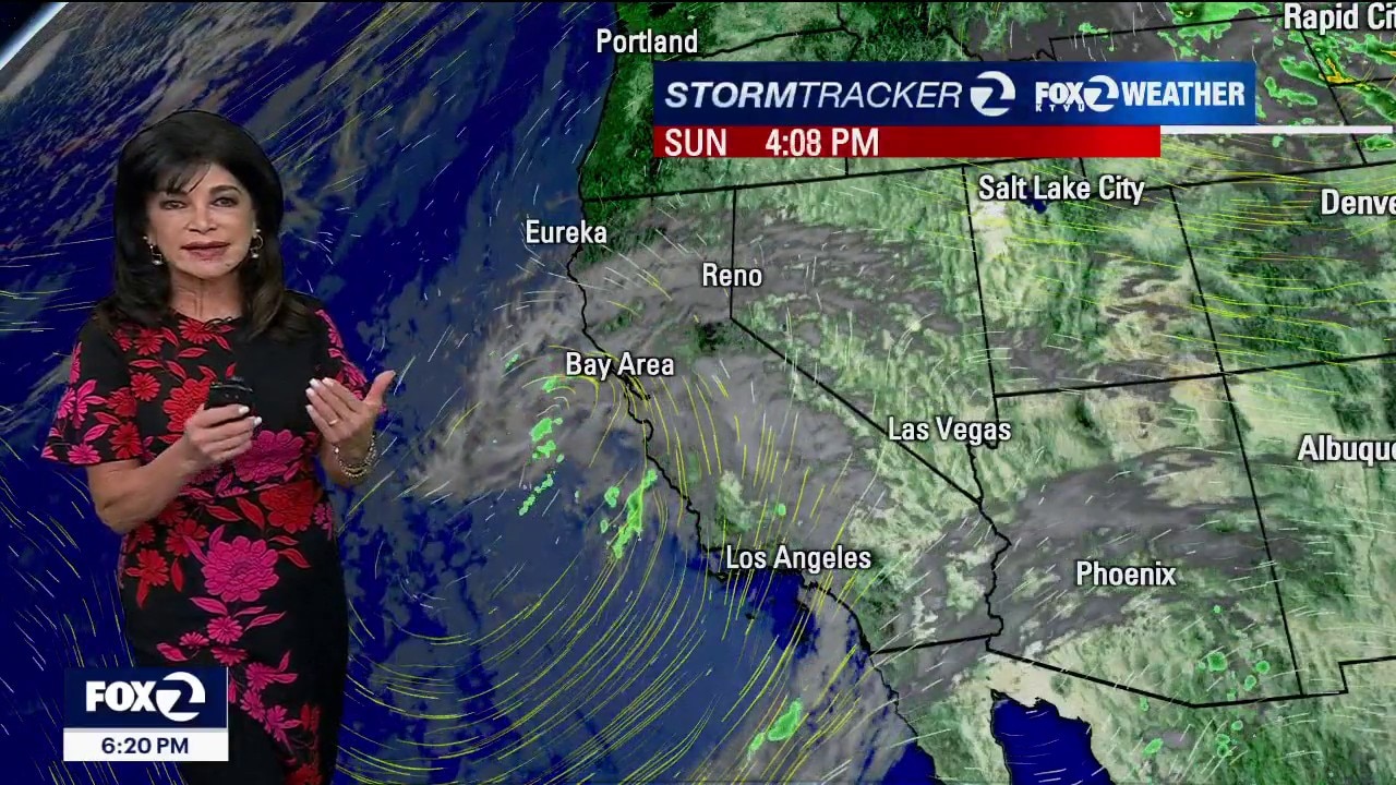
Warmer weather to come
Tonight into Monday: Low clouds spread inland, with a good chance of Monday-morning drizzle. Monday stays cool before the warm up. Monday's high temps from 62 to 81 degrees, winds SW 10-20 mph.
Tonight into Monday: Low clouds spread inland, with a good chance of Monday-morning drizzle. Monday stays cool before the warm up. Monday's high temps from 62 to 81 degrees, winds SW 10-20 mph.
Cloudy, cooler, breezy today
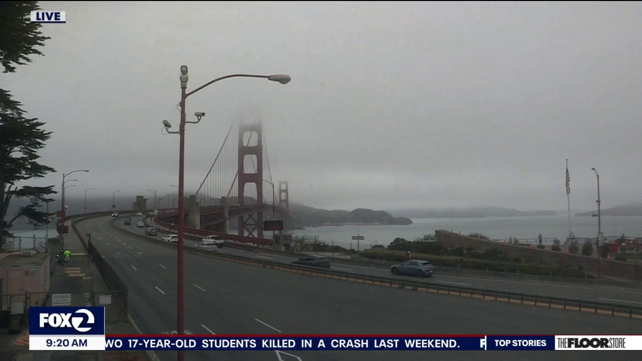
Happy Sunday! It's a cooler, cloudy, drizzly end to the weekend with onshore breezes helping to keep temperatures below average. Highs will range from the 60s near the coast and Bay to the 70s and 80s inland. A few spots could see light drizzle overnight and Monday morning. Monday stays cool before a major warm-up begins Tuesday. Fall officially arrives Tuesday afternoon, but inland temperatures will climb into the 90s Wednesday and Thursday. By Thursday, some inland areas could be up to 15 degrees above normal.
Happy Sunday! It's a cooler, cloudy, drizzly end to the weekend with onshore breezes helping to keep temperatures below average. Highs will range from the 60s near the coast and Bay to the 70s and 80s inland. A few spots could see light drizzle overnight and Monday morning. Monday stays cool before a major warm-up begins Tuesday. Fall officially arrives Tuesday afternoon, but inland temperatures will climb into the 90s Wednesday and Thursday. By Thursday, some inland areas could be up to 15 degrees above normal.
Feels like football weather
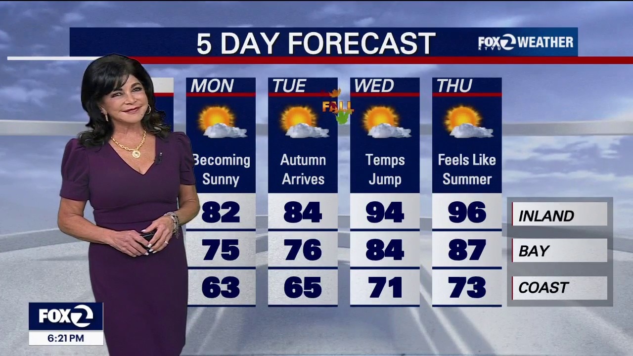
Sunday & Monday: A cooling trend begins as a weak low-pressure system moves in. Temperatures will drop 5 to 10 degrees below normal, and Monday morning could bring light coastal drizzle. Sunday football: Miami at the 49ers is on the weekend calendar worth a dedicated Santa Clara tailgate/game forecast! Kickoff at 1:25. Sun and clouds mix and low 70s degrees. (Dont forget the sunblock! Northwest winds to 10 mph. Tuesday – Thursday: A substantial warm-up takes place. Inland temperatures will climb steadily, peaking on Wednesday and Thursday at 10 to 15 degrees above normal. Heat Advisories are possible, though longer autumn nights will help provide relief. Thursday will flirt with 100 degrees Inland.
Sunday & Monday: A cooling trend begins as a weak low-pressure system moves in. Temperatures will drop 5 to 10 degrees below normal, and Monday morning could bring light coastal drizzle. Sunday football: Miami at the 49ers is on the weekend calendar worth a dedicated Santa Clara tailgate/game forecast! Kickoff at 1:25. Sun and clouds mix and low 70s degrees. (Dont forget the sunblock! Northwest winds to 10 mph. Tuesday – Thursday: A substantial warm-up takes place. Inland temperatures will climb steadily, peaking on Wednesday and Thursday at 10 to 15 degrees above normal. Heat Advisories are possible, though longer autumn nights will help provide relief. Thursday will flirt with 100 degrees Inland.
Feels like football weather
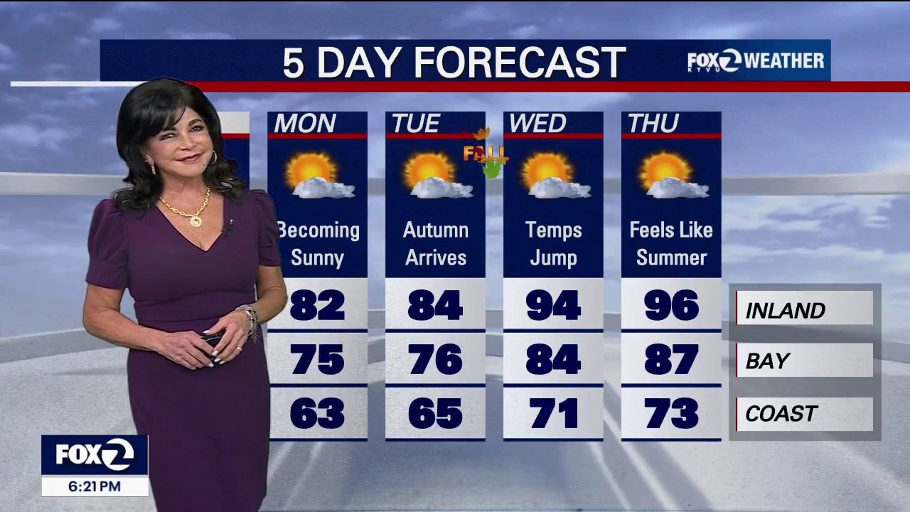
Sunday & Monday: A cooling trend begins as a weak low-pressure system moves in. Temperatures will drop 5 to 10 degrees below normal, and Monday morning could bring light coastal drizzle. Sunday football: Miami at the 49ers is on the weekend calendar worth a dedicated Santa Clara tailgate/game forecast! Kickoff at 1:25. Sun and clouds mix and low 70s degrees. (Dont forget the sunblock! Northwest winds to 10 mph. Tuesday – Thursday: A substantial warm-up takes place. Inland temperatures will climb steadily, peaking on Wednesday and Thursday at 10 to 15 degrees above normal. Heat Advisories are possible, though longer autumn nights will help provide relief. Thursday will flirt with 100 degrees Inland.
Sunday & Monday: A cooling trend begins as a weak low-pressure system moves in. Temperatures will drop 5 to 10 degrees below normal, and Monday morning could bring light coastal drizzle. Sunday football: Miami at the 49ers is on the weekend calendar worth a dedicated Santa Clara tailgate/game forecast! Kickoff at 1:25. Sun and clouds mix and low 70s degrees. (Dont forget the sunblock! Northwest winds to 10 mph. Tuesday – Thursday: A substantial warm-up takes place. Inland temperatures will climb steadily, peaking on Wednesday and Thursday at 10 to 15 degrees above normal. Heat Advisories are possible, though longer autumn nights will help provide relief. Thursday will flirt with 100 degrees Inland.
Warm today but the heat won't last
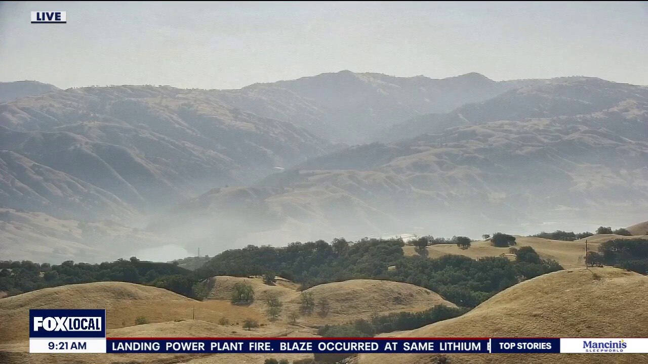
Happy Saturday everyone! Our cloudy, cool start will give way to sunshine and warm weather this afternoon. Inland temperatures will climb into the 80s and lower 90s, while the Bay Area shoreline stays much cooler in the 60s with onshore winds along the coast and through wind prone gaps and passes. Sunday brings a change. A cutoff low will move into California, bringing cooler temperatures and a deeper marine layer. Inland highs will drop roughly 5 to 10 degrees Sunday and Monday. But the cooldown will be short-lived. High pressure rebuilds Tuesday, the first day of fall, sending temperatures up again. By Wednesday and Thursday, inland areas could be back into the 90s.
Happy Saturday everyone! Our cloudy, cool start will give way to sunshine and warm weather this afternoon. Inland temperatures will climb into the 80s and lower 90s, while the Bay Area shoreline stays much cooler in the 60s with onshore winds along the coast and through wind prone gaps and passes. Sunday brings a change. A cutoff low will move into California, bringing cooler temperatures and a deeper marine layer. Inland highs will drop roughly 5 to 10 degrees Sunday and Monday. But the cooldown will be short-lived. High pressure rebuilds Tuesday, the first day of fall, sending temperatures up again. By Wednesday and Thursday, inland areas could be back into the 90s.
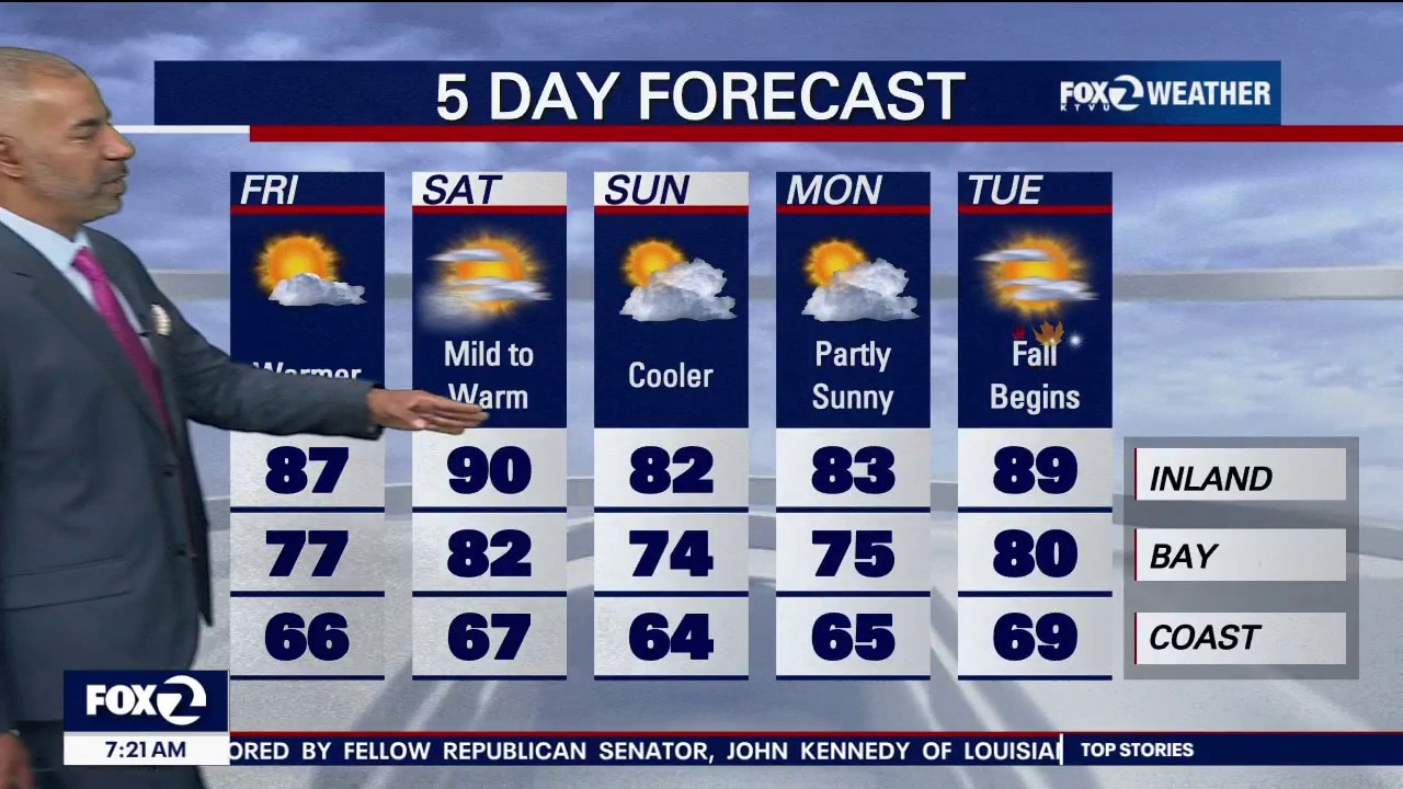
Cool morning, wind picks up midday Friday
Expect a cool morning on Friday with windy weather conditions throughout the day.
Expect a cool morning on Friday with windy weather conditions throughout the day.
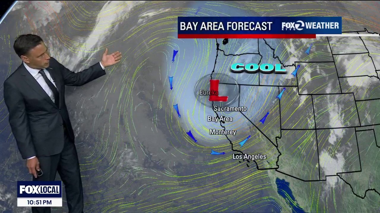
Warming trend begins
Low clouds will return to the coast and bay Friday morning. Partly to mostly sunny skies are expected later in the day. Our warming trend begins! Highs should range from the upper 60s to the upper 80s.
Low clouds will return to the coast and bay Friday morning. Partly to mostly sunny skies are expected later in the day. Our warming trend begins! Highs should range from the upper 60s to the upper 80s.
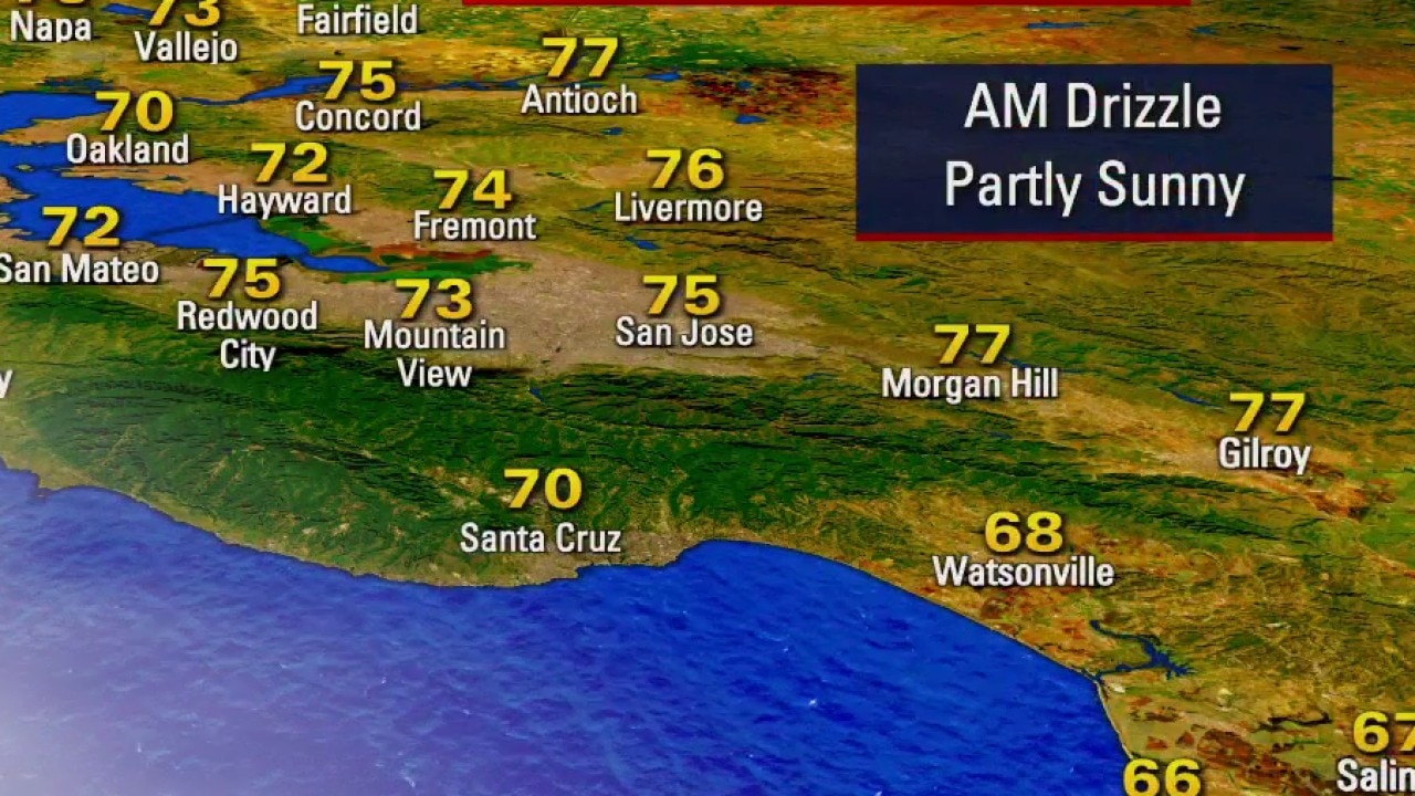
Warmer weather on the way
Meteorologist Bryan Gallo says the Bay Area is experiencing breezy conditions Thursday, but temperatures are expected to jump Friday and into the weekend.
Meteorologist Bryan Gallo says the Bay Area is experiencing breezy conditions Thursday, but temperatures are expected to jump Friday and into the weekend.


Judge rules Trump administration plan to cut FEMA workforce in half was unlawful
A federal judge ruled that the Trump administration’s plan to cut the Federal Emergency Management Agency’s workforce by 50% violated congressional protections governing the agency.
A federal judge ruled that the Trump administration’s plan to cut the Federal Emergency Management Agency’s workforce by 50% violated congressional protections governing the agency.
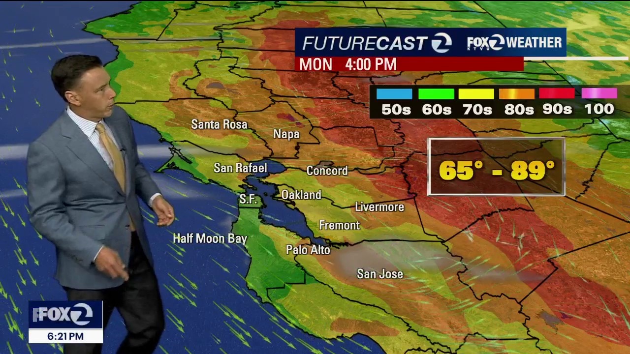
Warmer Monday forecast
Patchy fog will resurface near the coast and bay Monday morning. The afternoon forecast features mostly sunny skies and warmer temperatures. Highs should range from the mid 60s to the upper 80s;
Patchy fog will resurface near the coast and bay Monday morning. The afternoon forecast features mostly sunny skies and warmer temperatures. Highs should range from the mid 60s to the upper 80s;
Spectacular Sunday
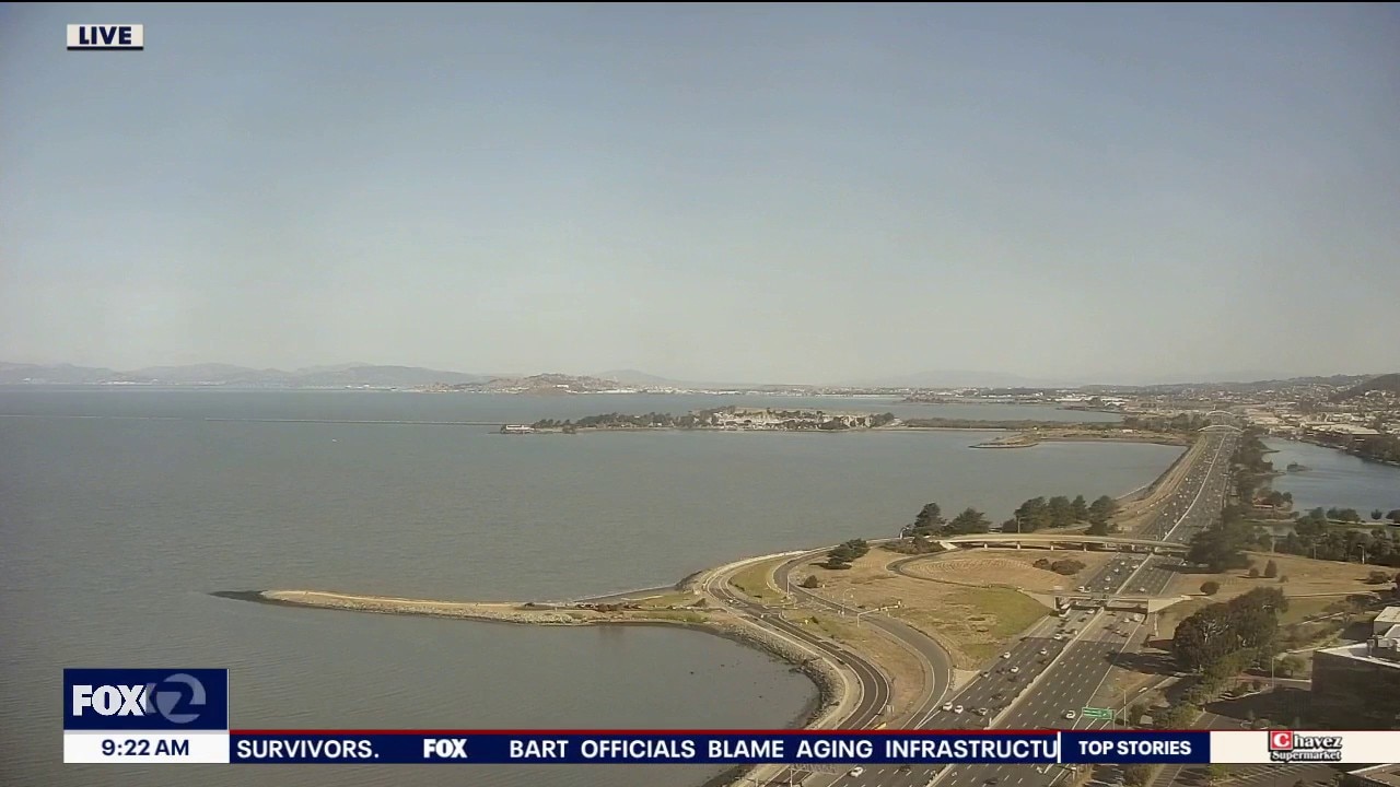
Happy Sunday everyone! The Bay Area is settling into a comfortable pattern that will continue for the final full week of summer. Seasonal temperatures will stick around with sunshine away from the coast. Expect 60s and lower 70s near the Coastal and Bay, with 70s and 80s inland. Overall, expect a quiet and enjoyable stretch of late-summer weather with no major swings in temperature on the horizon.
Happy Sunday everyone! The Bay Area is settling into a comfortable pattern that will continue for the final full week of summer. Seasonal temperatures will stick around with sunshine away from the coast. Expect 60s and lower 70s near the Coastal and Bay, with 70s and 80s inland. Overall, expect a quiet and enjoyable stretch of late-summer weather with no major swings in temperature on the horizon.

You can thank El Niño for this year's record-slow Atlantic hurricane season: Here's why
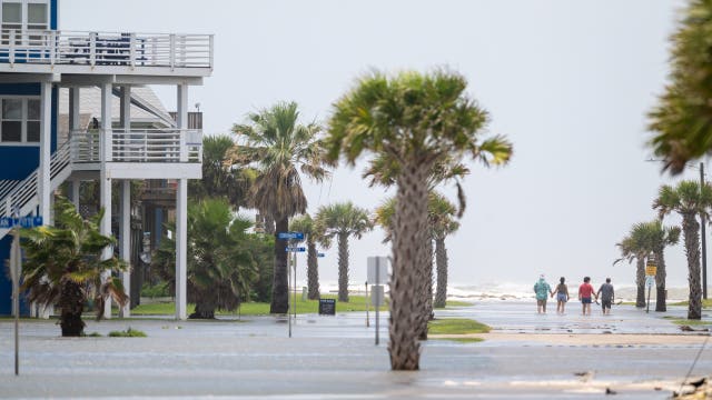
It’s been a record-slow hurricane season for the Atlantic this year, but experts warn it’s not over yet – and it only takes one.
It’s been a record-slow hurricane season for the Atlantic this year, but experts warn it’s not over yet – and it only takes one.

Tourism officials urge visitors to avoid Hawaiian island in wake of Hurricane Lowell
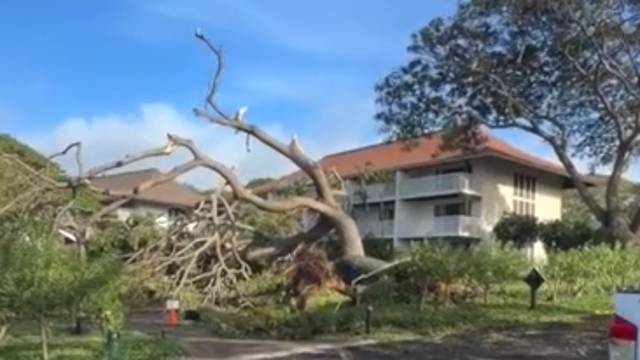
Tourism officials are urging visitors to adjust travel plans to one of Hawaii’s hardest-hit islands as residents and businesses recover from Hurricane Lowell.
Tourism officials are urging visitors to adjust travel plans to one of Hawaii’s hardest-hit islands as residents and businesses recover from Hurricane Lowell.