

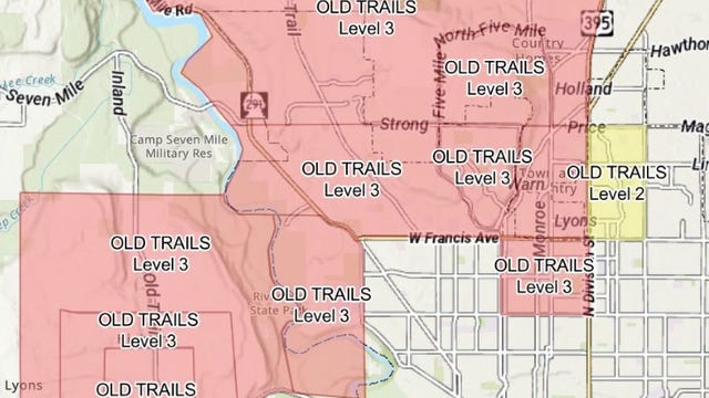

Wildfire burning in Spokane, WA prompts evacuation orders
Emergency responders in Spokane County issued emergency Level 3 evacuation orders on Aug. 1 as crews battled the fast-moving Old Trails Fire during elevated fire weather conditions.
Emergency responders in Spokane County issued emergency Level 3 evacuation orders on Aug. 1 as crews battled the fast-moving Old Trails Fire during elevated fire weather conditions.
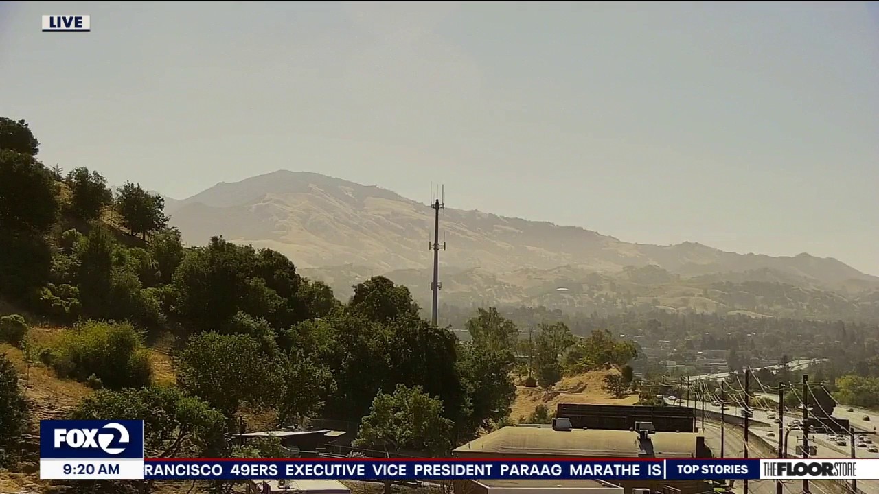
Dry, hot, hazy today
Dry, hot and hazy for many today. While temps. along the coast will be mild, interior valleys will heat up into the 90s to near 100 degrees, with elevated fire danger continuing in the North Bay hills, East Bay hills, and other higher terrain. There is no Spare the Air Alert today. For most people, outdoor activities can continue as planned, but those sensitive to smoke or air quality changes should check local conditions.
Dry, hot and hazy for many today. While temps. along the coast will be mild, interior valleys will heat up into the 90s to near 100 degrees, with elevated fire danger continuing in the North Bay hills, East Bay hills, and other higher terrain. There is no Spare the Air Alert today. For most people, outdoor activities can continue as planned, but those sensitive to smoke or air quality changes should check local conditions.
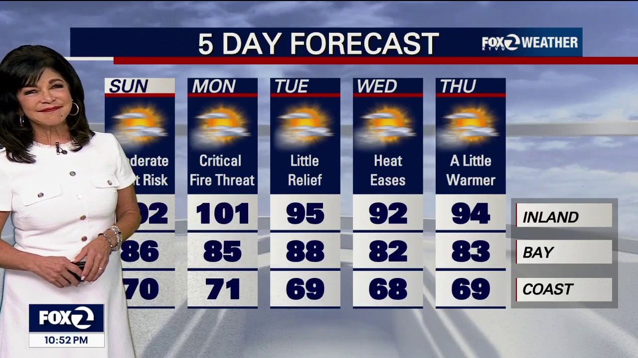
Critical Fire Danger
Saturday Night Update! • The Threat: A near-critical fire weather threat is active through Monday across the interior North Bay, East Bay, Diablo Range and Santa Lucia Range.. • Nocturnal Wind Blast: A cold front will trigger a weak offshore wind push across the North Bay and Central Coast tonight, which could drag warm, bone-dry ridge air all the way down to the beaches. Mixes out marine layer except for a patch near Half Moon Bay and Santa Cruz. • The Sunday Night Peak: An even stronger, deeper pulse of dry offshore downslope winds is forecast to slam the Bay Area and North Bay ridges from Sunday night into Monday morning. While wind speeds will stay just below official Wind Advisory criteria, these nocturnal winds will cause severe humidity drops, keeping mountain fire behavior aggressively active overnight. . • Temps inland up to and over 100 degrees through Monday!
Saturday Night Update! • The Threat: A near-critical fire weather threat is active through Monday across the interior North Bay, East Bay, Diablo Range and Santa Lucia Range.. • Nocturnal Wind Blast: A cold front will trigger a weak offshore wind push across the North Bay and Central Coast tonight, which could drag warm, bone-dry ridge air all the way down to the beaches. Mixes out marine layer except for a patch near Half Moon Bay and Santa Cruz. • The Sunday Night Peak: An even stronger, deeper pulse of dry offshore downslope winds is forecast to slam the Bay Area and North Bay ridges from Sunday night into Monday morning. While wind speeds will stay just below official Wind Advisory criteria, these nocturnal winds will cause severe humidity drops, keeping mountain fire behavior aggressively active overnight. . • Temps inland up to and over 100 degrees through Monday!
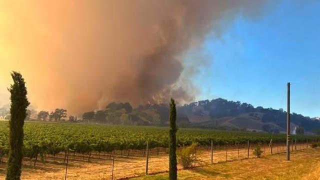

Feliz Fire in Mendocino County grows to more than 840 acres, prompts evacuation orders
The brush fire – dubbed the Feliz Fire – broke out around 3:40 p.m. near Feliz Creek Road and Highway 101.
The brush fire – dubbed the Feliz Fire – broke out around 3:40 p.m. near Feliz Creek Road and Highway 101.
Woodside Fire in North Bay reaches 45% containment
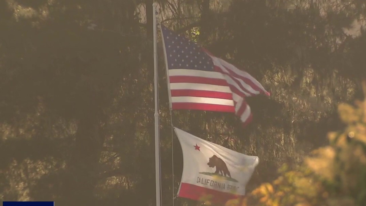
The fire has burned over 150 acres, though no injuries have been reported.
The fire has burned over 150 acres, though no injuries have been reported.


Netflix documentary star Nirmal Purja among 10 climbers confirmed dead after Pakistan avalanche
Renowned mountaineer Nirmal Purja and nine other climbers have been confirmed dead after an avalanche on Pakistan's Broad Peak.
Renowned mountaineer Nirmal Purja and nine other climbers have been confirmed dead after an avalanche on Pakistan's Broad Peak.
Heat, haze, hazardous surf
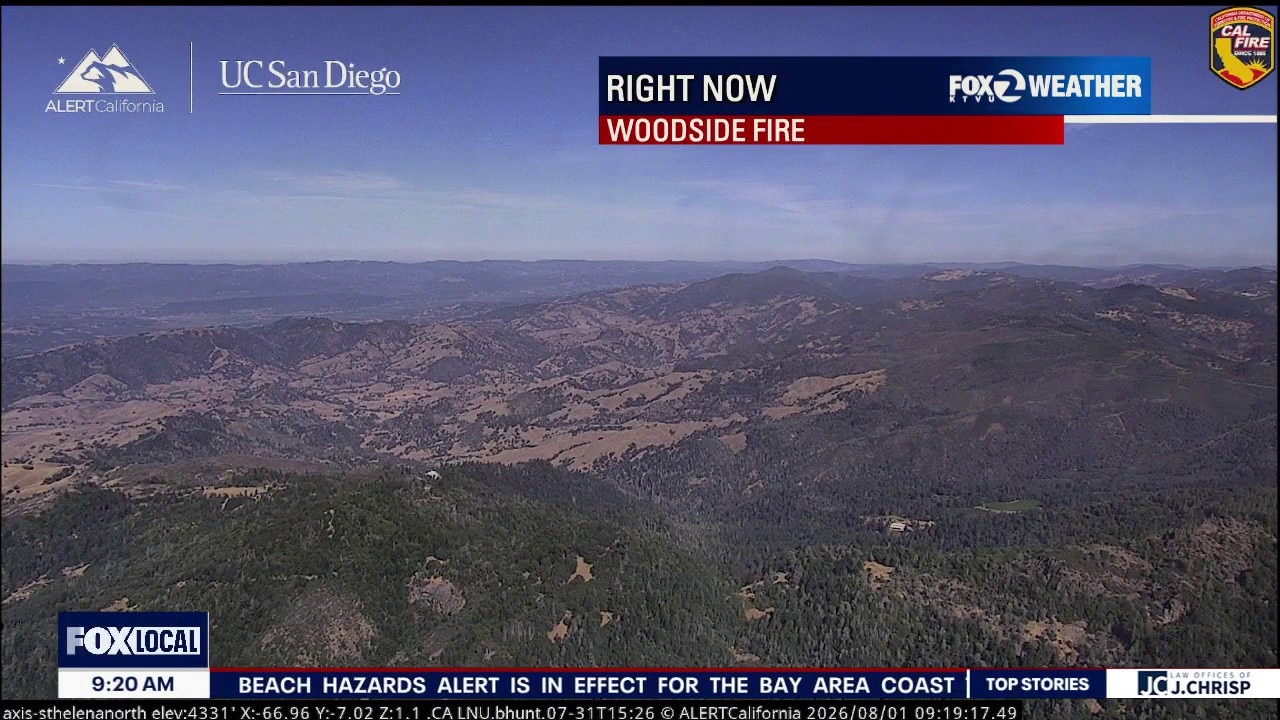
Hazy skies continue across the Bay Area today as smoke from a nearby wildfire creates reduced air quality, especially across the North Bay. A Spare the Air Alert is in place for the entire Bay Area. The weather pattern is turning hotter and drier this weekend as high pressure strengthens over California. Inland communities will see the biggest warm-up, with afternoon temperatures climbing into the upper 90s, while bayside locations remain warm and the coast stays noticeably cooler. If you're planning to head to the beach to escape the heat, use extra caution. A Beach Hazards Statement remains in effect until 5:00 p.m. Long-period swells are creating dangerous rip currents and the potential for sneaker waves that can unexpectedly rush much farther up the beach than normal.
Hazy skies continue across the Bay Area today as smoke from a nearby wildfire creates reduced air quality, especially across the North Bay. A Spare the Air Alert is in place for the entire Bay Area. The weather pattern is turning hotter and drier this weekend as high pressure strengthens over California. Inland communities will see the biggest warm-up, with afternoon temperatures climbing into the upper 90s, while bayside locations remain warm and the coast stays noticeably cooler. If you're planning to head to the beach to escape the heat, use extra caution. A Beach Hazards Statement remains in effect until 5:00 p.m. Long-period swells are creating dangerous rip currents and the potential for sneaker waves that can unexpectedly rush much farther up the beach than normal.
Smoke, Sunshine, and Soaring Temperatures
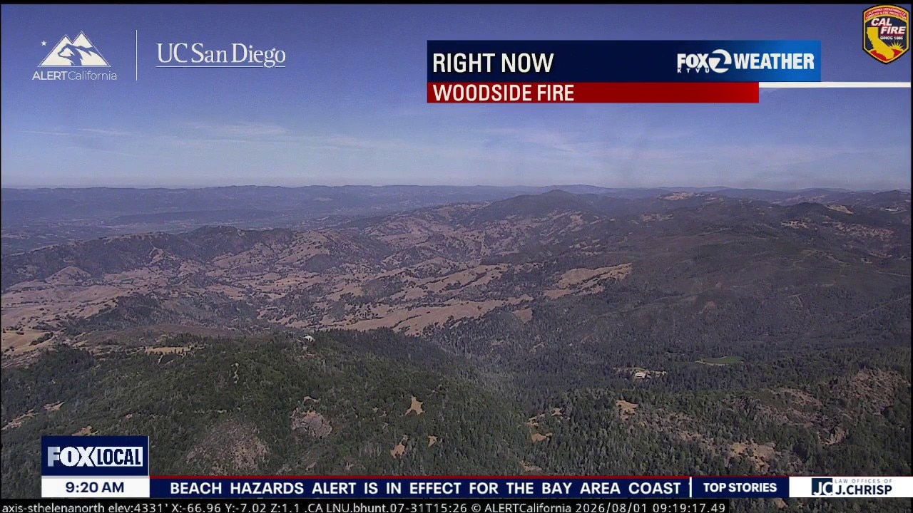
Hazy skies continue across the Bay Area today as smoke from a nearby wildfire creates reduced air quality, especially across the North Bay. A Spare the Air Alert is in place for the entire Bay Area. The weather pattern is turning hotter and drier this weekend as high pressure strengthens over California. Inland communities will see the biggest warm-up, with afternoon temperatures climbing into the upper 90s, while bayside locations remain warm and the coast stays noticeably cooler. If you're planning to head to the beach to escape the heat, use extra caution. A Beach Hazards Statement remains in effect until 5:00 p.m. Long-period swells are creating dangerous rip currents and the potential for sneaker waves that can unexpectedly rush much farther up the beach than normal.
Hazy skies continue across the Bay Area today as smoke from a nearby wildfire creates reduced air quality, especially across the North Bay. A Spare the Air Alert is in place for the entire Bay Area. The weather pattern is turning hotter and drier this weekend as high pressure strengthens over California. Inland communities will see the biggest warm-up, with afternoon temperatures climbing into the upper 90s, while bayside locations remain warm and the coast stays noticeably cooler. If you're planning to head to the beach to escape the heat, use extra caution. A Beach Hazards Statement remains in effect until 5:00 p.m. Long-period swells are creating dangerous rip currents and the potential for sneaker waves that can unexpectedly rush much farther up the beach than normal.
August is coming in hot
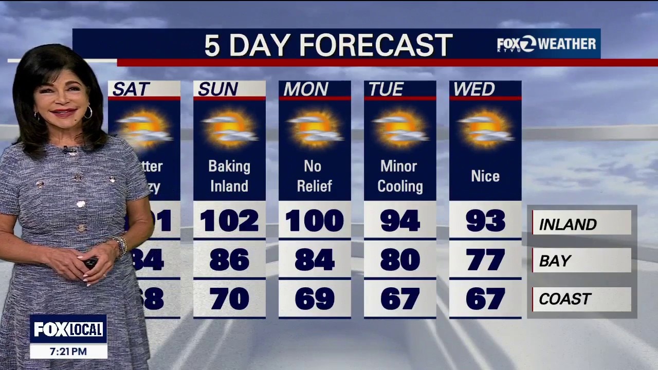
Woodside Fire Smoke The Smoke Path: High-resolution tracking shows heavy smoke from the Woodside Fire pushing into the Sonoma County valleys and across the North Bay. Blasting northwest winds of 25 to 30 mph are hitting the active wildfire site this evening, pushing the smoke parallel to the Sonoma coast before dragging it straight through the Petaluma Gap and dumping it into the inland valleys. If you live in northern and western Sonoma County you should monitor the Northern Sonoma County Air Pollution Control District, while the rest of the Bay Area should track the Bay Area Air Quality Management District for real-time air quality closures and particulate safety. Saturday Heat Wave Peak The Sizzle: High pressure over the Desert Southwest is compressing the marine layer and forcing temperatures well above averages. Highs will tick a few degrees hotter tomorrow. Expect mid-60s at the beaches, comfortable mid-70s to low 80s around the Bays, and roasting 90s to 104°F across the inland valleys.
Woodside Fire Smoke The Smoke Path: High-resolution tracking shows heavy smoke from the Woodside Fire pushing into the Sonoma County valleys and across the North Bay. Blasting northwest winds of 25 to 30 mph are hitting the active wildfire site this evening, pushing the smoke parallel to the Sonoma coast before dragging it straight through the Petaluma Gap and dumping it into the inland valleys. If you live in northern and western Sonoma County you should monitor the Northern Sonoma County Air Pollution Control District, while the rest of the Bay Area should track the Bay Area Air Quality Management District for real-time air quality closures and particulate safety. Saturday Heat Wave Peak The Sizzle: High pressure over the Desert Southwest is compressing the marine layer and forcing temperatures well above averages. Highs will tick a few degrees hotter tomorrow. Expect mid-60s at the beaches, comfortable mid-70s to low 80s around the Bays, and roasting 90s to 104°F across the inland valleys.

San Francisco weekend weather: Smoke, dangerous beaches, heat
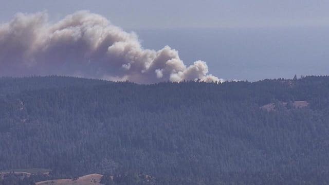
Several weather hazards are lining up across the Bay Area heading into the weekend, from wildfire smoke and dangerous beach conditions to increasing inland heat and elevated fire weather concerns.
Several weather hazards are lining up across the Bay Area heading into the weekend, from wildfire smoke and dangerous beach conditions to increasing inland heat and elevated fire weather concerns.

Woodside Fire prompts evacuations, Highway 1 closures along Sonoma County coast
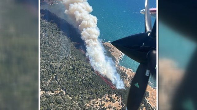
A wildfire burning along the Sonoma County coast prompted evacuations and road closures Thursday as firefighters worked to slow its spread.
A wildfire burning along the Sonoma County coast prompted evacuations and road closures Thursday as firefighters worked to slow its spread.

There's a whole lot of weather going on
Today & Friday: Highs lower-to-middle 60s at the coast, 70s to lower 80s around the Bays, and 90s in the valleys. Saturday through Monday: Moderate Heat Risk will engulf the entire interior through early next week. 100 to 102 inland. Downtown Oakland & San Francisco will remain shielded from the worst of the heat, mid-70s to lower 80s. An elevated fire weather across the interior North Bay, East Bay, Diablo Range and Santa Lucia Range through next week. Sunday Night Wind: Dry offshore wind gusts is forecast across the North Bay & SF Bay regions. The Marine Engine: Advanced weather modeling is flashing POTENTIALLY HISTORIC winds over the ocean this weekend. Storm-force gusts exceeding 60 mph across the northern waters off the Sonoma and Marin county coastlines. (Late Saturday). Beach Hazards Statement (through Saturday 5 PM) in effect across all local Pacific beaches. The Risk: Long-period southerly ocean swells are generating massive, deceptive sneaker waves and intense rip currents.
Today & Friday: Highs lower-to-middle 60s at the coast, 70s to lower 80s around the Bays, and 90s in the valleys. Saturday through Monday: Moderate Heat Risk will engulf the entire interior through early next week. 100 to 102 inland. Downtown Oakland & San Francisco will remain shielded from the worst of the heat, mid-70s to lower 80s. An elevated fire weather across the interior North Bay, East Bay, Diablo Range and Santa Lucia Range through next week. Sunday Night Wind: Dry offshore wind gusts is forecast across the North Bay & SF Bay regions. The Marine Engine: Advanced weather modeling is flashing POTENTIALLY HISTORIC winds over the ocean this weekend. Storm-force gusts exceeding 60 mph across the northern waters off the Sonoma and Marin county coastlines. (Late Saturday). Beach Hazards Statement (through Saturday 5 PM) in effect across all local Pacific beaches. The Risk: Long-period southerly ocean swells are generating massive, deceptive sneaker waves and intense rip currents.

Gov. Newsom dispatches CAL FIRE team to help fight Washington fires
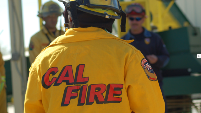
Governor Gavin Newsom on Wednesday announced plans to deploy a CAL FIRE Incident Management Team to Washington State to help manage the Sinlahekin Fire, which is burning in rural Okanogan County.
Governor Gavin Newsom on Wednesday announced plans to deploy a CAL FIRE Incident Management Team to Washington State to help manage the Sinlahekin Fire, which is burning in rural Okanogan County.

Hot stretch inland
No major changes in the Thursday forecast. Patchy fog will resurface near the coast during the morning hours. Mostly sunny skies and warm to hot temperatures will highlight the afternoon forecast. Highs should range from the mid 60s to the low 90s. The warmer will move in by Friday and will last through the weekend. Inland areas could approach triple digit territory. The Beach Hazards Statement is in effect through Saturday afternoon.
No major changes in the Thursday forecast. Patchy fog will resurface near the coast during the morning hours. Mostly sunny skies and warm to hot temperatures will highlight the afternoon forecast. Highs should range from the mid 60s to the low 90s. The warmer will move in by Friday and will last through the weekend. Inland areas could approach triple digit territory. The Beach Hazards Statement is in effect through Saturday afternoon.
August is coming in HOT
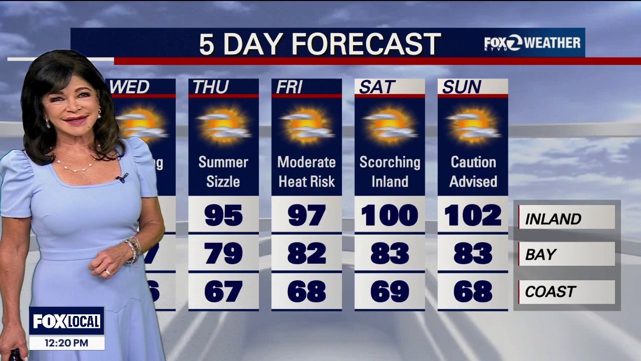
• Wave 1: This Weekend (Thursday – Sunday): High pressure will build aggressively westward starting tomorrow, compressing the marine layer.. ◦ The Numbers: Saturday inland downright hot, easily cracking 100 - 102.. ◦ Heat Risk: Widespread Moderate Heat Risk will lock over our inland neighborhoods Thursday through Sunday night.. ◦ The Coast Shield: Strong northwest winds blowing over the ocean this weekend will trigger cold water upwelling. This will enhance a stubborn, narrow marine cloud block, keeping beaches highly comfortable in the 60s and 70s while inland valleys bake.. • Wave 2: Next Week (August 5 – August 8 Watch): The Climate Prediction Center (CPC) is tracking an even more alarming pattern as the ridge will rebuild massively by next Tuesday, flashing high-confidence signals for another round of even hotter, extreme temperatures toward the end of next week.. Critical Fire Weather Alert (Elevated All Week) • The Threat: An elevated fire weather threat remains active across the interior North Bay, East Bay, Diablo Range, and Santa Lucia Range.. • The Ridge Factor: While lower valleys will benefit from good overnight cooling, the higher elevations will suffer. Mountain ridges and peaks will struggle to cool down at night, trapping bone-dry air and keeping temperatures warm with near-zero humidity recovery. Avoid any sparks, campfires, or outdoor equipment use. Beach Warning Active • Sneaker Wave Alert: The Beach Hazards Statement is locked in through the weekend. Deceptive, long-period southerly ocean swells are generating dangerous rip currents and sudden sneaker waves along the Pacific Coast. Stay off wet coastal rocks and jetties..
• Wave 1: This Weekend (Thursday – Sunday): High pressure will build aggressively westward starting tomorrow, compressing the marine layer.. ◦ The Numbers: Saturday inland downright hot, easily cracking 100 - 102.. ◦ Heat Risk: Widespread Moderate Heat Risk will lock over our inland neighborhoods Thursday through Sunday night.. ◦ The Coast Shield: Strong northwest winds blowing over the ocean this weekend will trigger cold water upwelling. This will enhance a stubborn, narrow marine cloud block, keeping beaches highly comfortable in the 60s and 70s while inland valleys bake.. • Wave 2: Next Week (August 5 – August 8 Watch): The Climate Prediction Center (CPC) is tracking an even more alarming pattern as the ridge will rebuild massively by next Tuesday, flashing high-confidence signals for another round of even hotter, extreme temperatures toward the end of next week.. Critical Fire Weather Alert (Elevated All Week) • The Threat: An elevated fire weather threat remains active across the interior North Bay, East Bay, Diablo Range, and Santa Lucia Range.. • The Ridge Factor: While lower valleys will benefit from good overnight cooling, the higher elevations will suffer. Mountain ridges and peaks will struggle to cool down at night, trapping bone-dry air and keeping temperatures warm with near-zero humidity recovery. Avoid any sparks, campfires, or outdoor equipment use. Beach Warning Active • Sneaker Wave Alert: The Beach Hazards Statement is locked in through the weekend. Deceptive, long-period southerly ocean swells are generating dangerous rip currents and sudden sneaker waves along the Pacific Coast. Stay off wet coastal rocks and jetties..
Wednesday Warm Up
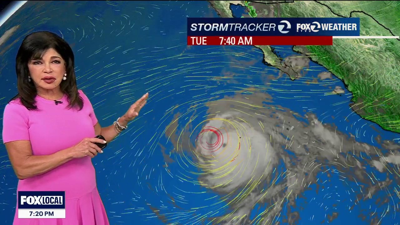
Wednesday will be an incredibly pleasant transition day across the area. The Numbers: Seasonally warm inland and slightly cooler than normal along the immediate beaches. Interior valleys will see comfortable 80s to near 90°F. Tonight's Fog Loop: A weak disturbance passing inland tonight will drag a widespread return of marine fog deep into the interior valleys by Wednesday morning. Clouds will mix out by midday. The Winds: Reliable, breezy onshore winds will blast through local gaps and passes each afternoon and evening through early midweek. Beach Hazards Statement in effect though Saturday at 5pm. Sneaker waves and strong rip currents are present and dangerous. Do not turn your back on the ocean!
Wednesday will be an incredibly pleasant transition day across the area. The Numbers: Seasonally warm inland and slightly cooler than normal along the immediate beaches. Interior valleys will see comfortable 80s to near 90°F. Tonight's Fog Loop: A weak disturbance passing inland tonight will drag a widespread return of marine fog deep into the interior valleys by Wednesday morning. Clouds will mix out by midday. The Winds: Reliable, breezy onshore winds will blast through local gaps and passes each afternoon and evening through early midweek. Beach Hazards Statement in effect though Saturday at 5pm. Sneaker waves and strong rip currents are present and dangerous. Do not turn your back on the ocean!


Magnitude 4.3 earthquake strikes near Cloverdale
The U.S. Geological Survey measured a magnitude 4.3 earthquake Tuesday night near Cloverdale.
The U.S. Geological Survey measured a magnitude 4.3 earthquake Tuesday night near Cloverdale.
Wednesday Warm Up
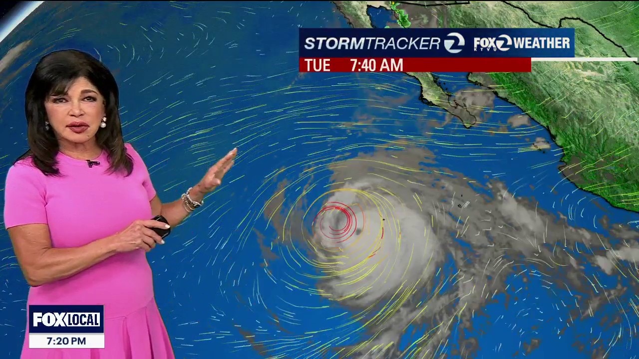
Wednesday will be an incredibly pleasant transition day across the area. The Numbers: Seasonally warm inland and slightly cooler than normal along the immediate beaches. Interior valleys will see comfortable 80s to near 90°F. Tonight's Fog Loop: A weak disturbance passing inland tonight will drag a widespread return of marine fog deep into the interior valleys by Wednesday morning. Clouds will mix out by midday. The Winds: Reliable, breezy onshore winds will blast through local gaps and passes each afternoon and evening through early midweek.
Wednesday will be an incredibly pleasant transition day across the area. The Numbers: Seasonally warm inland and slightly cooler than normal along the immediate beaches. Interior valleys will see comfortable 80s to near 90°F. Tonight's Fog Loop: A weak disturbance passing inland tonight will drag a widespread return of marine fog deep into the interior valleys by Wednesday morning. Clouds will mix out by midday. The Winds: Reliable, breezy onshore winds will blast through local gaps and passes each afternoon and evening through early midweek.
Warm to hot
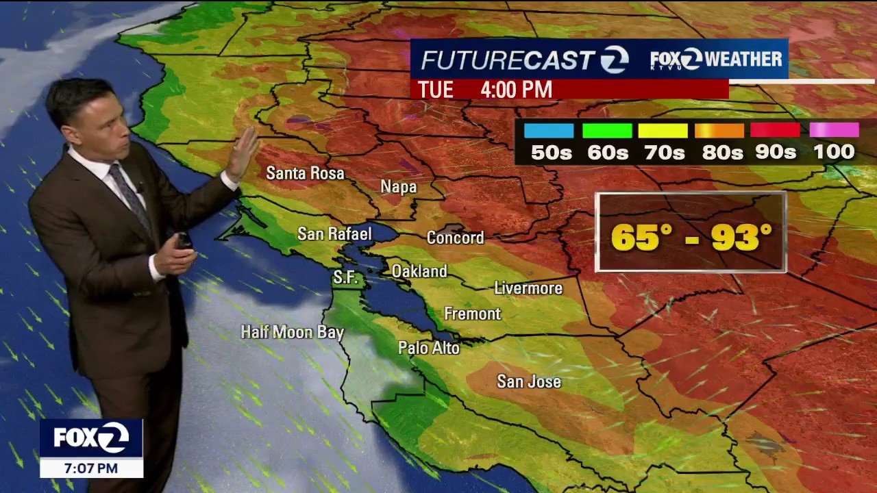
Our warm to hot weather forecast remains on track. Patchy fog returns to the coast and bay Tuesday morning. Mostly sunny skies are expected later in the day. You should plan on warmer temperatures. Highs should range from the mid 60s to the low 90s. The heat will continue to intensify later in the week. Inland areas could be flirting with 100 by Saturday. The Beach Hazards Statement (Alert) has been extended through Saturday afternoon.
Our warm to hot weather forecast remains on track. Patchy fog returns to the coast and bay Tuesday morning. Mostly sunny skies are expected later in the day. You should plan on warmer temperatures. Highs should range from the mid 60s to the low 90s. The heat will continue to intensify later in the week. Inland areas could be flirting with 100 by Saturday. The Beach Hazards Statement (Alert) has been extended through Saturday afternoon.
Warming up again
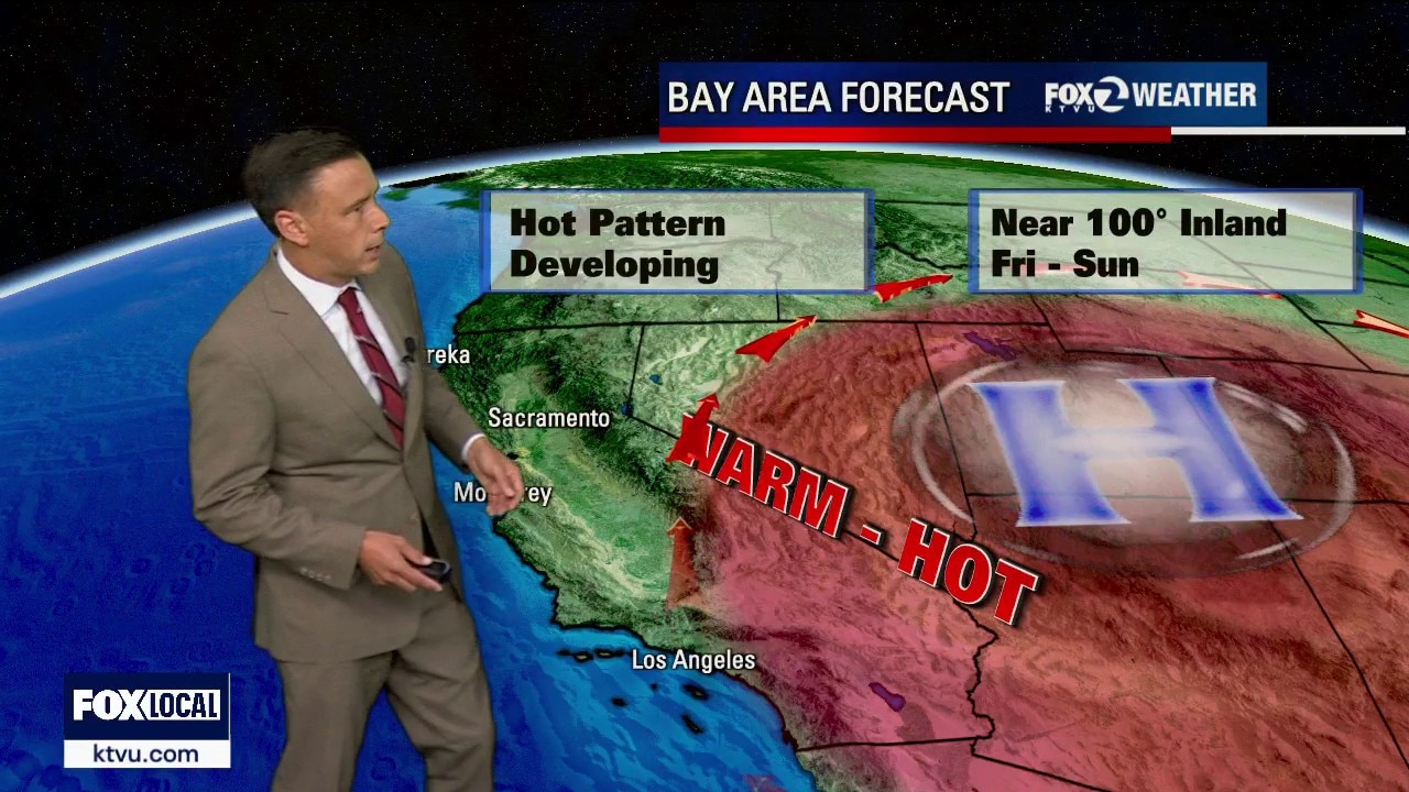
Patchy fog returns to the coast and bay Monday morning. The clouds will retreat to near the coast. Warmer temperatures will highlight the forecast. Highs should range from the mid 60s to the low 90s. A warm to hot pattern will be paying us a visit for the rest of the week.
Patchy fog returns to the coast and bay Monday morning. The clouds will retreat to near the coast. Warmer temperatures will highlight the forecast. Highs should range from the mid 60s to the low 90s. A warm to hot pattern will be paying us a visit for the rest of the week.