

Red Flag Warning in effect Sunday night through Tuesday
SAN FRANCISCO BAY AREA - The danger for fire will increase beginning Sunday night in the East Bay hills and north into Solano County, according to the National Weather Service.
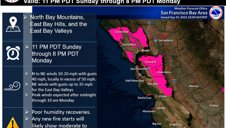
For several Northern California counties, forecasters have declared a fire weather watch, which is used when the risk of a fire is raised but its occurrence, location and/or timing is still uncertain.

SUNDAY FORECAST: Fire weather watch begins at 11 p.m.
KTVU's Rosemary Orozco has your Bay Area forecast.
The watch alert was prompted by a forecast gusty offshore winds that will create drying conditions Sunday night through Tuesday morning in the East Bay hills, the Diablo Range and the mountains of the north bay.
North to northeast winds of 15 to 25 mph are expected with gusts 30 to 40 mph, locally up to 60 mph at the ridge tops. Winds will be weaker at lower elevations.
The watch includes the prediction that "Any fire starts would likely see rapid spread due to dry fuels, low humidity and gusty winds in areas that do not receive wetting rains over the weekend."