

Sierra snowstorm worst in three years: UC Berkeley scientists
Powerful snow storm slam the Sierra
The storm, which created slick conditions on roadways up to Tahoe, is also blanketing area ski resorts with much needed snow.
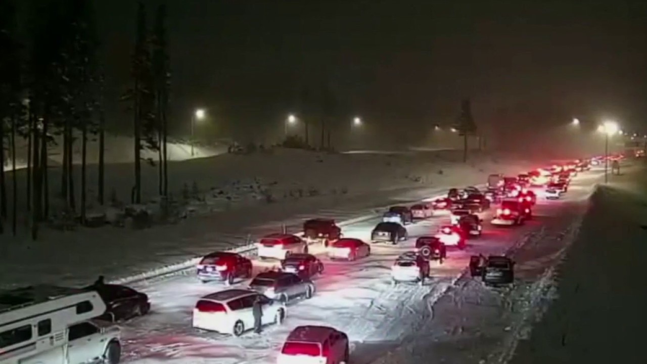
OAKLAND, Calif. - The snow hitting the Sierra, combined with low visibility and high winds, have created the worst winter conditions in three years.
That's the assessment on Tuesday by the UC Berkeley Central Sierra Snow Lab, which shared that more than two feet of snow fell in the last day and up to three more feet could land in the area by Wednesday night.
"It. Is. Dumping," the scientists wrote on X, adding that these are the worst conditions since February 2023.
Whiteout conditions and hazardous roads were making it tough for travelers to make it up to the slopes.
Caltrans closed Interstate 80 over Donner Summit because of "hazardous" weather, the agency said. And Highway 50 was also closed from Sly Park in Placerville to Meyers.
Meanwhile, at lower elevations in the Bay Area, the National Weather Service issued a coastal flood advisory for San Francisco until Tuesday afternoon, with cooler showers and a chance of hail.
In fact, NWS meteorologist Dylan Flynn, said the most active day of the storms, with the potential for thunderstorms, would be Tuesday.
Flynn said the entire Bay Area will continue to receive steady rainfall. Thunder ripped across Concord and lightning struck Marin County, for example, early Tuesday morning.
A power outage hit Stanford University on Tuesday morning, forcing some class cancelations.
On Monday, the weather was rough, too.
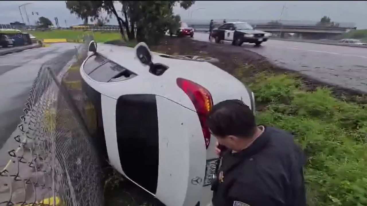
The storm wreaked havoc on roadways spanning from Sonoma County to the Sierra Nevada.
Traffic was halted temporarily in both directions on I-80 near the Nevada state line due to spinouts and crashes, the California Department of Transportation reported.
"For us, it's been a lot of vehicle spin-outs, a lot of typical wet weather crashes, but also a lot of response to debris washing into the roadways, and flooding in certain areas," said California Highway Patrol Sgt. Andrew Barclay.
Wet roads across Bay Area lead to crashes as CHP urges drivers to slow down
The CHP says slick conditions and standing water are contributing to spinouts and collisions as another round of rain moves through the Bay Area.
The latest storm comes amid a snow drought across much of the American West, with snow cover and depth measuring at the lowest levels scientists have seen in decades. Most states saw half their average precipitation or less in January, though California fared better than others due to heavy rains in December.