


Warm and windy
Steve Paulson says today will be warm and windy.
Steve Paulson says today will be warm and windy.


PG&E notifies thousands of possible power shutoffs
PG&E is preparing for some possible planned power shutoffs, as early as tonight, in 6 Bay Area counties and 17 counties in its service territory. Though the shutoff will affect on 22,000 of PG&E's 5.5 million electric customers, many often tell me they are tired of it.
PG&E is preparing for some possible planned power shutoffs, as early as tonight, in 6 Bay Area counties and 17 counties in its service territory. Though the shutoff will affect on 22,000 of PG&E's 5.5 million electric customers, many often tell me they are tired of it.


Stronger winds boosting fire danger
Fire season continues in Northern California. Northerly winds will be increasing overnight Gusts could approach 50 to 60 mph. The strongest winds will be focused in the North Bay Interior Mountains. The dry wind will also boost fire danger. A Red Flag Warning is in effect until 7 am Thursday. Your Wednesday forecast features mostly sunny skies and mild temperatures. Highs should range from the upper 60s to the mid 70s.
Fire season continues in Northern California. Northerly winds will be increasing overnight Gusts could approach 50 to 60 mph. The strongest winds will be focused in the North Bay Interior Mountains. The dry wind will also boost fire danger. A Red Flag Warning is in effect until 7 am Thursday. Your Wednesday forecast features mostly sunny skies and mild temperatures. Highs should range from the upper 60s to the mid 70s.
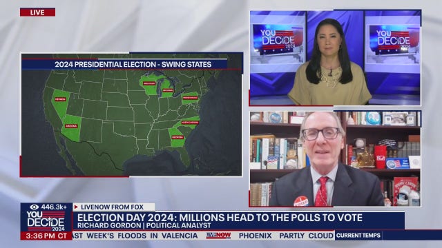

2 poll workers among those killed in Election Day flooding in Missouri
The storms and flooding in Missouri have left multiple people dead, including two poll workers.
The storms and flooding in Missouri have left multiple people dead, including two poll workers.


Bay Area polling location closed due to fire concerns
Some voters were turned away at one Bay Area polling location, due to heightened fire concerns.
Some voters were turned away at one Bay Area polling location, due to heightened fire concerns.


High clouds, winds
Today will see high clouds and strong winds. Temps in the 60s and 70s.
Today will see high clouds and strong winds. Temps in the 60s and 70s.


Red flag warning issued for Tuesday through early Thursday throughout the region
A Red Flag Warning for nearly all of the Bay Area and Central Coast was issued by the National Weather Service on Monday that will last from Tuesday at 11 a.m. through Thursday at 7 a.m.
A Red Flag Warning for nearly all of the Bay Area and Central Coast was issued by the National Weather Service on Monday that will last from Tuesday at 11 a.m. through Thursday at 7 a.m.


Dry, windy weather prompts elevated fire danger
Dry Winds will increase over the course of Tuesday and last into early Thursday. There is a Red Flag Warning for most of the Bay Aera from Tuesday 11am - Thursday 7am for elevated fire danger.
Dry Winds will increase over the course of Tuesday and last into early Thursday. There is a Red Flag Warning for most of the Bay Aera from Tuesday 11am - Thursday 7am for elevated fire danger.


Tropical Storm Rafael forms, expected to move into the Gulf of Mexico this week
Tropical Depression 18 formed Monday morning, and is expected to get the name Rafael before moving into the Gulf of Mexico this week, according to the National Hurricane Center.
Tropical Depression 18 formed Monday morning, and is expected to get the name Rafael before moving into the Gulf of Mexico this week, according to the National Hurricane Center.


Power shutoffs expected in Bay Area on Election Day
Six Bay Area counties are facing possible power shutoffs on Election Day and the following days, PG&E reported.
Six Bay Area counties are facing possible power shutoffs on Election Day and the following days, PG&E reported.


Sunny, windy
Today will be sunny and windy. Highs in the high 70s.
Today will be sunny and windy. Highs in the high 70s.


Stronger winds boosting Bay Area fire danger
Last Friday’s system had a winter flavor with steady downpours in parts of the Bay Area and a fresh blanket of Sierra snow. We might not be on a straight track toward winter just yet. A couple of wind events will dry out Northern California and increase the fire danger.
Last Friday’s system had a winter flavor with steady downpours in parts of the Bay Area and a fresh blanket of Sierra snow. We might not be on a straight track toward winter just yet. A couple of wind events will dry out Northern California and increase the fire danger.


Sunny and breezy today
A sunny, breezy day is underway with temperatures ranging from low 60s at the coast to low 70s inland. San Francisco sunset, 5:08 PM.
A sunny, breezy day is underway with temperatures ranging from low 60s at the coast to low 70s inland. San Francisco sunset, 5:08 PM.


Disturbance in the Caribbean likely to become Tropical Storm Rafael this week
Reasonable tracks for the end of the week range from west toward Mexico or Texas to north toward the Florida Panhandle.
Reasonable tracks for the end of the week range from west toward Mexico or Texas to north toward the Florida Panhandle.


Dry and cool today
The latest storm is moving out with dry weather moving in for the rest of the weekend. Afternoon highs will range from low 60s at the coast to upper 60s inland.
The latest storm is moving out with dry weather moving in for the rest of the weekend. Afternoon highs will range from low 60s at the coast to upper 60s inland.


Rain clouds moving out this weekend
The Friday night rain event will last into early Saturday morning. Party sunny skies will highlight your Saturday forecast. Highs should warm into the 60s. Your Sunday forecast features sunny skies and gusty winds. Northerly winds will boost the fire danger. Fire danger could be a concern next week. Have a great weekend! -Mark
The Friday night rain event will last into early Saturday morning. Party sunny skies will highlight your Saturday forecast. Highs should warm into the 60s. Your Sunday forecast features sunny skies and gusty winds. Northerly winds will boost the fire danger. Fire danger could be a concern next week. Have a great weekend! -Mark

'Winter is here': Snow covers Hawaii's Mauna Kea
Snow fell on Hawaii's tallest peak this week, briefly turning the mountaintop into a winter wonderland.
Snow fell on Hawaii's tallest peak this week, briefly turning the mountaintop into a winter wonderland.


2024 Winter Weather Outlook: Will we see La Ni?a storm conditions in the Bay Area?
KTVU's Mark Tamayo shares insight on the weather we can expect this winter in the Bay Area and California.
KTVU's Mark Tamayo shares insight on the weather we can expect this winter in the Bay Area and California.


Chilly, rain
It will be chilly in the morning and will possibly rain tonight.
It will be chilly in the morning and will possibly rain tonight.


The snow is coming down: When will Tahoe ski resorts open?
The anticipation is building among skiers and snowboarders as the snow falls in the Sierra Nevada and resorts prepare for their opening day.
The anticipation is building among skiers and snowboarders as the snow falls in the Sierra Nevada and resorts prepare for their opening day.