

Interactive map: Live satellite images of the Kincade Fire
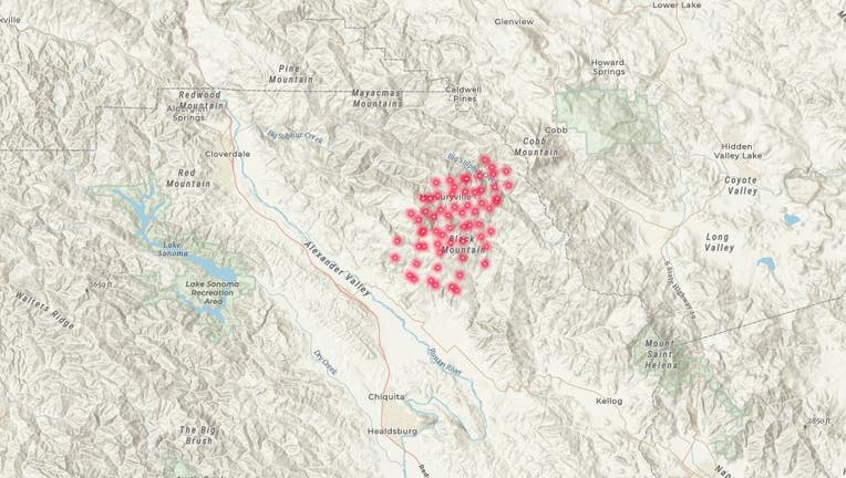
Satellite map of the Kincade Fire.
GEYSERVILLE, Calif. - A fast-moving wildfire broke out Wednesday in the heart of Wine Country in between Healdsburg and Geyserville. As of Thursday morning, the flames had scorched 10,000 acres.
Esri, a location intelligence company based in Redlands, Calif., is pulling in live data from NASA and US Geological Survey satellite images overhead, as well as information from a variety of government sources such as CalFire, the Bureau of Land Management and the National Oceanic Atmospheric Administration.