


Slightly cooler and a chance of showers for Saturday
Mostly cloudy and slightly cooler temperatures are expected on Saturday. A few showers are also possible, especially from San Francisco north.
Mostly cloudy and slightly cooler temperatures are expected on Saturday. A few showers are also possible, especially from San Francisco north.


Back to normal
Back to normal temps.
Back to normal temps.


Cooling Trend Continues
Cooler weather continues with the slight chance of a shower Saturday morning. Highs will remain in the 70s and low 80s.
Cooler weather continues with the slight chance of a shower Saturday morning. Highs will remain in the 70s and low 80s.


Mild to warm today
The cooler pattern is here to stay! Partly sunny skies will highlight your Thursday forecast. Highs should range from the low 60s near the coast to the low 80s inland. The cooling trend will lead us to the weekend. We are still tracking the chance of Saturday showers. Highest chances will be focused in the North Bay. Have a great Thursday! -Mark
The cooler pattern is here to stay! Partly sunny skies will highlight your Thursday forecast. Highs should range from the low 60s near the coast to the low 80s inland. The cooling trend will lead us to the weekend. We are still tracking the chance of Saturday showers. Highest chances will be focused in the North Bay. Have a great Thursday! -Mark


Mostly sunny, warm
Today's highs will be in the 80s inland.
Today's highs will be in the 80s inland.


Cooling continues
The cooler pattern has arrived! Clouds will linger near parts of the coast this afternoon. Highs should range from the low 60s to the upper 80s. Temperatures will continue to cool tomorrow. We are still tracking the chance of Saturday showers.
The cooler pattern has arrived! Clouds will linger near parts of the coast this afternoon. Highs should range from the low 60s to the upper 80s. Temperatures will continue to cool tomorrow. We are still tracking the chance of Saturday showers.


Cooler pattern
Today will be cooler in the 70s and 80s.
Today will be cooler in the 70s and 80s.


Cooler Weather Pattern
Wednesday will be a cooler day with some hot spots still in the upper 80s. A cooling trend will hang on thru the weekend.
Wednesday will be a cooler day with some hot spots still in the upper 80s. A cooling trend will hang on thru the weekend.


The cooler pattern is finally here
The recent extreme heat stretch is quickly fading away! Low clouds will resurface near the coast and bay Wednesday morning. Partly to mostly sunny skies are expected later in the day. The Heat Advisories and Excessive Heat Warnings are history. Wednesday afternoon highs should range from the low 60s near the coast to the upper 80s inland. The cooling trend will continue for the rest of the week. We are even tracking the slight chance of Saturday showers. Enjoy the cooler days heading our way! -Mark
The recent extreme heat stretch is quickly fading away! Low clouds will resurface near the coast and bay Wednesday morning. Partly to mostly sunny skies are expected later in the day. The Heat Advisories and Excessive Heat Warnings are history. Wednesday afternoon highs should range from the low 60s near the coast to the upper 80s inland. The cooling trend will continue for the rest of the week. We are even tracking the slight chance of Saturday showers. Enjoy the cooler days heading our way! -Mark


Warm to hot
Inland areas will still be hot today, in the 80s and 90s.
Inland areas will still be hot today, in the 80s and 90s.


Cooling Weather
Heat Advisories have been dropped and temperatures will lower back into the 80s by Wednesday. Slight chance of a shower this weekend.
Heat Advisories have been dropped and temperatures will lower back into the 80s by Wednesday. Slight chance of a shower this weekend.


Hot stretch
The Bay Area is still in a hot stretch.
The Bay Area is still in a hot stretch.


Cooler temps ahead
A significant cooling trend starts on Tuesday. Chance of a shower this weekend.
A significant cooling trend starts on Tuesday. Chance of a shower this weekend.


Excessive heat continues for one more day
We are joined by subtropical clouds this morning followed by mostly sunny, hot weather once again for today. Afternoon highs will range from 80s at the coast to 103 inland. A cooling trend begins tomorrow.
We are joined by subtropical clouds this morning followed by mostly sunny, hot weather once again for today. Afternoon highs will range from 80s at the coast to 103 inland. A cooling trend begins tomorrow.


The heat continues
The October heat wave continues. Excessive Heat Warnings remain in place through Sunday for parts of the Bay Area. Sunday afternoon highs should range from the low 80s near the coast to 102 well inland. Temperatures begin to cool Monday. More significant cooling finally arrives Tuesday. Have a great Sunday and try to stay cool! -Mark
The October heat wave continues. Excessive Heat Warnings remain in place through Sunday for parts of the Bay Area. Sunday afternoon highs should range from the low 80s near the coast to 102 well inland. Temperatures begin to cool Monday. More significant cooling finally arrives Tuesday. Have a great Sunday and try to stay cool! -Mark


Hot stretch continues
After some minor cooling Friday, temperatures will rebound Saturday. Heat Advisories are posted for a large portion of the Bay Area. Highs should range from the mid 80s near the coast to 103 well inland. Slightly cooler conditions move in Sunday. The cooling relief moves in next week. Try to stay cool this weekend! -Mark
After some minor cooling Friday, temperatures will rebound Saturday. Heat Advisories are posted for a large portion of the Bay Area. Highs should range from the mid 80s near the coast to 103 well inland. Slightly cooler conditions move in Sunday. The cooling relief moves in next week. Try to stay cool this weekend! -Mark


Cooling for some today
The warm to hot stretch continues today! A stronger onshore flow will cool off the coast and the bayside neighborhoods. The dangerous heat returns inland. Your Friday forecast slightly cooler temperatures. The weekend starts off on a hot note. The cooling relief is scheduled to arrive early next week. Drink lots of water and seek the shade! -Mark
The warm to hot stretch continues today! A stronger onshore flow will cool off the coast and the bayside neighborhoods. The dangerous heat returns inland. Your Friday forecast slightly cooler temperatures. The weekend starts off on a hot note. The cooling relief is scheduled to arrive early next week. Drink lots of water and seek the shade! -Mark


Heat Advisories Extended
A slow cooling trend into the weekend. It's still going to be hot, just not as hot. High temperatures on Thursday will be in the low 100s again with 90s around the Bay.
A slow cooling trend into the weekend. It's still going to be hot, just not as hot. High temperatures on Thursday will be in the low 100s again with 90s around the Bay.
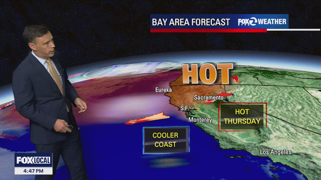

Excessive Heat Warning extended
The October heat wave continues. While temperatures should begin to cool in the Thursday forecast, another round of triple digit heat is expected. The Excessive Heat Warning has been extended until 11 pm Thursday. Forecast highs should range from the mid 70s near the coast to 103 well inland. The Friday forecast features slightly cooler temperatures. Drink lots of water and look for the shade! -Mark
The October heat wave continues. While temperatures should begin to cool in the Thursday forecast, another round of triple digit heat is expected. The Excessive Heat Warning has been extended until 11 pm Thursday. Forecast highs should range from the mid 70s near the coast to 103 well inland. The Friday forecast features slightly cooler temperatures. Drink lots of water and look for the shade! -Mark


Real hot inland
Temps continue to be in the triple digits inland.
Temps continue to be in the triple digits inland.