

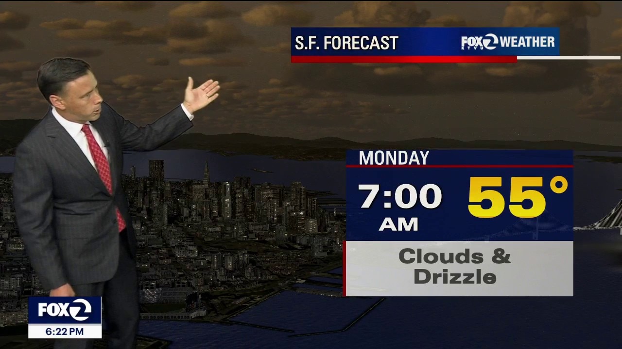
Cooler pattern
Heat will remain a distant stranger for now. A cool weather pattern is setting up camp in the Pacific. Low clouds will blanket most of the area Monday. Chance of drizzle too! Highs should range from the low 60s to the upper 70s. Tuesday will be the coolest day of the period. Have a great week! -Mark
Heat will remain a distant stranger for now. A cool weather pattern is setting up camp in the Pacific. Low clouds will blanket most of the area Monday. Chance of drizzle too! Highs should range from the low 60s to the upper 70s. Tuesday will be the coolest day of the period. Have a great week! -Mark
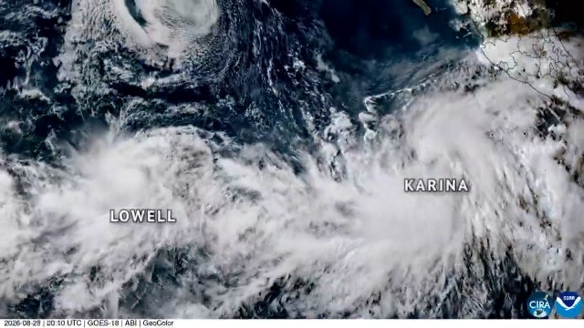

Karina surges to major hurricane wind speeds in Pacific, forecasters say
Hurricane Karina sits about 1,000 miles off the Baja California coast and is currently not a threat to land, meteorologists report.
Hurricane Karina sits about 1,000 miles off the Baja California coast and is currently not a threat to land, meteorologists report.
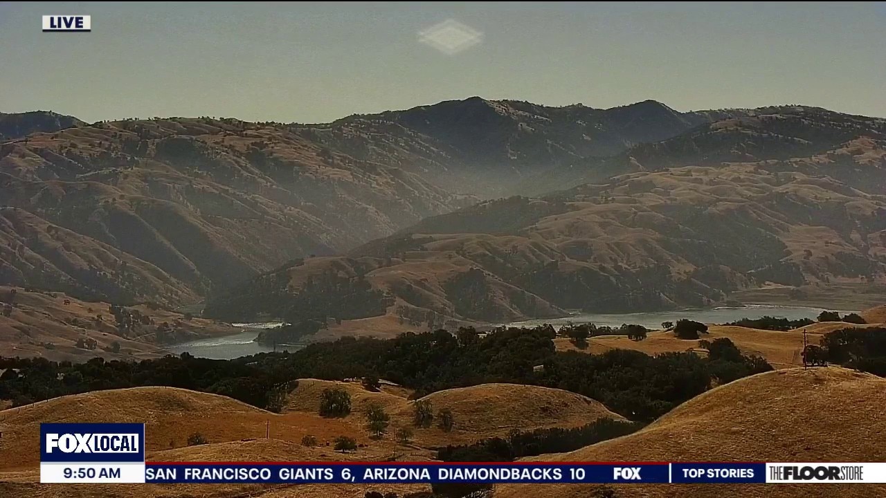
Early fall preview continues
Happy Sunday! A pleasant day is on tap across the Bay Area, with morning low clouds giving way to mostly sunny skies, away from the coast plus mild temperatures and a breezy afternoon. Changes arrive as we head into the first week of September. A deepening marine layer and noticeably cooler temps. in the forecast Monday, even cooler on Tuesday. There is also a slight chance of drizzle and light spotty showers in the days ahead. Looking to Labor Day weekend, the same type of pattern may keep temperatures below normal with plenty of coastal clouds and perhaps additional moisture from the south returning as well.
Happy Sunday! A pleasant day is on tap across the Bay Area, with morning low clouds giving way to mostly sunny skies, away from the coast plus mild temperatures and a breezy afternoon. Changes arrive as we head into the first week of September. A deepening marine layer and noticeably cooler temps. in the forecast Monday, even cooler on Tuesday. There is also a slight chance of drizzle and light spotty showers in the days ahead. Looking to Labor Day weekend, the same type of pattern may keep temperatures below normal with plenty of coastal clouds and perhaps additional moisture from the south returning as well.
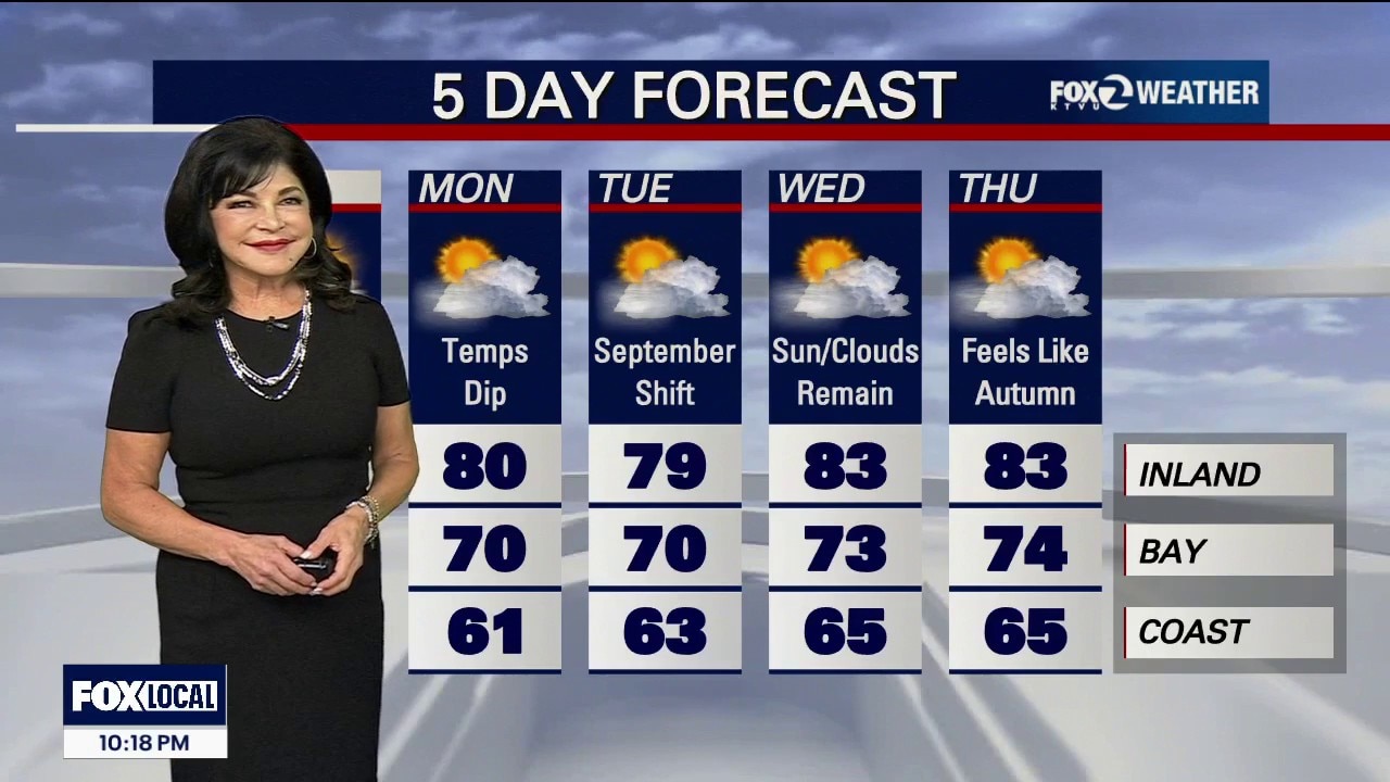
Sunday Funday
Sunday Forecast Daytime Temperatures: A broad upper-level low-pressure system parked over the Pacific Northwest and British Columbia is keeping the region comfortably cool. Expect afternoon temperatures across the entire Bay Area to remain a few to several degrees below late-August seasonal averages. The Microclimate Numbers: Immediate Pacific Coast: Crisp and autumnal, staying stuck in the low-to-mid 60s. Bayside Shoreline: Highly comfortable with highs reaching the upper 60s to mid-70s. Inland Valleys: Capped beautifully in the upper 70s to low 80s. Marine Layer & Clearing: The marine layer is forecast to deepen tonight. Morning low clouds will gradually mix out, giving way to mostly sunny skies for the afternoon hours Afternoon Winds: Breezy west-to-southwest 10 - 20 mph. Perhaps a little haze from the fires to the south, however, no alerts or advisories.
Sunday Forecast Daytime Temperatures: A broad upper-level low-pressure system parked over the Pacific Northwest and British Columbia is keeping the region comfortably cool. Expect afternoon temperatures across the entire Bay Area to remain a few to several degrees below late-August seasonal averages. The Microclimate Numbers: Immediate Pacific Coast: Crisp and autumnal, staying stuck in the low-to-mid 60s. Bayside Shoreline: Highly comfortable with highs reaching the upper 60s to mid-70s. Inland Valleys: Capped beautifully in the upper 70s to low 80s. Marine Layer & Clearing: The marine layer is forecast to deepen tonight. Morning low clouds will gradually mix out, giving way to mostly sunny skies for the afternoon hours Afternoon Winds: Breezy west-to-southwest 10 - 20 mph. Perhaps a little haze from the fires to the south, however, no alerts or advisories.


Deadly flash flooding in Nepal hits close to home for this North Bay man
North Bay man from Nepal shares photos and videos taken by family and friends coping with the devastating from the floods in his home country.
North Bay man from Nepal shares photos and videos taken by family and friends coping with the devastating from the floods in his home country.

Fall preview on tap for the weekend
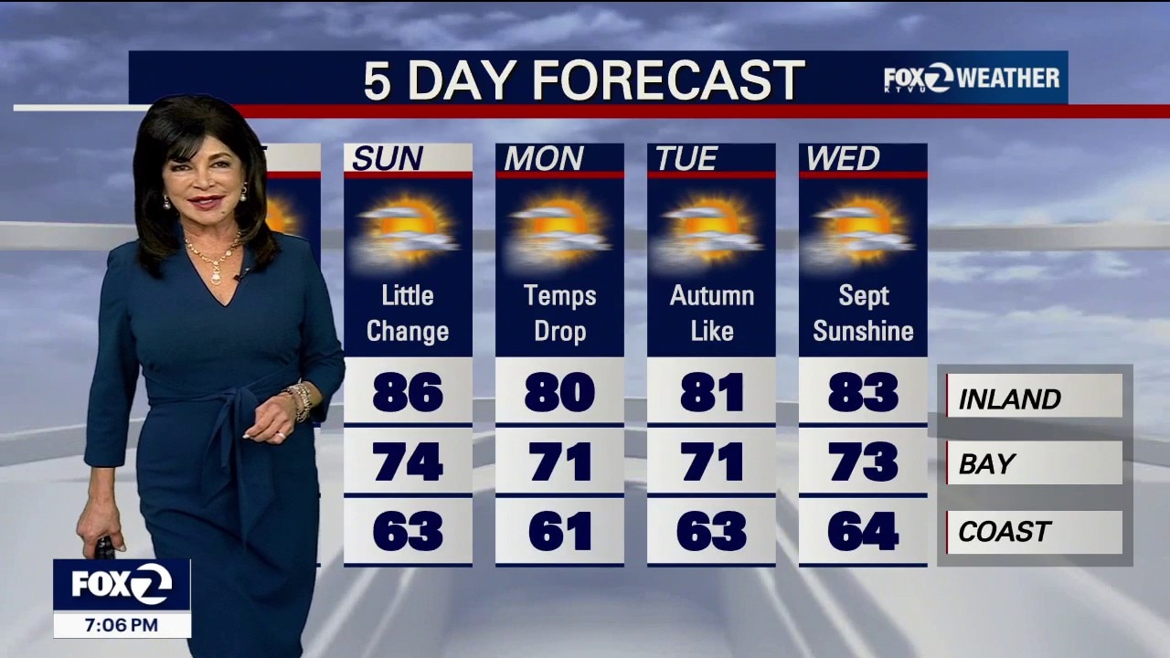
Happy Saturday everyone! Summer isn’t over yet, but it might feel like it. Under partly cloudy skies and a brisk onshore breeze, expect afternoon temperatures to drop well below average, ranging from low 60s at the coast to mid 80s inland.
Happy Saturday everyone! Summer isn’t over yet, but it might feel like it. Under partly cloudy skies and a brisk onshore breeze, expect afternoon temperatures to drop well below average, ranging from low 60s at the coast to mid 80s inland.
August's last weekend feels like Autumn
Atmospheric moisture shifts eastward, allowing the marine layer to retreat to the coast by the afternoon for widespread sunshine inland. Temperatures will bounce back slightly. SATURDAY Coastal Highs: Remaining chilly in the upper 60s with persistent afternoon shoreline clouds. Bayshore: Reaching comfortable highs in the low-to-mid 70s. Inland: Mostly sunny and warmer, climbing into the low-to-mid 80s. Winds: A strengthening offshore trough will drive gusty onshore winds. Expect widespread ocean breezes shifting west-southwest at 10 to 20 mph, with afternoon gusts peaking around 24 mph near gaps and passes. SUNDAY Coastal Highs: Mid-to-upper 60s under morning marine stratus. Bayshore: Upper 60s to around 70 degrees. Inland: Cooling down to the mid-to-upper 70s (5 to 15 degrees below seasonal averages). Winds: Sustained, southwest breezes will continue at 10 to 15 mph, keeping conditions feeling crisp with evening gusts tapering off around 20 mph. Have a nice weekend!
Atmospheric moisture shifts eastward, allowing the marine layer to retreat to the coast by the afternoon for widespread sunshine inland. Temperatures will bounce back slightly. SATURDAY Coastal Highs: Remaining chilly in the upper 60s with persistent afternoon shoreline clouds. Bayshore: Reaching comfortable highs in the low-to-mid 70s. Inland: Mostly sunny and warmer, climbing into the low-to-mid 80s. Winds: A strengthening offshore trough will drive gusty onshore winds. Expect widespread ocean breezes shifting west-southwest at 10 to 20 mph, with afternoon gusts peaking around 24 mph near gaps and passes. SUNDAY Coastal Highs: Mid-to-upper 60s under morning marine stratus. Bayshore: Upper 60s to around 70 degrees. Inland: Cooling down to the mid-to-upper 70s (5 to 15 degrees below seasonal averages). Winds: Sustained, southwest breezes will continue at 10 to 15 mph, keeping conditions feeling crisp with evening gusts tapering off around 20 mph. Have a nice weekend!
40 miles of Highway 1 closed as Timber, Plaskett wildfires grow in Monterey County
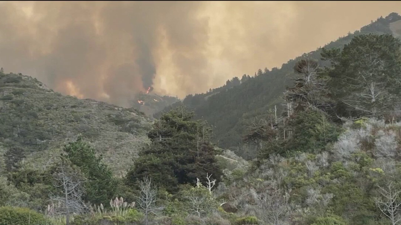
The Timber Fire has grown to about 23,000 acres as of Friday evening, while the Plaskett Fire is estimated at about 2,700 acres. The fires in Monterey County have shutdown a 40-mile stretch of Highway 1 from north to south. Jesse Gary reports.
The Timber Fire has grown to about 23,000 acres as of Friday evening, while the Plaskett Fire is estimated at about 2,700 acres. The fires in Monterey County have shutdown a 40-mile stretch of Highway 1 from north to south. Jesse Gary reports.
California slashes wildfire budget as resilience programs show results
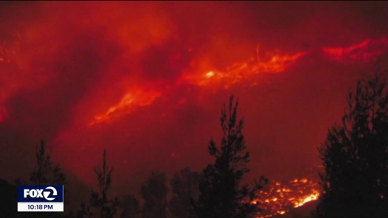
California is experiencing a mild peak fire season, with year-to-date figures showing a 12 percent drop in total fires and a 53 percent reduction in acres burned compared to the five-year average. Desperate to balance its budget, the state slashed $101 million from seven major wildfire and forest resilience programs, cutting funding by 47 percent. Tom Vacar reports.
California is experiencing a mild peak fire season, with year-to-date figures showing a 12 percent drop in total fires and a 53 percent reduction in acres burned compared to the five-year average. Desperate to balance its budget, the state slashed $101 million from seven major wildfire and forest resilience programs, cutting funding by 47 percent. Tom Vacar reports.


How to help survivors after catastrophic floods in Nepal and Tibet
Humanitarian groups are mobilizing to help survivors after catastrophic flooding near the Nepal-China border left hundreds dead or missing, including Americans.
Humanitarian groups are mobilizing to help survivors after catastrophic flooding near the Nepal-China border left hundreds dead or missing, including Americans.
Tropical clouds
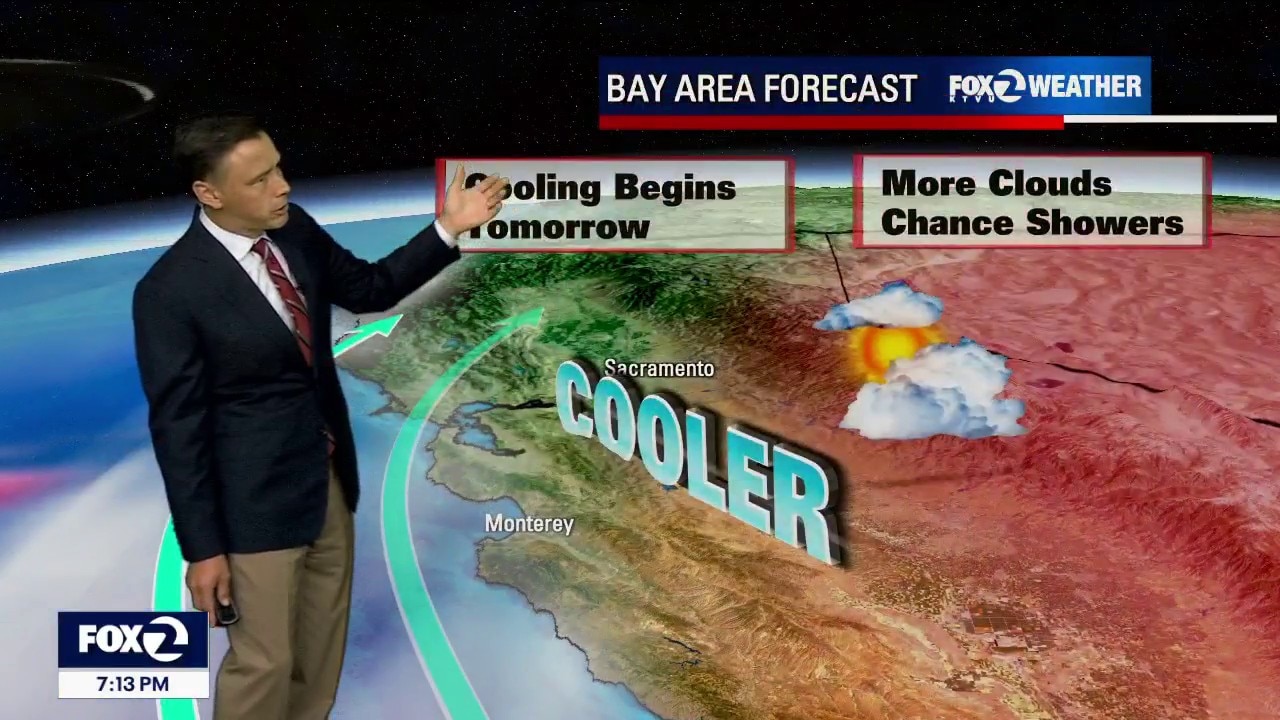
Tropical clouds will continue to drift into the Bay Area Friday. The slight chance (20%) of showers has also been introduced. Potential lightning strikes will boost the fire danger. A Red Flag Warning has been posted for the Santa Cruz Mountains and Monterey Bay for most of Friday, Our cooling trend begins. Highs should range from the low 60s to the mid 80s.
Tropical clouds will continue to drift into the Bay Area Friday. The slight chance (20%) of showers has also been introduced. Potential lightning strikes will boost the fire danger. A Red Flag Warning has been posted for the Santa Cruz Mountains and Monterey Bay for most of Friday, Our cooling trend begins. Highs should range from the low 60s to the mid 80s.

Puerto Rico's water crisis and drought disaster declaration
The U.S. government has announced a drought disaster for more than two dozen cities and towns in Puerto Rico. Pearl Marvell, editor at Yale Climate Connections, gives insight on the water crisis across the U.S. Caribbean territory.
The U.S. government has announced a drought disaster for more than two dozen cities and towns in Puerto Rico. Pearl Marvell, editor at Yale Climate Connections, gives insight on the water crisis across the U.S. Caribbean territory.

NHC: Tropical Storm Dolly forms in the Atlantic
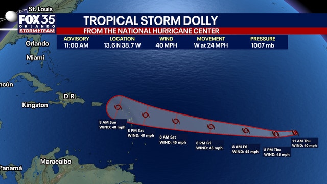
Tropical Storm Dolly has formed in the Atlantic, becoming the fourth named storm of the 2026 Atlantic Hurricane Season.
Tropical Storm Dolly has formed in the Atlantic, becoming the fourth named storm of the 2026 Atlantic Hurricane Season.

Tropical clouds moving in while the heat hangs on for one more day
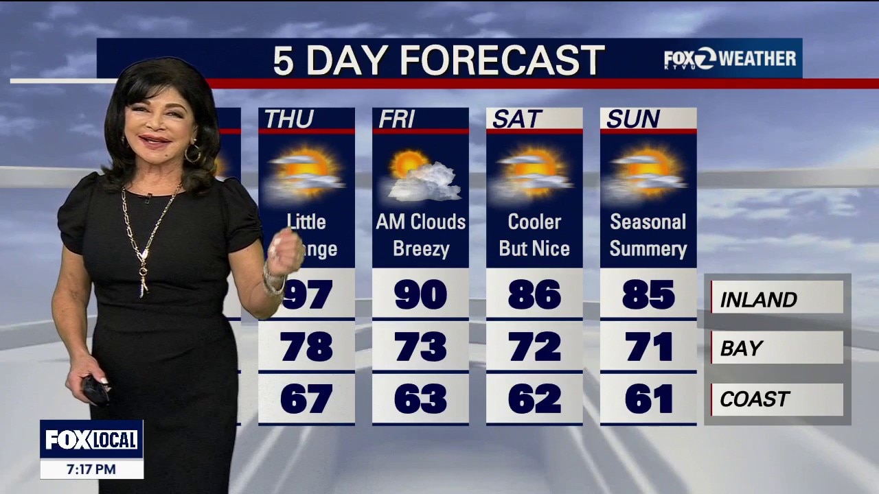
We have a classic summertime set up with temps running near average along the coast and bay. Toasty temps. inland with afternoon highs reaching into the 90s on Thursday. Patchy fog and tropical clouds during the evening could make it difficult to see the lunar eclipse. Bigger changes are expected on Friday as cloudy, cooler, breezier weather arrives. A few showers are possible as atmospheric moisture surges over the Bay Area Thunderstorms/dry lightning remain unlikely, but from a fire-weather perspective, it's worth watching.
We have a classic summertime set up with temps running near average along the coast and bay. Toasty temps. inland with afternoon highs reaching into the 90s on Thursday. Patchy fog and tropical clouds during the evening could make it difficult to see the lunar eclipse. Bigger changes are expected on Friday as cloudy, cooler, breezier weather arrives. A few showers are possible as atmospheric moisture surges over the Bay Area Thunderstorms/dry lightning remain unlikely, but from a fire-weather perspective, it's worth watching.
Warmer Wednesday
A shallow marine layer will keep the coast near seasonal averages through Wednesday, while inland areas experience warm, dry conditions with temperatures 10–12°F above average. Breezy onshore winds of 20–35 mph are expected along the coast and in valleys, with near-critical fire weather conditions persisting above 1,000 feet through Thursday. Coastal areas will see nightly stratus clearing by midday, and a significant pattern change with cooler temperatures and tropical moisture is expected by the weekend. No formal watches or warnings are currently in effect, except a Small Craft Advisory inside and outside the Gate until Thursday 9AM with stiff Northwest winds to 30 Knots.
A shallow marine layer will keep the coast near seasonal averages through Wednesday, while inland areas experience warm, dry conditions with temperatures 10–12°F above average. Breezy onshore winds of 20–35 mph are expected along the coast and in valleys, with near-critical fire weather conditions persisting above 1,000 feet through Thursday. Coastal areas will see nightly stratus clearing by midday, and a significant pattern change with cooler temperatures and tropical moisture is expected by the weekend. No formal watches or warnings are currently in effect, except a Small Craft Advisory inside and outside the Gate until Thursday 9AM with stiff Northwest winds to 30 Knots.

Atlantic’s next tropical storm will be named ‘Dolly,’ but that’s a coincidence
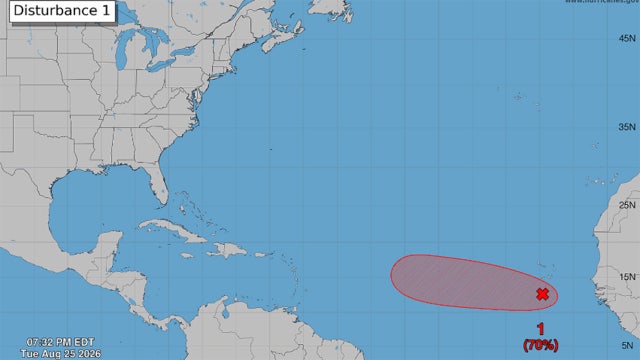
The next time a tropical storm forms in the Atlantic, it will be named Dolly. But, that has nothing to do with the death of the country superstar.
The next time a tropical storm forms in the Atlantic, it will be named Dolly. But, that has nothing to do with the death of the country superstar.
Warmer Tuesday
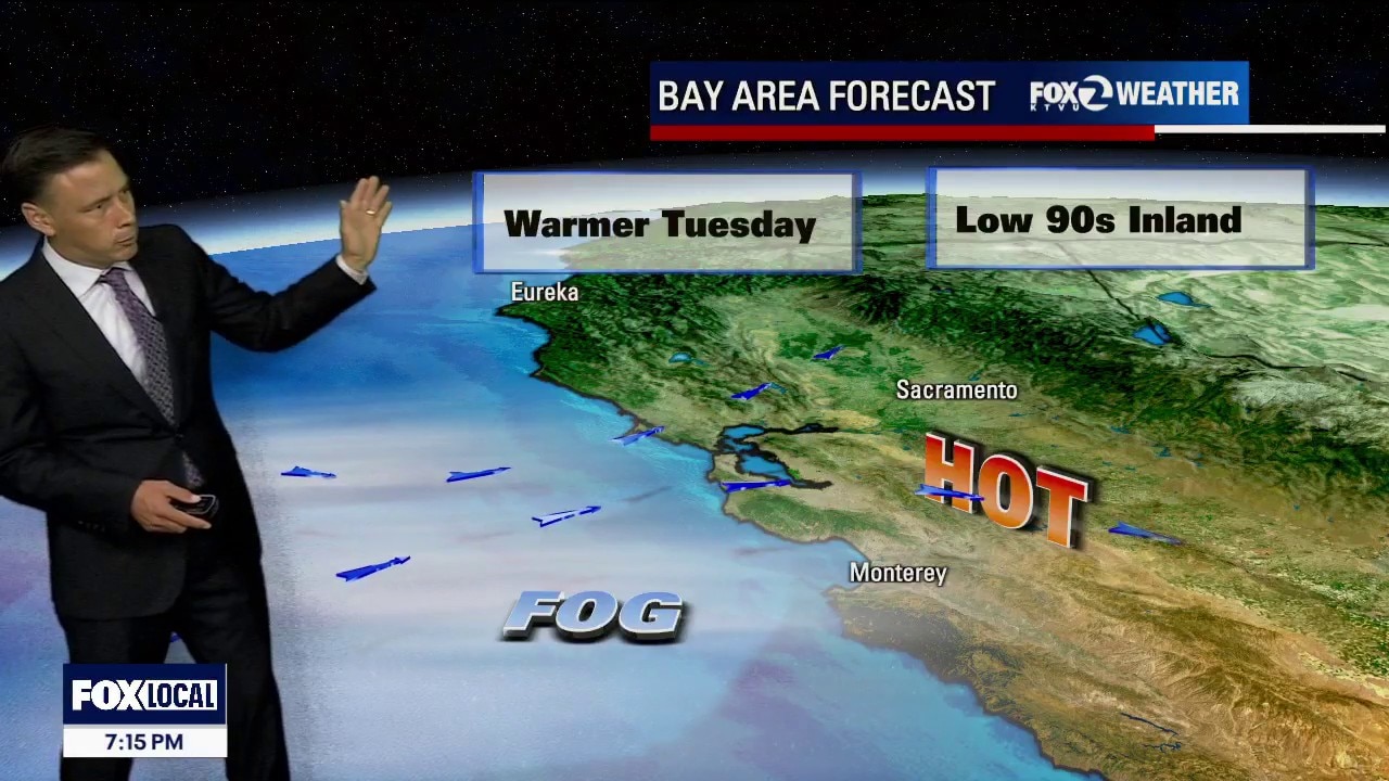
Warmer temperatures in the Tuesday forecast! Low clouds will blanket the coast and bay during the morning hours. We are expecting hazy sun later in the day. Highs should range from the mid 60s to the low 90s. The warm to hot pattern remains in place through the weekend.
Warmer temperatures in the Tuesday forecast! Low clouds will blanket the coast and bay during the morning hours. We are expecting hazy sun later in the day. Highs should range from the mid 60s to the low 90s. The warm to hot pattern remains in place through the weekend.
Cooler Monday forecast
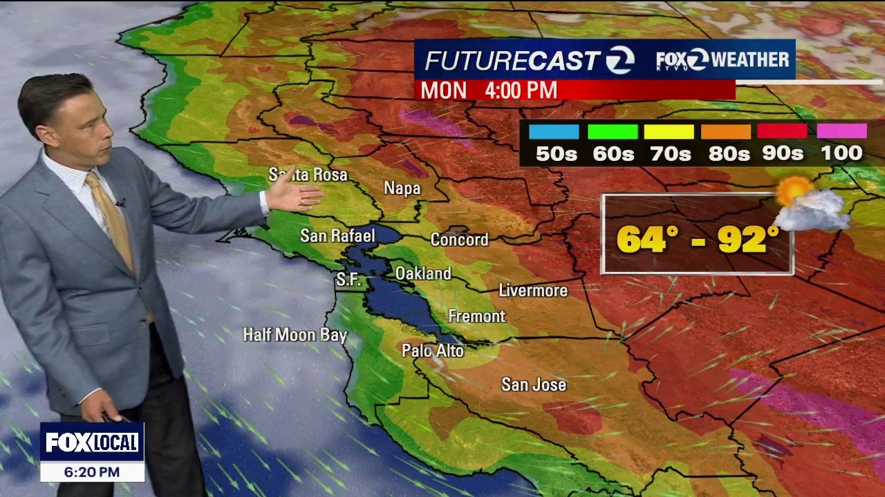
Your Monday weather forecast features cooler temperatures. Low clouds will resurface near the the coast and bay during the commute. The clouds are expected to clear back to near the coast later in the day. Highs should range from the mid 60s to the low 90s.
Your Monday weather forecast features cooler temperatures. Low clouds will resurface near the the coast and bay during the commute. The clouds are expected to clear back to near the coast later in the day. Highs should range from the mid 60s to the low 90s.

Human-caused Hawk Fire rapidly grows in Nevada, injuring 6 as tens of thousands are forced to evacuate
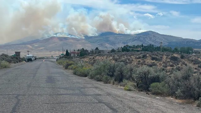
Level 3 “Go Now" evacuation zones extend across northwest Reno, while evacuation warnings remain in effect across surrounding communities.
Level 3 “Go Now" evacuation zones extend across northwest Reno, while evacuation warnings remain in effect across surrounding communities.


Indiana Gov. Braun: NIPSCO has failed 21,000 residents still without power
Gov. Braun said NIPSCO continues to "fail" the more than 20,000 Indiana residents still without power nearly two weeks after major storms.
Gov. Braun said NIPSCO continues to "fail" the more than 20,000 Indiana residents still without power nearly two weeks after major storms.