


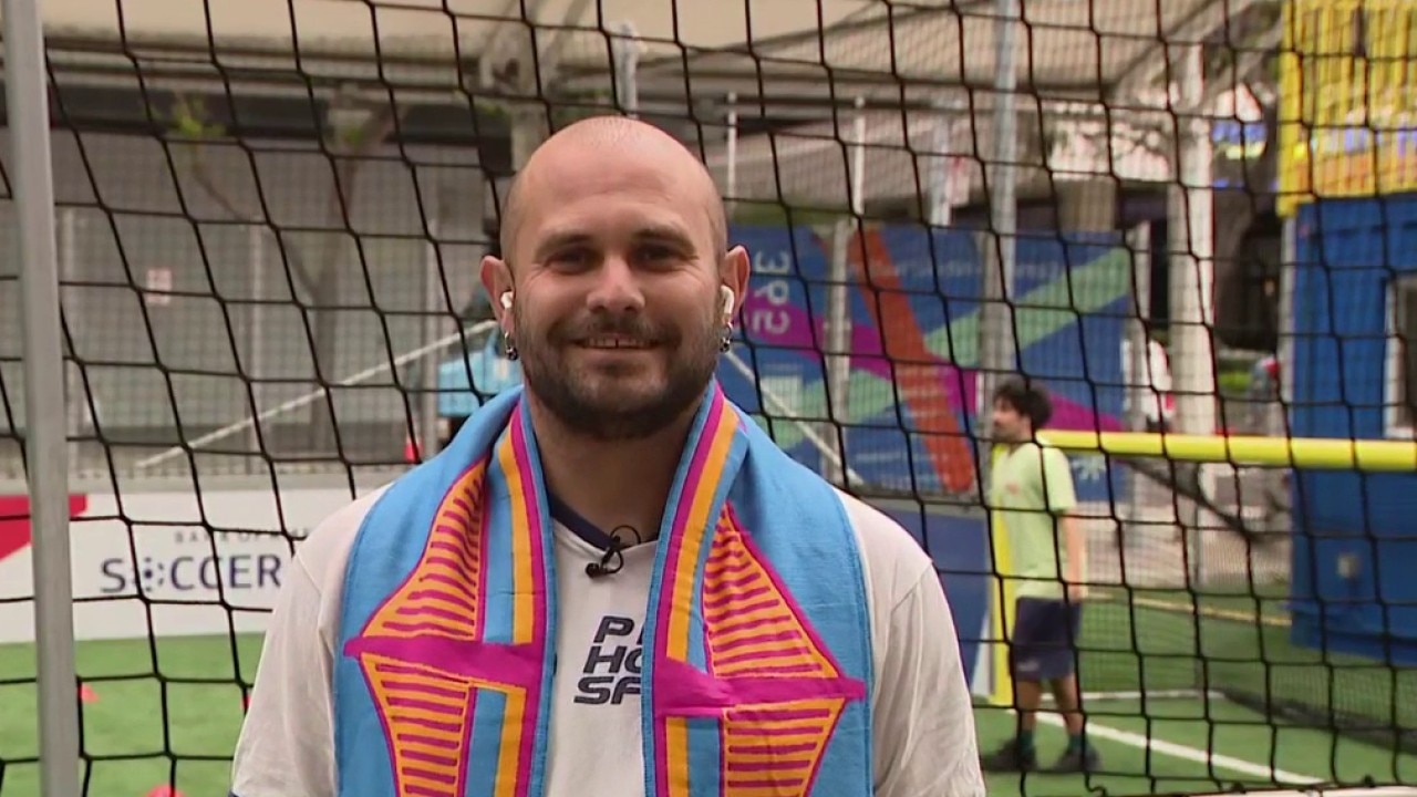
Pride House SF works to create inclusive environments for athletes
Pride House SF hosts USA World Cup Watch Party and a coaching workshop that aims to make youth soccer a more welcoming space for all.
Pride House SF hosts USA World Cup Watch Party and a coaching workshop that aims to make youth soccer a more welcoming space for all.

More of the same today with changes arriving tomorrow
Happy weekend everyone! A near repeat in weather is expected for the final day of spring. Partly sunny at the coast to mostly sunny inland is in the afternoon forecast with temps. ranging from low 60s in Pacifica to Upper 70s in Livermore. A warming trend begins for Father's Day and first day of summer.
Happy weekend everyone! A near repeat in weather is expected for the final day of spring. Partly sunny at the coast to mostly sunny inland is in the afternoon forecast with temps. ranging from low 60s in Pacifica to Upper 70s in Livermore. A warming trend begins for Father's Day and first day of summer.

Local soccer club on U.S. success
Spokesperson for the San Francisco Glens soccer club talks about Team USA, and how youth members helped prepare the stadium for the FIFA World Cup.
Spokesperson for the San Francisco Glens soccer club talks about Team USA, and how youth members helped prepare the stadium for the FIFA World Cup.

Youth soccer development in Richmond
Richmond United Soccer Club appeared on KTVU, to discusss its all-volunteer program to teach children about soccer at an affordable cost for the family.
Richmond United Soccer Club appeared on KTVU, to discusss its all-volunteer program to teach children about soccer at an affordable cost for the family.
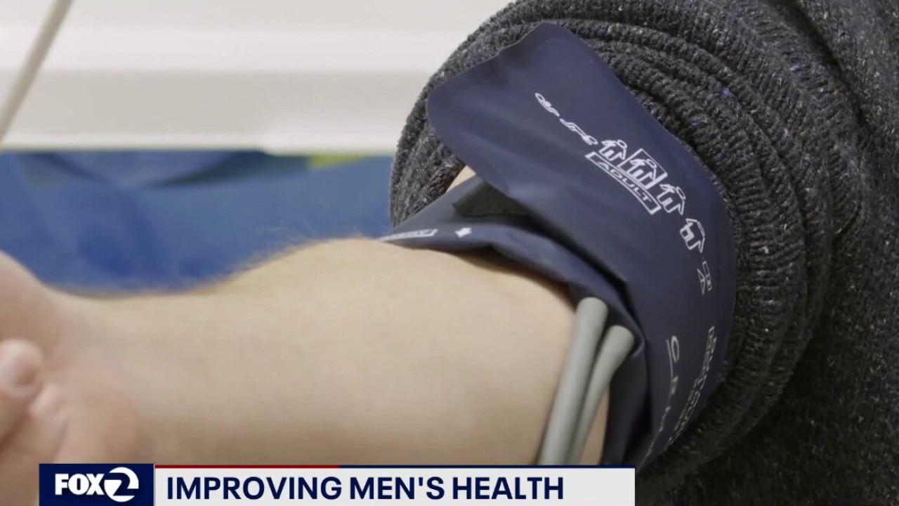
Improving men's health during Father's Day celebration
Kaiser Permanente San Jose's Dr. Nolan Lee discusses steps men need to take to improve their health, and live longer.
Kaiser Permanente San Jose's Dr. Nolan Lee discusses steps men need to take to improve their health, and live longer.
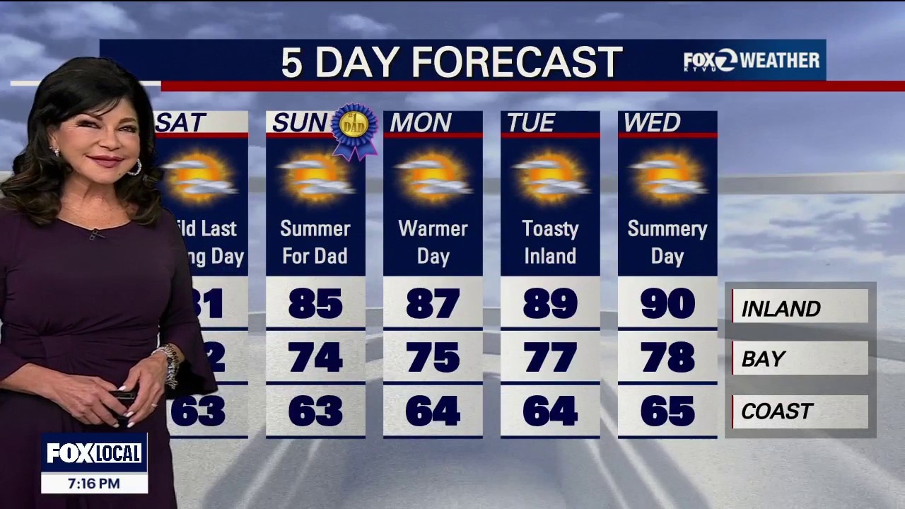
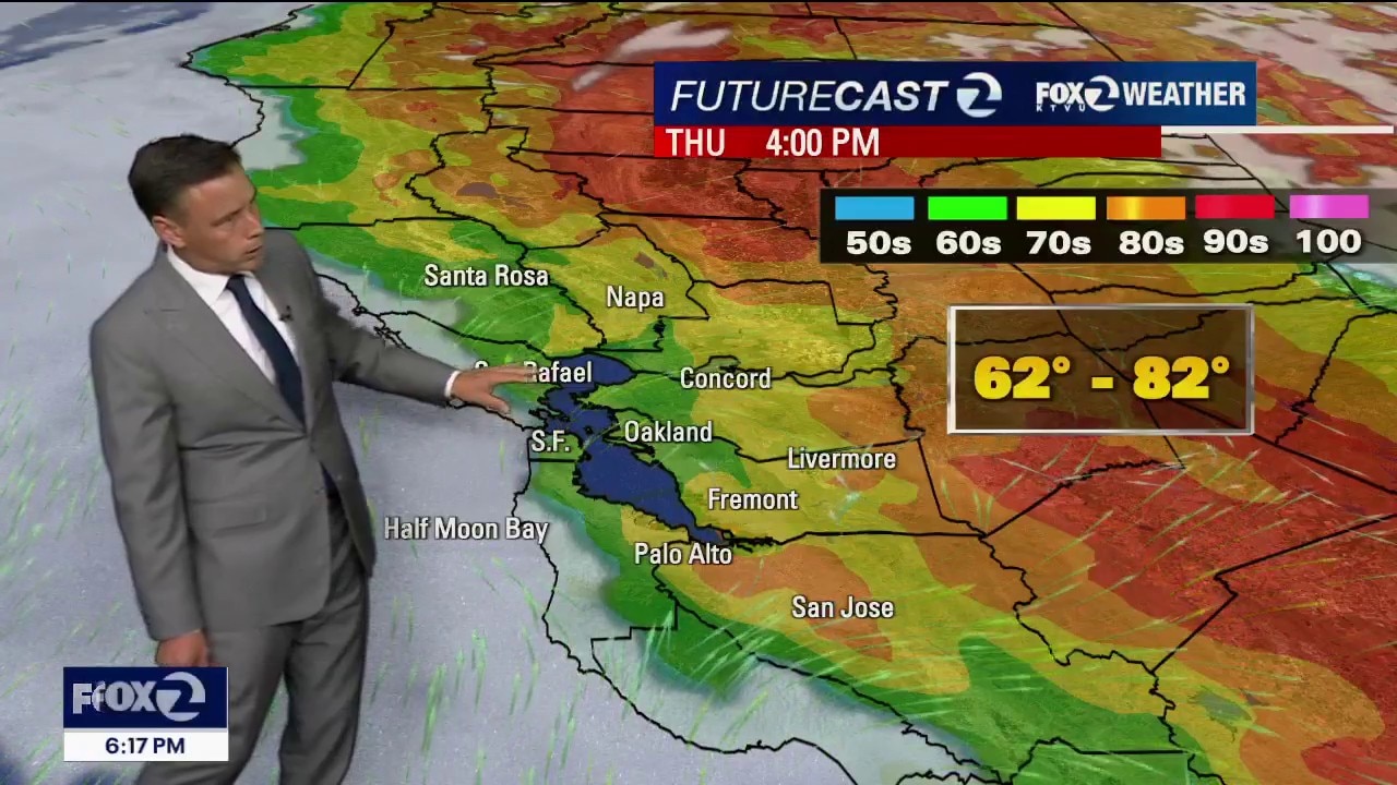
Summer arrives Sunday, but will it FEEL like it?
Tomorrow will be a near-carbon copy of today. Expect a cloudy morning with patchy coastal drizzle followed by slow clearing to the coast, keeping daytime temperatures below seasonal temperatures. A contrast between the cloudy coast and sunlit inland areas will spin up strong onshore winds. Expect widespread gusts of 20 to 30 mph, with gusts up to 40 mph. Highs will bank from low-mid 60s at the Coast to 81 inland. A Beach Hazards Statement remains active through early Sunday for sneaker waves and dangerous rip currents. Do NOT turn your back to the ocean and stay out of the water. The cooling upper trough will lose its grip as shortwave high pressure begins compressing the marine layer, starting a subtle warming trend on Father's Day and the first day of summer on Sunday.
Tomorrow will be a near-carbon copy of today. Expect a cloudy morning with patchy coastal drizzle followed by slow clearing to the coast, keeping daytime temperatures below seasonal temperatures. A contrast between the cloudy coast and sunlit inland areas will spin up strong onshore winds. Expect widespread gusts of 20 to 30 mph, with gusts up to 40 mph. Highs will bank from low-mid 60s at the Coast to 81 inland. A Beach Hazards Statement remains active through early Sunday for sneaker waves and dangerous rip currents. Do NOT turn your back to the ocean and stay out of the water. The cooling upper trough will lose its grip as shortwave high pressure begins compressing the marine layer, starting a subtle warming trend on Father's Day and the first day of summer on Sunday.


US advances to knockout round after 2-0 win over Australia
It's official; with today's win, the USMNT has clinched a spot in the World Cup knockout round.
It's official; with today's win, the USMNT has clinched a spot in the World Cup knockout round.

Injured SFPD officer released from hospital after line-of-duty shooting
San Francisco Police Officer Brittany Taylor was discharged from San Francisco General Hospital on Thursday afternoon after suffering life-threatening injuries in a shooting less than three weeks ago.
San Francisco Police Officer Brittany Taylor was discharged from San Francisco General Hospital on Thursday afternoon after suffering life-threatening injuries in a shooting less than three weeks ago.

Cooling trend
The Bay Area cooling trend continues. Low clouds and drizzle return to the area Friday morning. Partly sunny skies are expected later in day. Winds will be picking up again (20 - 35 mph). Highs should range from the low 60s to the upper 70s. The Beach Hazards Statement is in effect until 5 am Sunday.
The Bay Area cooling trend continues. Low clouds and drizzle return to the area Friday morning. Partly sunny skies are expected later in day. Winds will be picking up again (20 - 35 mph). Highs should range from the low 60s to the upper 70s. The Beach Hazards Statement is in effect until 5 am Sunday.

Concord's Cocina Híjole María bringing World Cup energy
It’s Mexico vs. South Korea on the world stage tonight, but in Concord, the energy is just as personal at Cocina Híjole María, located on1819 Colfax Street. The family-run spot known for its watch parties and deep community ties. Owner, Francisco Laredo, his sister, Anayeli and mother and head chef, Ana Maria Arellano, talk family, tradition, and food.
It’s Mexico vs. South Korea on the world stage tonight, but in Concord, the energy is just as personal at Cocina Híjole María, located on1819 Colfax Street. The family-run spot known for its watch parties and deep community ties. Owner, Francisco Laredo, his sister, Anayeli and mother and head chef, Ana Maria Arellano, talk family, tradition, and food.
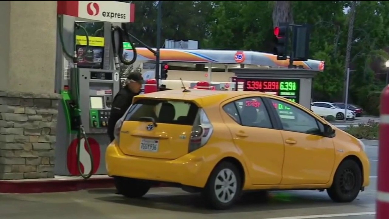
Gas prices finally dip for the first time since March
For the first time in months, drivers are seeing some welcome relief at the pump. The national average price for gasoline has slipped below four dollars a gallon. Patrick De Haan, head of petroleum analysis, at GasBuddy, gives insight.
For the first time in months, drivers are seeing some welcome relief at the pump. The national average price for gasoline has slipped below four dollars a gallon. Patrick De Haan, head of petroleum analysis, at GasBuddy, gives insight.
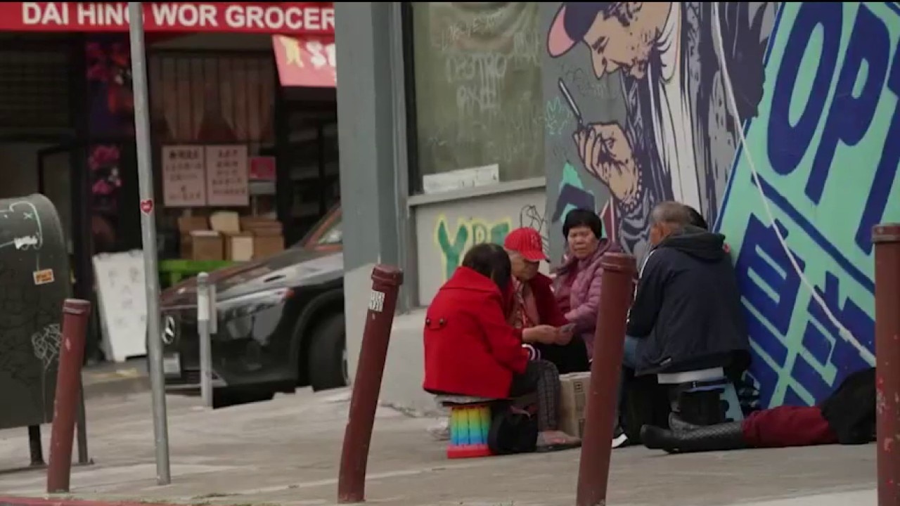
SF Chinatown faces major disruptions as 3 construction projects loom
San Francisco's Chinatown is facing significant disruptions as three major construction projects are scheduled to hit the historic neighborhood nearly all at once. While city officials emphasize that the work represents much-needed infrastructure improvements, local merchants and residents argue that the overlapping timelines are creating too much strain on the community.
San Francisco's Chinatown is facing significant disruptions as three major construction projects are scheduled to hit the historic neighborhood nearly all at once. While city officials emphasize that the work represents much-needed infrastructure improvements, local merchants and residents argue that the overlapping timelines are creating too much strain on the community.

Palo Alto restaurant showcases sushi-making
Peninsula restaurant, with Chef Hoa Tan, appearing on Mornings on 2, to display sushi preparation and rolling techniques
Peninsula restaurant, with Chef Hoa Tan, appearing on Mornings on 2, to display sushi preparation and rolling techniques
Slightly cooler
Low clouds will blanket most of the Bay Area Thursday morning. Drizzle could also resurface near the coast and bay. The clouds will gradually retreat to near the coast. Slightly cooler temperatures are expected too. Highs should range from the low 60s to the low 80s.
Low clouds will blanket most of the Bay Area Thursday morning. Drizzle could also resurface near the coast and bay. The clouds will gradually retreat to near the coast. Slightly cooler temperatures are expected too. Highs should range from the low 60s to the low 80s.
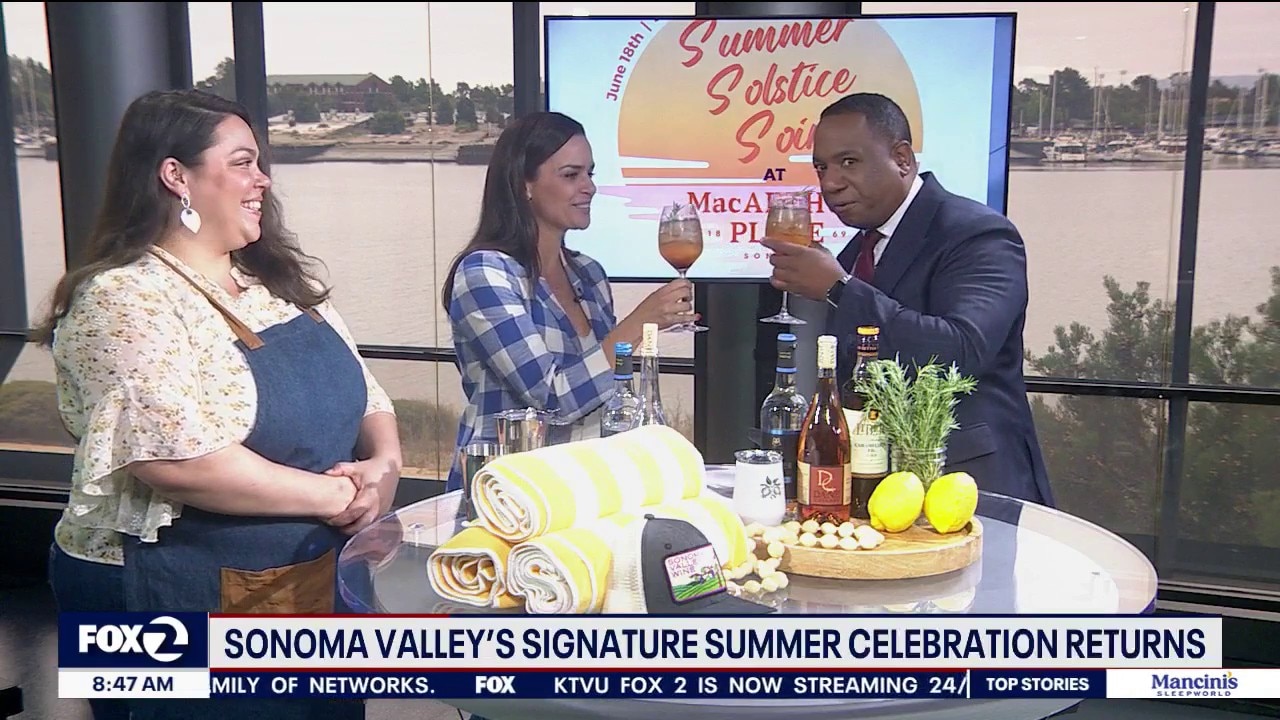
A summer celebration of Sonoma Valley wine
On June 18, Sonoma Valley Vintners & Growers Alliance will launch the Year of Community with the Sonoma Summer Solstice Soirée at MacArthur Place Hotel & Spa. Guests will enjoy poolside wine tastings from some of Sonoma Valley’s most celebrated wineries, seasonal cuisine, live music, and the signature Sonoma Spritz cocktail. The event marks the beginning of a summer-long celebration leading up to the 129th Vintage Festival in September.
On June 18, Sonoma Valley Vintners & Growers Alliance will launch the Year of Community with the Sonoma Summer Solstice Soirée at MacArthur Place Hotel & Spa. Guests will enjoy poolside wine tastings from some of Sonoma Valley’s most celebrated wineries, seasonal cuisine, live music, and the signature Sonoma Spritz cocktail. The event marks the beginning of a summer-long celebration leading up to the 129th Vintage Festival in September.


Celebrity fitness trainer sues Equinox for discrimination, wrongful termination
The suit alleges the luxury fitness company failed to protect the trainer from racist comments made by gym members and that managers retaliated against him.
The suit alleges the luxury fitness company failed to protect the trainer from racist comments made by gym members and that managers retaliated against him.

A discussion about financial freedom and understanding the ongoing wealth gap as we celebrate Juneteenth
A conversation about financial freedom, generational wealth & the ongoing wealth gap
A conversation about financial freedom, generational wealth & the ongoing wealth gap
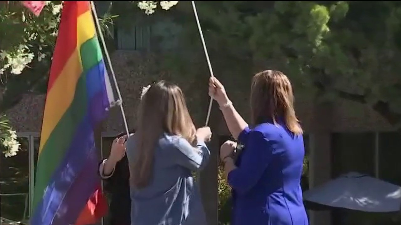
Supporting the LGBTQ+ community during Pride Month
An expert joins us to talk about how to create inclusive environments for all in a time when LGBTQ+ support declines.
An expert joins us to talk about how to create inclusive environments for all in a time when LGBTQ+ support declines.
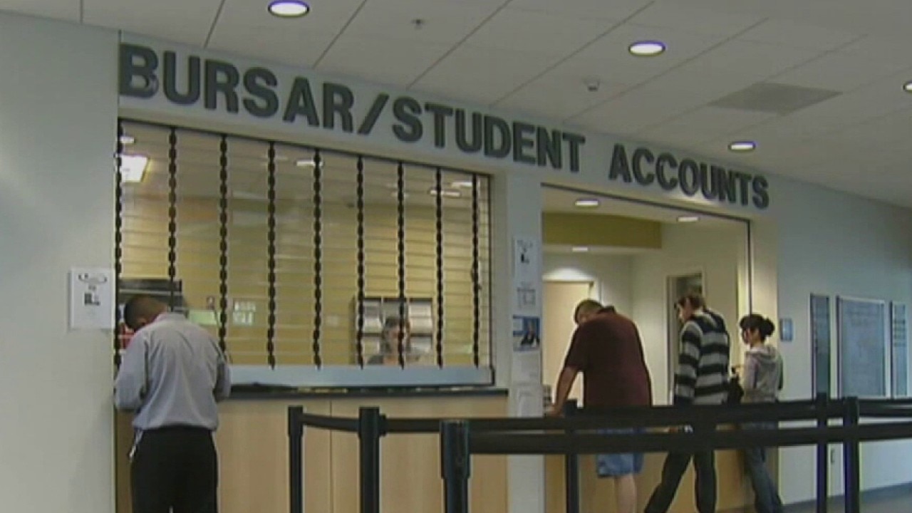
Changes ahead for student loan borrowers
An expert joins us to talk about the changes coming to student loan borrowers and discusses options for those seeking higher education.
An expert joins us to talk about the changes coming to student loan borrowers and discusses options for those seeking higher education.


San Francisco supervisor working to bring more supermarkets to the city
San Francisco Supervisor Bilal Mahood is introducing the Affordable Groceries Act, a set of legislation and ballot measures aimed at turning vacant buildings into bustling supermarkets.
San Francisco Supervisor Bilal Mahood is introducing the Affordable Groceries Act, a set of legislation and ballot measures aimed at turning vacant buildings into bustling supermarkets.