

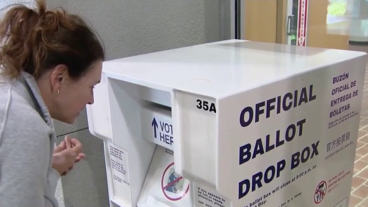
California midterm primaries
California voters are making major decisions today, from choosing who advances in the race for governor to narrowing crowded congressional contests. Under the state’s top-two primary system, the leading candidates move on to November, regardless of party. Andres Quintero, political science professor at Evergreen Valley College, gives insight.
California voters are making major decisions today, from choosing who advances in the race for governor to narrowing crowded congressional contests. Under the state’s top-two primary system, the leading candidates move on to November, regardless of party. Andres Quintero, political science professor at Evergreen Valley College, gives insight.
Mother Nature easing off the heat
Happy Tuesday everyone! The fog is back, the onshore breeze is up and afternoon highs are taking a subtle drop. For the second half of the day, a mix of low and high level clouds will join us with temps. ranging from 60s at the coast to upper 80s inland. Minor fluctuations are expected until a bigger cool down on the weekend.
Happy Tuesday everyone! The fog is back, the onshore breeze is up and afternoon highs are taking a subtle drop. For the second half of the day, a mix of low and high level clouds will join us with temps. ranging from 60s at the coast to upper 80s inland. Minor fluctuations are expected until a bigger cool down on the weekend.


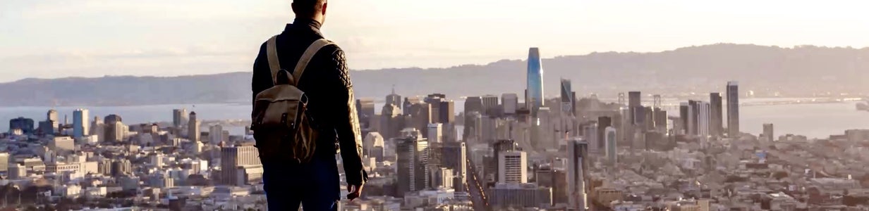
San Francisco-based Anthropic files for IPO with $965 billion valuation
San Francisco-based artificial intelligence company Anthropic filed with the SEC on Monday for a proposed initial public offering, a move that is expected to generate immense wealth and further fuel the rapid growth of the AI industry in the city.
San Francisco-based artificial intelligence company Anthropic filed with the SEC on Monday for a proposed initial public offering, a move that is expected to generate immense wealth and further fuel the rapid growth of the AI industry in the city.
Cooler Tuesday forecast
Welcome to June! The marine layer will deepen Tuesday morning. Most areas will cool off a bit. Low clouds will blanket the coast and bay during the morning hours. The clouds will gradually clear back to near the shoreline later in the day. Highs should range from the low 60s for the beaches to the upper 80s inland.
Welcome to June! The marine layer will deepen Tuesday morning. Most areas will cool off a bit. Low clouds will blanket the coast and bay during the morning hours. The clouds will gradually clear back to near the shoreline later in the day. Highs should range from the low 60s for the beaches to the upper 80s inland.
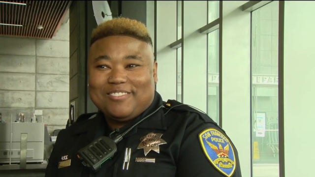

San Francisco officer injured in shootout, and suspect arrested, identified
KTVU has learned through multiple sources the name of the San Francisco Police Department officer injured in a shootout with a robbery suspect Sunday night. In addition, police have named the suspect who was arrested.
KTVU has learned through multiple sources the name of the San Francisco Police Department officer injured in a shootout with a robbery suspect Sunday night. In addition, police have named the suspect who was arrested.
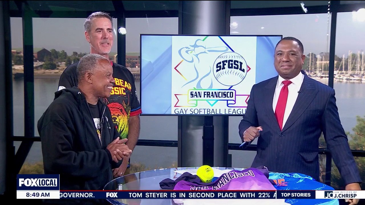
San Francisco to host the 50th anniversary of the Gay Softball World Series
Long before inclusion became a national sports conversation, one San Francisco league was creating opportunities on local ballfields. Now, the San Francisco Gay Softball League is looking ahead to a historic return of the Gay Softball World Series, five decades after the tournament was first played in the city. Vincent Fuqua, SFGSL commissioner, and Michael Cross, League treasurer, give insight.
Long before inclusion became a national sports conversation, one San Francisco league was creating opportunities on local ballfields. Now, the San Francisco Gay Softball League is looking ahead to a historic return of the Gay Softball World Series, five decades after the tournament was first played in the city. Vincent Fuqua, SFGSL commissioner, and Michael Cross, League treasurer, give insight.
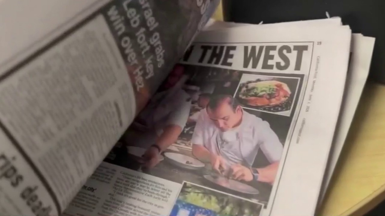
California Post expands north
The California Post is expanding its print distribution to reach thousands of new readers across northern California. The publication already has reporters covering local news, sports, technology, and politics, with plans for even more regionally focused content. Nick Papps, editor-in-chief of The California Post, gives insight.
The California Post is expanding its print distribution to reach thousands of new readers across northern California. The publication already has reporters covering local news, sports, technology, and politics, with plans for even more regionally focused content. Nick Papps, editor-in-chief of The California Post, gives insight.
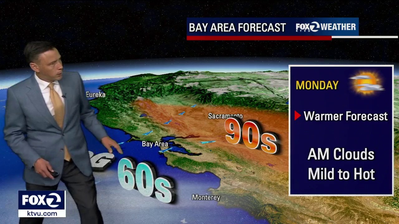
Hottest day of the week is upon us
Happy Monday Everyone. Mostly sunny skies will reign over the Bay Area today with afternoon highs ranging from low 60s at the shore to low 90s inland. A Beach Hazard Alert for our coast continues until Tuesday morning. Temperatures take a dip tomorrow. Additional cooling is expected for the weekend.
Happy Monday Everyone. Mostly sunny skies will reign over the Bay Area today with afternoon highs ranging from low 60s at the shore to low 90s inland. A Beach Hazard Alert for our coast continues until Tuesday morning. Temperatures take a dip tomorrow. Additional cooling is expected for the weekend.
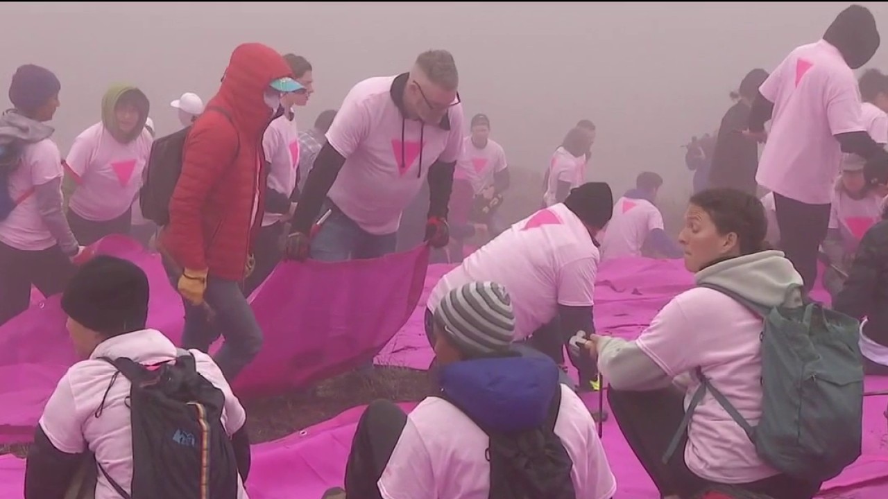
Volunteers needed for San Francisco's Pink Triangle display
Today is the first day of Pride Month, and one organization in San Francisco is looking for volunteers to help install the annual Pink Triangle on Twin Peaks. Patrick Carney joins Mornings on 2 with more on how you can help.
Today is the first day of Pride Month, and one organization in San Francisco is looking for volunteers to help install the annual Pink Triangle on Twin Peaks. Patrick Carney joins Mornings on 2 with more on how you can help.
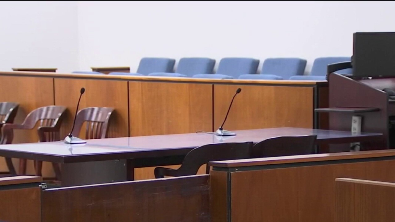
SF Superior Court ending pretrial diversion program
The San Francisco Superior Court is planning on ending a pretrial diversion program that works with people who are facing criminal charges, over accusations the organization that runs it is not being transparent. But the nonprofit is pushing back against those accusations. CEO of the SF Pretrial Diversion Project, David Mauroff, joins Mornings on 2 to discuss the possible changes.
The San Francisco Superior Court is planning on ending a pretrial diversion program that works with people who are facing criminal charges, over accusations the organization that runs it is not being transparent. But the nonprofit is pushing back against those accusations. CEO of the SF Pretrial Diversion Project, David Mauroff, joins Mornings on 2 to discuss the possible changes.
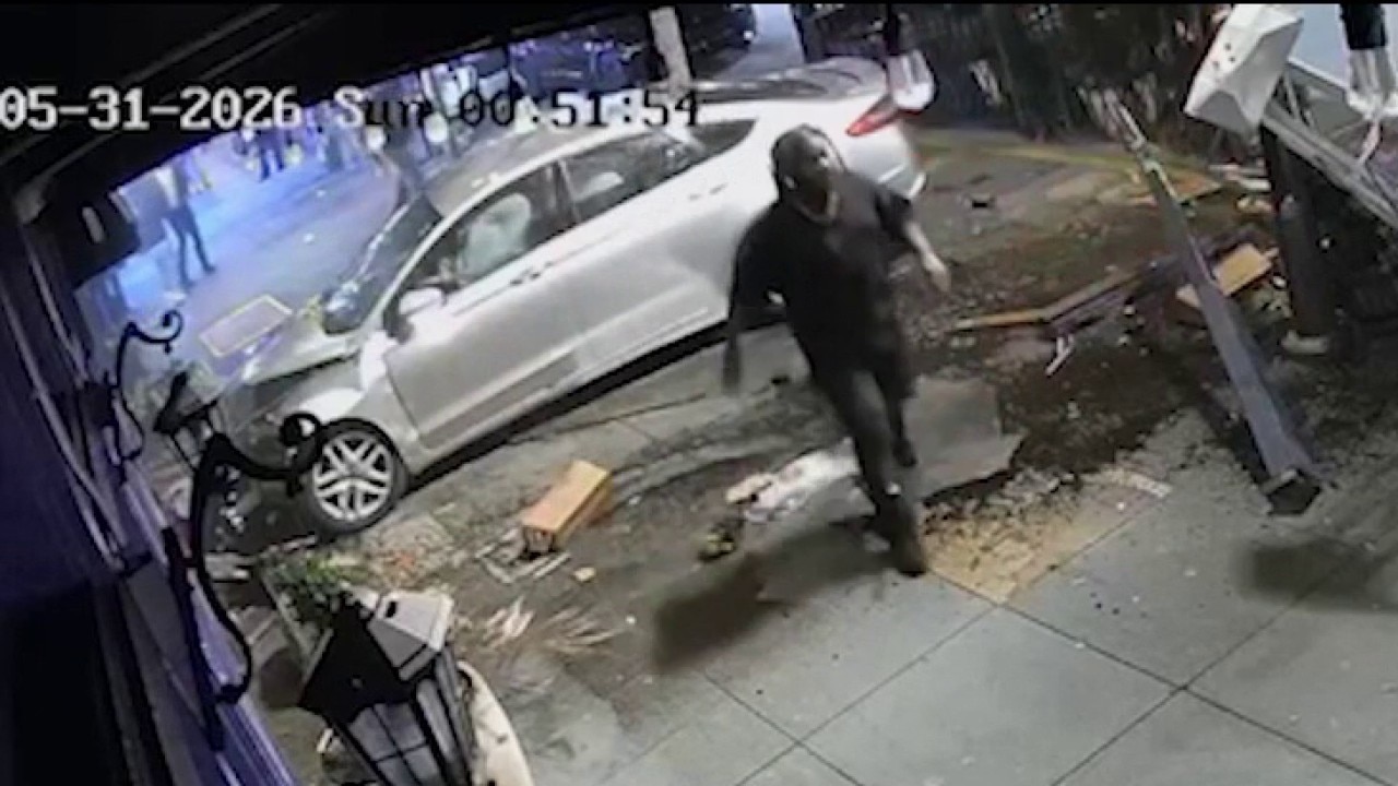
Driver flees after crashing into Castro district restaurants
Police are looking for a driver who caused thousands of dollars in damage early Sunday morning after slamming into a restaurant in San Francisco's Castro district and simply walking away from the scene.
Police are looking for a driver who caused thousands of dollars in damage early Sunday morning after slamming into a restaurant in San Francisco's Castro district and simply walking away from the scene.
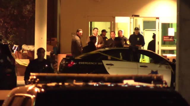

San Francisco officer, passenger injured in shootout; robbery suspect arrested
A San Francisco police officer and the passenger in a suspect vehicle were shot Sunday night in a shootout and taken to the hospital, and a robbery suspect who tried to run away was ultimately arrested, police said.
A San Francisco police officer and the passenger in a suspect vehicle were shot Sunday night in a shootout and taken to the hospital, and a robbery suspect who tried to run away was ultimately arrested, police said.
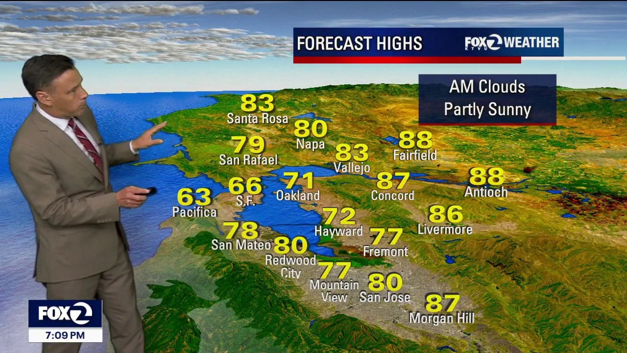
Warming continues
The Bay Area warming trend continues. Patchy fog will resurface near the coast Monday morning. Mostly sunny skies and warmer temperatures will highlight the afternoon forecast. Highs should range from the mid 60s near the coast to the low 90s inland.
The Bay Area warming trend continues. Patchy fog will resurface near the coast Monday morning. Mostly sunny skies and warmer temperatures will highlight the afternoon forecast. Highs should range from the mid 60s near the coast to the low 90s inland.
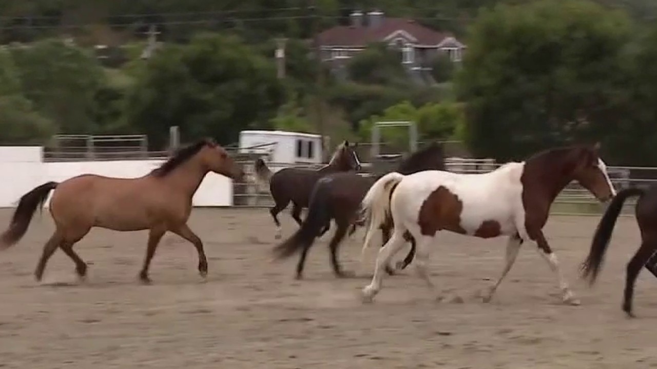
A day of healing with horses
"Horses & Healers" in Novato recently hosted a healing event for healthcare workers to emphasize the importance of those who care for others learning to care for themselves.
"Horses & Healers" in Novato recently hosted a healing event for healthcare workers to emphasize the importance of those who care for others learning to care for themselves.
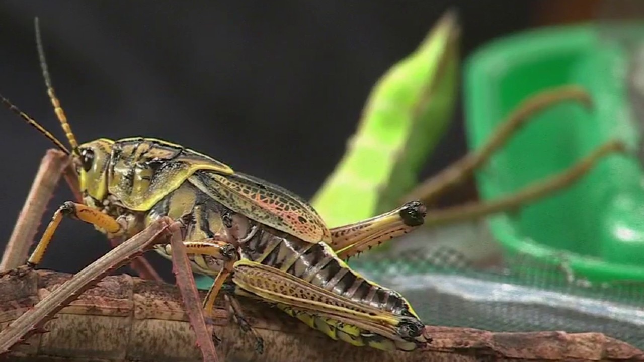
Insectpalooza returns to San Francisco
SaveNature.org hosts another Insectpalooza in San Francisco on Sunday, June 7th. We get a sneak peak of the giant bugs that will be on display on this FREE event.
SaveNature.org hosts another Insectpalooza in San Francisco on Sunday, June 7th. We get a sneak peak of the giant bugs that will be on display on this FREE event.
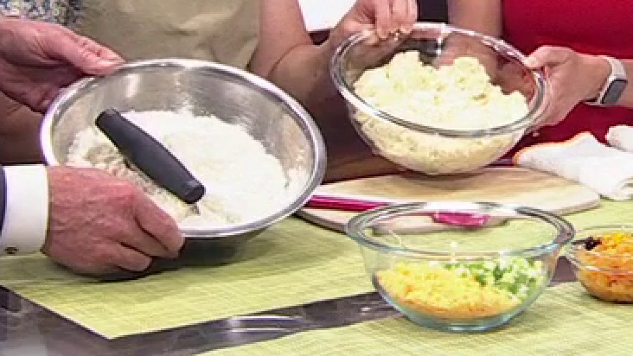
From Tech to Bake: Trading Bytes for Bites
From coding to baking. Stacie Frederick, co-owner of Evergreen Cafe in Berkeley, explains why she decided to reboot her career and shift from tech to the baking industry. Plus, she shares how she makes her scrumptious, crowd-favorite scones.
From coding to baking. Stacie Frederick, co-owner of Evergreen Cafe in Berkeley, explains why she decided to reboot her career and shift from tech to the baking industry. Plus, she shares how she makes her scrumptious, crowd-favorite scones.


17-year-old boy killed when Camaro crashes into Recology truck, flies off I-80 Freeway
The teens' car was catapulted over the bridge railings and fell about 25 feet down into a San Francisco Police Department impound lot, where it struck several other vehicles and flipped onto its roof.
The teens' car was catapulted over the bridge railings and fell about 25 feet down into a San Francisco Police Department impound lot, where it struck several other vehicles and flipped onto its roof.
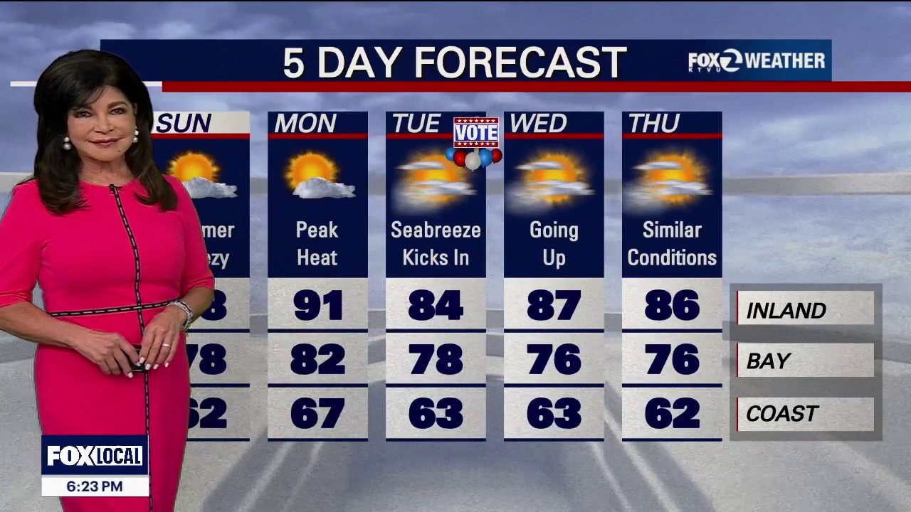
Sunday Sunshine: Inland Valleys Climb into the 80s for a Beautiful Weekend Finish
The Big Picture Our seasonal warmup is right on track. The cool, May gray weather is clearing out today, paving the way for a bright, very warm Sunday and an even hotter Monday before a cooling trend returns late next week. The Forecast: Day-by-Day Tonight: Skies will stay mostly clear for most airports, but coastal fog will return to Half Moon Bay, Monterey, and Salinas. Sunday: High pressure builds in, pushing temperatures higher under sunny skies. The coast will hit the 60s to near 70, while the interior jumps into the mid-70s to mid-80s. Monday (The Warmest Day): The heat peaks at 5 to 10 degrees above average. If the morning fog stays out at sea, even the coastal beaches will enjoy a very warm afternoon. Highs from 67 Beaches to 91 Inland. Tuesday (VOTE!) & Midweek: Temperatures bounce around a bit Wednesday and Thursday depending on how far inland the morning fog pushes. Next Weekend: A new weather system takes aim at the West Coast. While it will pull temperatures well below average, any actual rain looks like it will stay far to our north.
The Big Picture Our seasonal warmup is right on track. The cool, May gray weather is clearing out today, paving the way for a bright, very warm Sunday and an even hotter Monday before a cooling trend returns late next week. The Forecast: Day-by-Day Tonight: Skies will stay mostly clear for most airports, but coastal fog will return to Half Moon Bay, Monterey, and Salinas. Sunday: High pressure builds in, pushing temperatures higher under sunny skies. The coast will hit the 60s to near 70, while the interior jumps into the mid-70s to mid-80s. Monday (The Warmest Day): The heat peaks at 5 to 10 degrees above average. If the morning fog stays out at sea, even the coastal beaches will enjoy a very warm afternoon. Highs from 67 Beaches to 91 Inland. Tuesday (VOTE!) & Midweek: Temperatures bounce around a bit Wednesday and Thursday depending on how far inland the morning fog pushes. Next Weekend: A new weather system takes aim at the West Coast. While it will pull temperatures well below average, any actual rain looks like it will stay far to our north.
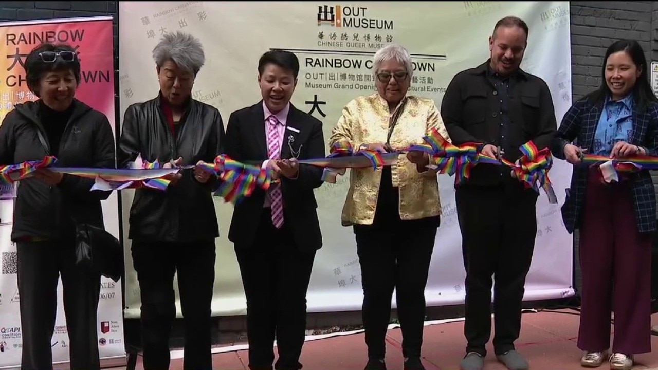
World’s first Chinese queer museum opens in San Francisco’s Chinatown
Founder and LGBTQ activist Xiang Qui Chen, who moved to San Francisco from China, said the museum is a way to educate, inspire, and promote visibility for the Chinese LGBTQ community in her adopted city.
Founder and LGBTQ activist Xiang Qui Chen, who moved to San Francisco from China, said the museum is a way to educate, inspire, and promote visibility for the Chinese LGBTQ community in her adopted city.
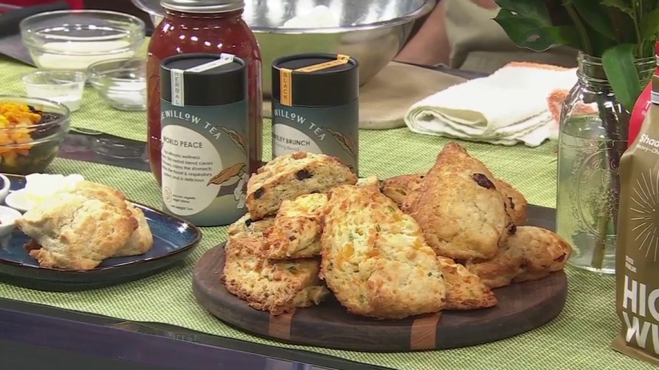
New local spot serves "best scones ever" in the East Bay
It's National Scone Day so we asked Berkeley's Evergreen Cafe to show us how it's done.
It's National Scone Day so we asked Berkeley's Evergreen Cafe to show us how it's done.