


January highlights cervical cancer: Experts say prevention is within reach
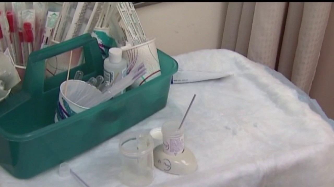
The month of January puts a spotlight on a type of cancer that is both common, and largely preventable. According to the CDC, 9 out of every 10 cases of cervical cancer is caused by the virus known as HPV.
The month of January puts a spotlight on a type of cancer that is both common, and largely preventable. According to the CDC, 9 out of every 10 cases of cervical cancer is caused by the virus known as HPV.


2026 expected to be a good year for investors, expert says
2026 is shaping up to be a good year, but the big story isn't where the markets rise, it's who leads them. George Noceti, a family wealth advisor at Morgan Stanley, joined us on 'The Nine' for insight into where the markets are headed.
2026 is shaping up to be a good year, but the big story isn't where the markets rise, it's who leads them. George Noceti, a family wealth advisor at Morgan Stanley, joined us on 'The Nine' for insight into where the markets are headed.


Valentino Garavani, legendary fashion designer, dies
Valentino Garavani — the legendary fashion designer and founder of the Valentino brand — has died. Here's what we know.
Valentino Garavani — the legendary fashion designer and founder of the Valentino brand — has died. Here's what we know.


3-alarm fire breaks out at residential building in Downtown Oakland
Three people were taken to a hospital for treatment of smoke inhalation.
Three people were taken to a hospital for treatment of smoke inhalation.


San Leandro police shoot at man allegedly armed with rifle; investigation underway
Neither the suspect nor officers were injured in the shooting, and police took the suspect into custody.
Neither the suspect nor officers were injured in the shooting, and police took the suspect into custody.


Today is Dolly Parton Day as legendary performer turns 80
It's official: Today is Dolly Parton Day as the legendary performer turns 80. Her milestone birthday comes after a year marked by her husband's death and health setbacks.
It's official: Today is Dolly Parton Day as the legendary performer turns 80. Her milestone birthday comes after a year marked by her husband's death and health setbacks.


Cold start to MLK Day will give way to warmer Monday
Monday morning will be cold with some fog, but temps will warm as the day goes on.
Monday morning will be cold with some fog, but temps will warm as the day goes on.


MLK Day holiday: What’s open and closed
Here's what is open and closed on Jan. 19, 2026, the day the nation commemorates Dr. Martin Luther King, Jr.'s legacy.
Here's what is open and closed on Jan. 19, 2026, the day the nation commemorates Dr. Martin Luther King, Jr.'s legacy.


Mild to warm Monday
No big changes to the Bay Area forecast. Our dry stretch continues. Patchy fog will resurface in the inland valleys Monday morning. The afternoon forecast features mostly sunny skies and mild temperatures away from the fog. Highs should range from the upper 50s to the low 70s. We are expecting a cooling trend later in the week.
No big changes to the Bay Area forecast. Our dry stretch continues. Patchy fog will resurface in the inland valleys Monday morning. The afternoon forecast features mostly sunny skies and mild temperatures away from the fog. Highs should range from the upper 50s to the low 70s. We are expecting a cooling trend later in the week.


Demonstrators in San Francisco show solidarity with Iranian protesters, call for regime change
In San Francisco Sunday, demonstrators gathered in solidarity with Iranian protesters, after thousands have been killed inside Iran.
In San Francisco Sunday, demonstrators gathered in solidarity with Iranian protesters, after thousands have been killed inside Iran.


Chick-fil-A opening new location in Walnut Creek
The new Chick-fil-A will bring approximately 80 jobs to the community, and joins more than 29 other Chick-fil-A restaurants serving the Bay Area.
The new Chick-fil-A will bring approximately 80 jobs to the community, and joins more than 29 other Chick-fil-A restaurants serving the Bay Area.


New England Patriots beat Houston Texans 28-16 to advance to the 2026 AFC Championship Game
The New England Patriots advanced to the AFC Championship Game by defeating the Houston Texans 28-16, overcoming a turnover-heavy game behind a dominant defense and key fourth-quarter scoring.
The New England Patriots advanced to the AFC Championship Game by defeating the Houston Texans 28-16, overcoming a turnover-heavy game behind a dominant defense and key fourth-quarter scoring.


Two San Francisco churches pray for help after car destroys building
A car crashed into the side of a San Francisco church on Sunday afternoon, during Sunday worship, injuring several people and prompting authorities to evacuate the building to evaluate the damage.
A car crashed into the side of a San Francisco church on Sunday afternoon, during Sunday worship, injuring several people and prompting authorities to evacuate the building to evaluate the damage.


Oakland police investigating pair of weekend homicides
One man was found stabbed to death on Friday, and another was found shot in the street on Saturday.
One man was found stabbed to death on Friday, and another was found shot in the street on Saturday.


Lamar Odom arrested and charged with DUI in Las Vegas
Lamar Odom was arrested and charged with DUI in Las Vegas, according to court records obtained by Fox News Digital.
Lamar Odom was arrested and charged with DUI in Las Vegas, according to court records obtained by Fox News Digital.


Another round of unseasonable warmth in store for the Bay Area
Dry weather is expected for the area, possibly extending into next weekend.
Dry weather is expected for the area, possibly extending into next weekend.


3 killed in wrong-way crash on Solano County highway
Authorities responded just after 2 a.m. to Interstate 80 east of the Cordelia Weigh Station on reports of a four-car crash.
Authorities responded just after 2 a.m. to Interstate 80 east of the Cordelia Weigh Station on reports of a four-car crash.


Man beaten, robbed by group of juveniles near SF’s Fisherman’s Wharf
The SFPD said the group of suspects fled the scene “after being confronted by bystanders."
The SFPD said the group of suspects fled the scene “after being confronted by bystanders."


Foods that Americans were told to avoid for decades are back under Trump's new nutrition rules
Foods that Americans were told to avoid for decades are back under Trump's new nutrition rules. Here's a summary of which foods are back.
Foods that Americans were told to avoid for decades are back under Trump's new nutrition rules. Here's a summary of which foods are back.

Snow in Florida: See photos and videos
Does it snow in Florida? It can – and it did.
Does it snow in Florida? It can – and it did.