


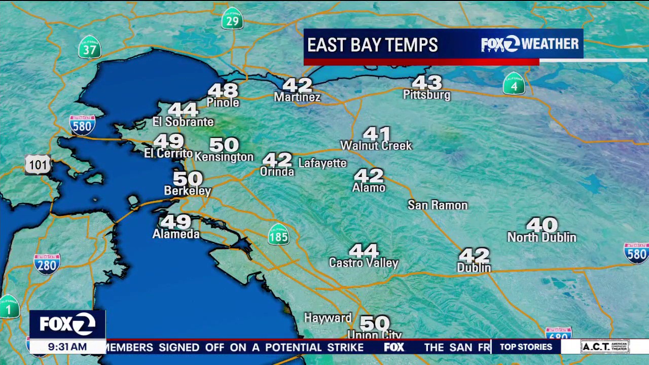
Temps rebound as sun and clouds blanket the Bay
Conditions are warming up, but that brings the risk of hazardous snowmelts in more mountainous areas.
Conditions are warming up, but that brings the risk of hazardous snowmelts in more mountainous areas.

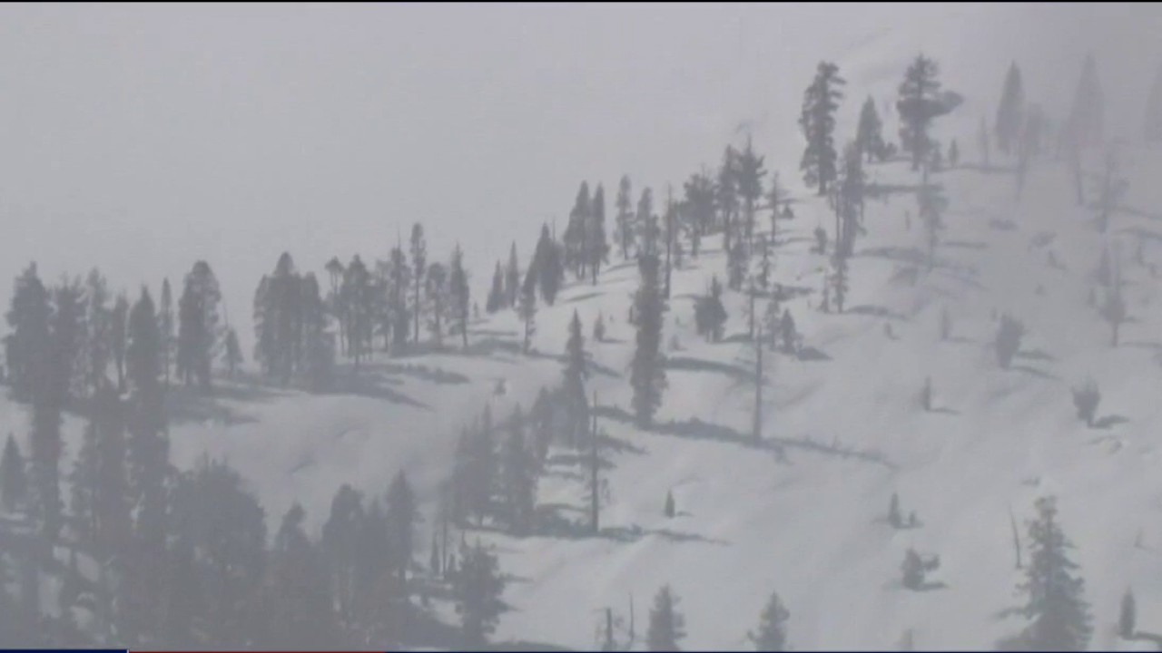
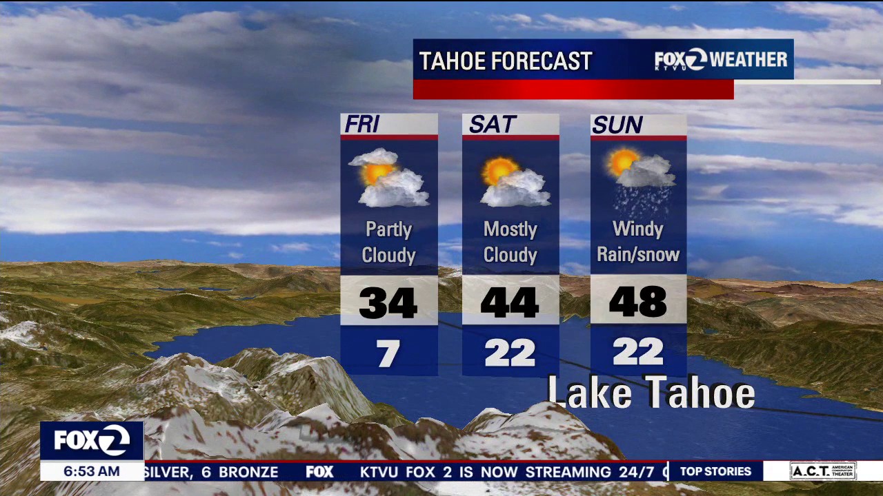
From avalanche threat to flood concerns: Tahoe faces rapid warmup and rain
After a week of heavy snowfall and a deadly avalanche in the greater Lake Tahoe region, the focus is now shifting from snow accumulation to what happens next.
After a week of heavy snowfall and a deadly avalanche in the greater Lake Tahoe region, the focus is now shifting from snow accumulation to what happens next.


Clouds and chilly winds to linger in the Bay Area
Temperatures are remaining frosty, and the North Bay could see some scattered showers beginning on Sunday.
Temperatures are remaining frosty, and the North Bay could see some scattered showers beginning on Sunday.

Utah avalanches kill 11-year-old girl and father in season’s first deaths
Separate avalanches in Utah this week killed an 11-year-old girl near a ski resort and a father who was snowmobiling with his son.
Separate avalanches in Utah this week killed an 11-year-old girl near a ski resort and a father who was snowmobiling with his son.

Cold, cloudy start to the day
Cool temperatures and breezy conditions are forecasted as the Bay Area enters the afternoon.
Cool temperatures and breezy conditions are forecasted as the Bay Area enters the afternoon.
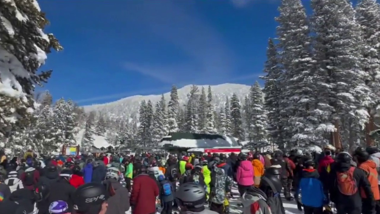

Safety concerns grow after 2 skiers die at Heavenly's Boulder Lodge in Tahoe
Amid a week of deadly tragedies and as fresh snow brings visitors back to the Tahoe region this weekend, safety is top of mind.
Amid a week of deadly tragedies and as fresh snow brings visitors back to the Tahoe region this weekend, safety is top of mind.

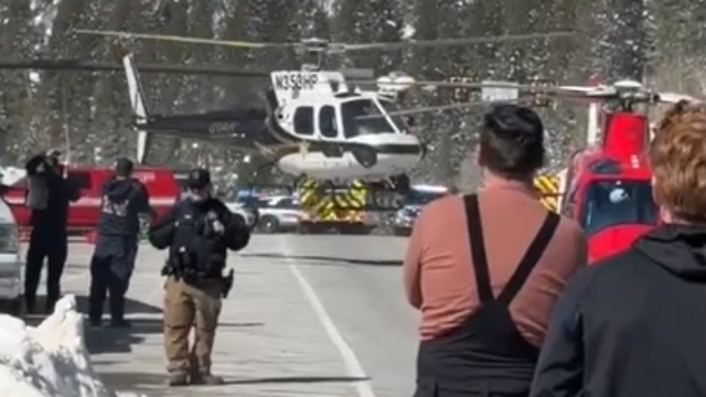
Sheriff's office opens investigation, uses explosives to help teams access avalanche victims
The Nevada County Sheriff's office on Friday conducted an aerial survey of the avalanche site near Castle Peak.
The Nevada County Sheriff's office on Friday conducted an aerial survey of the avalanche site near Castle Peak.

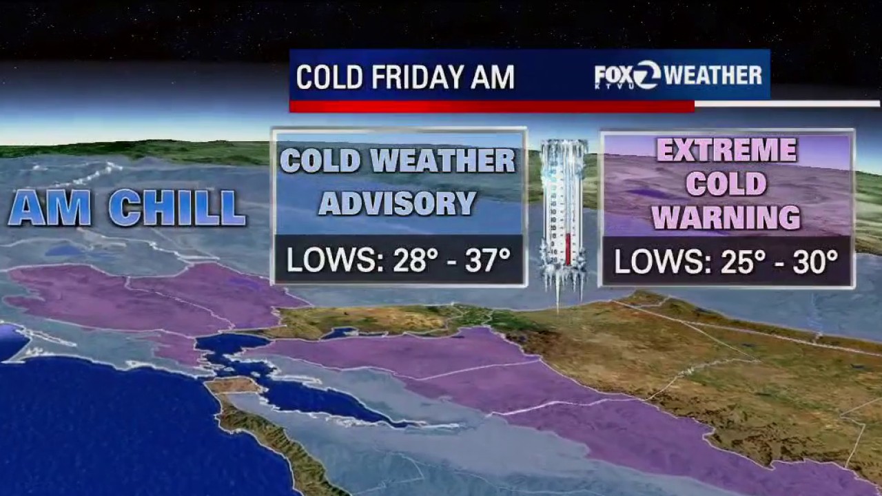
Extreme cold predicted for Saturday morning brings concerns for vulnerable groups
The National Weather Service has issued another cold weather advisory for early Saturday morning.
The National Weather Service has issued another cold weather advisory for early Saturday morning.
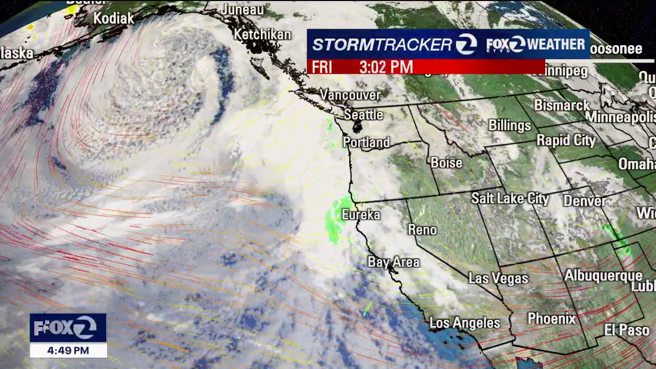

Frigid conditions expected before yet another storm lands
A few scattered showers could fall on the Bay Area as soon as Saturday night, but rain is expected in earnest beginning on Monday.
A few scattered showers could fall on the Bay Area as soon as Saturday night, but rain is expected in earnest beginning on Monday.


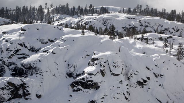
Deadly Tahoe avalanche: Snow drought likely a factor
A snow scientist says a snow drought likely contributed to this week’s deadly avalanche in the Sierra Nevada, where eight people died and one is still missing, and warned the risk remains high for another slide.
A snow scientist says a snow drought likely contributed to this week’s deadly avalanche in the Sierra Nevada, where eight people died and one is still missing, and warned the risk remains high for another slide.

Cold start, clouds increase
Today will start off cold. Temps will rise to the 50s. Clouds in the afternoon.
Today will start off cold. Temps will rise to the 50s. Clouds in the afternoon.

Cold temps sticking around
Cold conditions are expected to continue across the Bay Area, with some areas forecast to see temperatures in the low to mid-30s.
Cold conditions are expected to continue across the Bay Area, with some areas forecast to see temperatures in the low to mid-30s.

Lake Tahoe avalanche: What we know about the victims and survivors
Authorities say 15 people were on a three-day skiing trip. Here's what we know so far about the victims and survivors of the avalanche.
Authorities say 15 people were on a three-day skiing trip. Here's what we know so far about the victims and survivors of the avalanche.


Dunkin' is giving away limited-edition iced coffee gloves on Friday
If you're an iced coffee lover, even in the coldest of weather — Dunkin' has a gift just for you!
If you're an iced coffee lover, even in the coldest of weather — Dunkin' has a gift just for you!


Scattered morning showers and gusty winds
Thursday morning will be cold and wet, but the rainy conditions will clear as the afternoon approaches.
Thursday morning will be cold and wet, but the rainy conditions will clear as the afternoon approaches.


Another cold system
Our active weather stretch continues. A cold system will move into the Bay Area Wednesday evening - early Thursday. There is the chance of thunderstorms. Winds will also be factor. Gusts could approach 40 mph. With the cold air in place, snow levels will remain quite low (close to 2000 feet). The showers should taper Thursday afternoon. Plan on some very cold temperatures to start off your Friday morning (20s and 30s).
Our active weather stretch continues. A cold system will move into the Bay Area Wednesday evening - early Thursday. There is the chance of thunderstorms. Winds will also be factor. Gusts could approach 40 mph. With the cold air in place, snow levels will remain quite low (close to 2000 feet). The showers should taper Thursday afternoon. Plan on some very cold temperatures to start off your Friday morning (20s and 30s).


Lake Tahoe avalanche: 8 backcountry skiers dead, 1 still missing
Nevada County Sheriff Shannan Moon said in addition to those who died, there were six people rescued, whose ages range from 30 to 55.
Nevada County Sheriff Shannan Moon said in addition to those who died, there were six people rescued, whose ages range from 30 to 55.


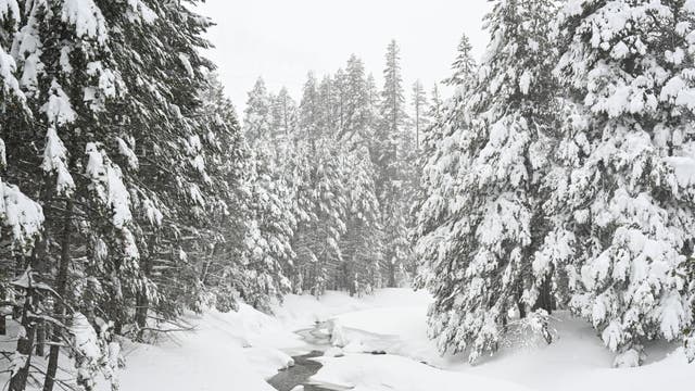
Snow covers parts of the Bay Area: photos
Snow dusted several Bay Area peaks as a cold front moved through the region.
Snow dusted several Bay Area peaks as a cold front moved through the region.
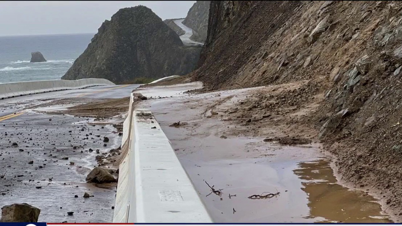

6 miles of Highway 1 south of Big Sur remains closed
A six-mile stretch of Highway 1 in Monterey County near Regent’s Slide remains closed, according to Caltrans.
A six-mile stretch of Highway 1 in Monterey County near Regent’s Slide remains closed, according to Caltrans.


Live updates: Frigid conditions, more rain, avalanche search
The winter storm isn't going away any time soon. Near-frigid temperatures will persist on Wednesday with highs in the 40s in some Bay Area cities.
The winter storm isn't going away any time soon. Near-frigid temperatures will persist on Wednesday with highs in the 40s in some Bay Area cities.