

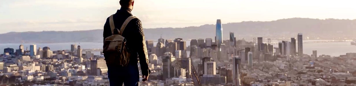

USMNT upcoming match in Bay Area builds soccer fan excitement
With the USMNT having two wins under their belt, the team hopes to keep this momentum and intensity up for their match against Türkiye on Thursday at SoFi Stadium in Los Angeles.
With the USMNT having two wins under their belt, the team hopes to keep this momentum and intensity up for their match against Türkiye on Thursday at SoFi Stadium in Los Angeles.

Kayma Algerian Eatery: first Bay Area Algerian cuisine & pastry
The World Cup atmosphere is building as Algeria takes on Jordan today, and for many fans, food is just as important as the match itself. At Kayma Algerian Eatery in San Francisco, owners Wafa and Mounir Bahloul are introducing Bay Area diners to a culture built around hospitality, family, and gathering around the table.
The World Cup atmosphere is building as Algeria takes on Jordan today, and for many fans, food is just as important as the match itself. At Kayma Algerian Eatery in San Francisco, owners Wafa and Mounir Bahloul are introducing Bay Area diners to a culture built around hospitality, family, and gathering around the table.
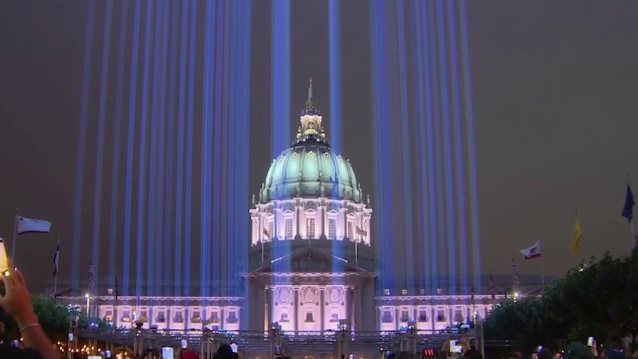
New '7X7' installation lights up San Francisco to mark historic summer
A new public art installation featuring 49 beams of light over Civic Center Plaza is lighting up San Francisco's skyline as the city welcomes visitors for Pride Weekend, the FIFA World Cup and Fourth of July celebrations.
A new public art installation featuring 49 beams of light over Civic Center Plaza is lighting up San Francisco's skyline as the city welcomes visitors for Pride Weekend, the FIFA World Cup and Fourth of July celebrations.
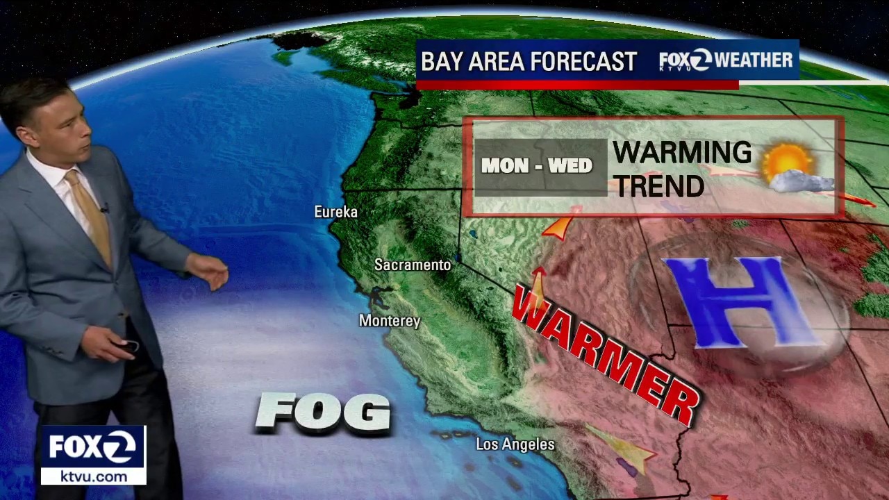
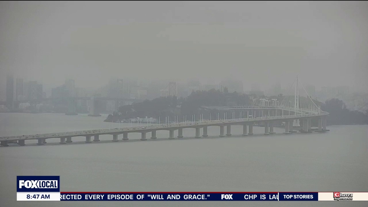
Warming trend
Welcome to summer! A warmer pattern will settle into the Bay Area over the next 3 days. Low clouds will resurface near the coast and bay Monday morning. The clouds will clear back to near the coast later in the day. Highs should range from the mid 60s to the upper 80s.
Welcome to summer! A warmer pattern will settle into the Bay Area over the next 3 days. Low clouds will resurface near the coast and bay Monday morning. The clouds will clear back to near the coast later in the day. Highs should range from the mid 60s to the upper 80s.
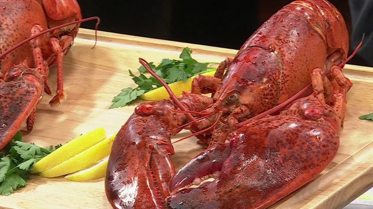
Summer lobster done right. A conversation about getting a sustainable lobster on your dinner table.
Fourth-generation lobstermen Justin and Travis Madeira of Lobsterboys join the show to break down how they are shifting the traditional supply chain. Watch to hear how their direct-to-consumer model focuses on sourcing sustainable seafood directly from regional fishermen.
Fourth-generation lobstermen Justin and Travis Madeira of Lobsterboys join the show to break down how they are shifting the traditional supply chain. Watch to hear how their direct-to-consumer model focuses on sourcing sustainable seafood directly from regional fishermen.
Classic pattern for first day of summer
Happy 1st day of summer everyone! Mother nature is responding with a minor warm up, especially inland. Low clouds and patchy drizzle will clear out to mostly sunny skies for most today. High will range from 60s in Pacifica to 80s inland.
Happy 1st day of summer everyone! Mother nature is responding with a minor warm up, especially inland. Low clouds and patchy drizzle will clear out to mostly sunny skies for most today. High will range from 60s in Pacifica to 80s inland.
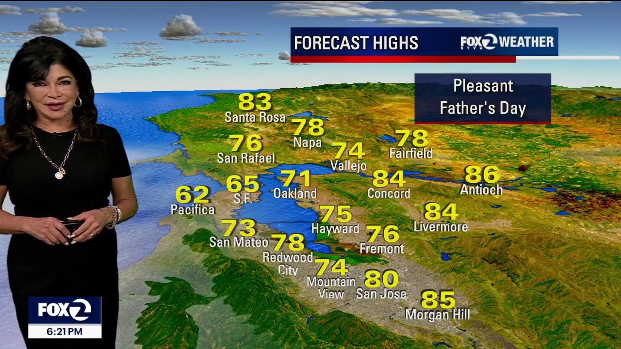
Summer arrives for Father's day
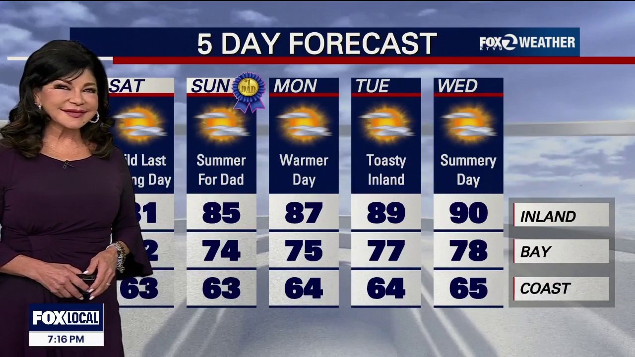
Father's Day will be pleasant, as a weak ridge of high pressure moves into the region. It will bring sunshine and slightly warmer temperatures away from the coast, though dangerous beach conditions and an upcoming midweek heat spike remain the main long-term concerns. 1. Father's Day Weather • The Forecast: It is looking like a beautiful Father’s Day across the area. A weak, incoming ridge of high pressure is compressing the marine layer, allowing morning clouds to clear out much faster than they did today. • The Temperatures: Inland will climb several degrees higher than yesterday, reaching comfortable highs in the 70s to mid-80s. • The Coast Note: While inland areas bask in the sun, coastal beaches will struggle to see clearing and will remain cool and overcast with only brief clearing. 2. Beach Warning Extended • The Threat: Powerful storms in the Southern Hemisphere are continuing to churn up the Pacific Ocean. • The Warning: A Beach Hazards Statement has been officially extended through Wednesday afternoon for all Pacific coastlines, especially steep beaches in the North Bay, San Mateo, and Santa Cruz counties. • Danger: Deceptive sneaker waves can surge dozens of feet up dry sand completely unannounced during long lulls in the surf. Combined with severe rip currents, swimming is highly hazardous. Stay off coastal rocks and never turn your back on the ocean.
Father's Day will be pleasant, as a weak ridge of high pressure moves into the region. It will bring sunshine and slightly warmer temperatures away from the coast, though dangerous beach conditions and an upcoming midweek heat spike remain the main long-term concerns. 1. Father's Day Weather • The Forecast: It is looking like a beautiful Father’s Day across the area. A weak, incoming ridge of high pressure is compressing the marine layer, allowing morning clouds to clear out much faster than they did today. • The Temperatures: Inland will climb several degrees higher than yesterday, reaching comfortable highs in the 70s to mid-80s. • The Coast Note: While inland areas bask in the sun, coastal beaches will struggle to see clearing and will remain cool and overcast with only brief clearing. 2. Beach Warning Extended • The Threat: Powerful storms in the Southern Hemisphere are continuing to churn up the Pacific Ocean. • The Warning: A Beach Hazards Statement has been officially extended through Wednesday afternoon for all Pacific coastlines, especially steep beaches in the North Bay, San Mateo, and Santa Cruz counties. • Danger: Deceptive sneaker waves can surge dozens of feet up dry sand completely unannounced during long lulls in the surf. Combined with severe rip currents, swimming is highly hazardous. Stay off coastal rocks and never turn your back on the ocean.
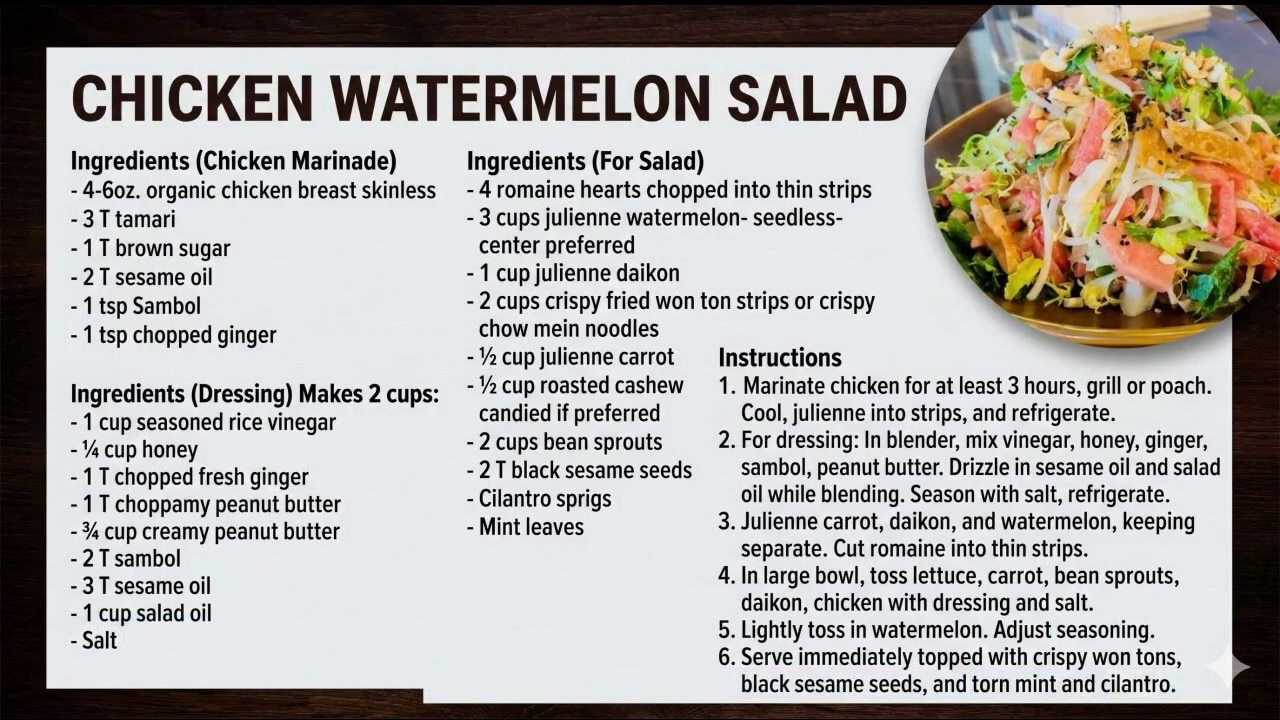
Cooking what's in season: Summer Melons
Summer is here, which means it's officially melon season! Joining us live is Chef Michael Garcia of Cavallo Point to share his secrets for picking the best melons and show us how to whip up a delicious chicken watermelon salad.
Summer is here, which means it's officially melon season! Joining us live is Chef Michael Garcia of Cavallo Point to share his secrets for picking the best melons and show us how to whip up a delicious chicken watermelon salad.
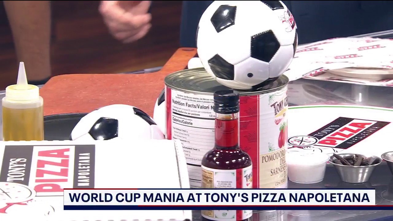
Bay Area's favorite pizza maker creates World Cup pizza
How do you put all seven continents on a single pizza? 13-time World Pizza Champion Tony Gemignani joins us live to explain his new 7-Spice Pizza created just for the 2026 World Cup!
How do you put all seven continents on a single pizza? 13-time World Pizza Champion Tony Gemignani joins us live to explain his new 7-Spice Pizza created just for the 2026 World Cup!
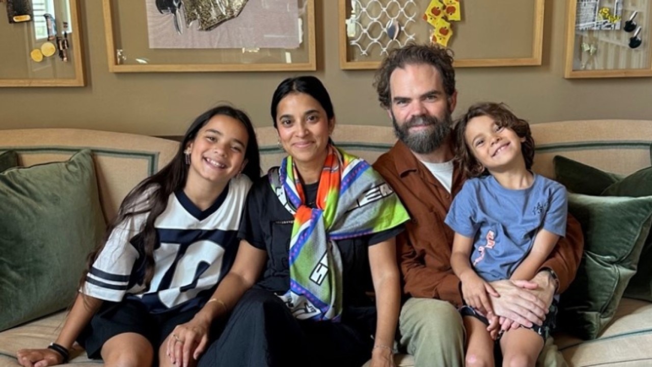
The New Fatherhood: A book about the evolution of fatherhood
The old rules of fatherhood—protect, provide, and look tough—don't cut it anymore. Kevin Maguire, author of The New Fatherhood, joins us to break down what it means to be a dad today. We dive into moving past generational patterns, dealing with the identity shift of becoming a father, and why modern parenting requires an entirely new operating system.
The old rules of fatherhood—protect, provide, and look tough—don't cut it anymore. Kevin Maguire, author of The New Fatherhood, joins us to break down what it means to be a dad today. We dive into moving past generational patterns, dealing with the identity shift of becoming a father, and why modern parenting requires an entirely new operating system.
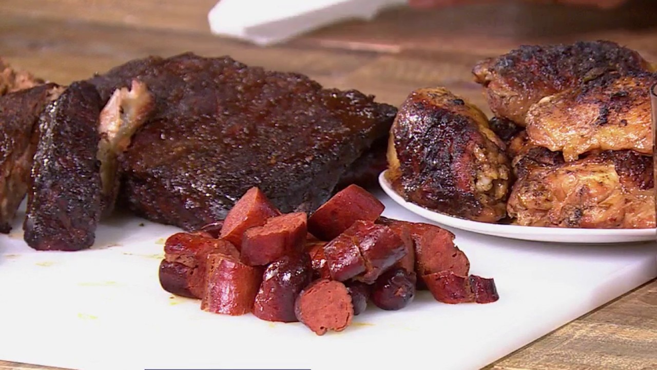
Viewers weighed in -- Futbol fans traveling to the U.S. for the World Cup should try Texas BBQ
American BBQ is having a moment as visitors from around the world try BBQ. 96H Brand Catering tells Sal Castaneda how to make the most delicious, fall-off-the bone BBQ meat.
American BBQ is having a moment as visitors from around the world try BBQ. 96H Brand Catering tells Sal Castaneda how to make the most delicious, fall-off-the bone BBQ meat.
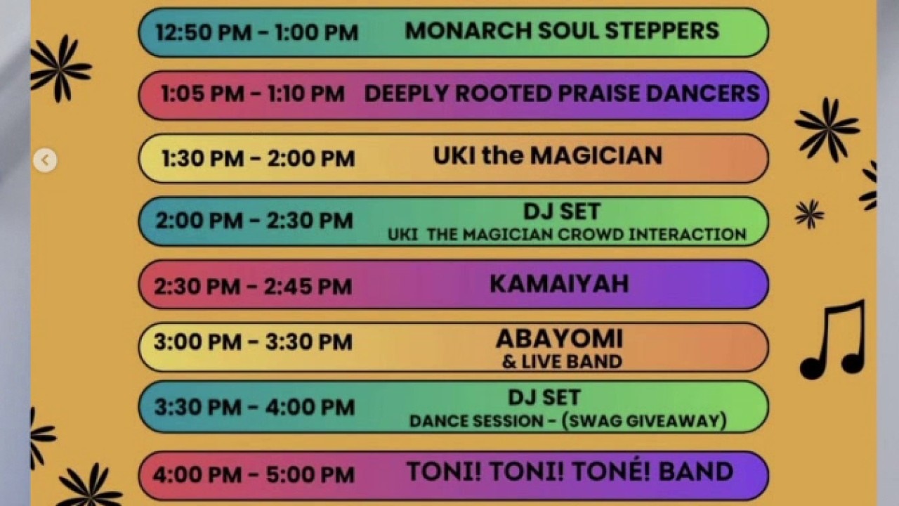
Hayward's inaugural 5k medal run and Juneteenth celebration
The East Bay is getting a new race with the Hayward 5k medal run. We speak with The City Eats about their efforts to make fitness and healthy diets accessible to all.
The East Bay is getting a new race with the Hayward 5k medal run. We speak with The City Eats about their efforts to make fitness and healthy diets accessible to all.
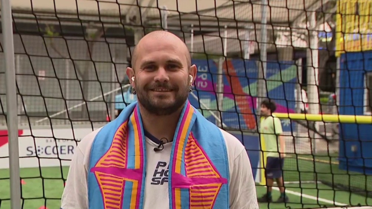
Pride House SF works to create inclusive environments for athletes
Pride House SF hosts USA World Cup Watch Party and a coaching workshop that aims to make youth soccer a more welcoming space for all.
Pride House SF hosts USA World Cup Watch Party and a coaching workshop that aims to make youth soccer a more welcoming space for all.
More of the same today with changes arriving tomorrow
Happy weekend everyone! A near repeat in weather is expected for the final day of spring. Partly sunny at the coast to mostly sunny inland is in the afternoon forecast with temps. ranging from low 60s in Pacifica to Upper 70s in Livermore. A warming trend begins for Father's Day and first day of summer.
Happy weekend everyone! A near repeat in weather is expected for the final day of spring. Partly sunny at the coast to mostly sunny inland is in the afternoon forecast with temps. ranging from low 60s in Pacifica to Upper 70s in Livermore. A warming trend begins for Father's Day and first day of summer.
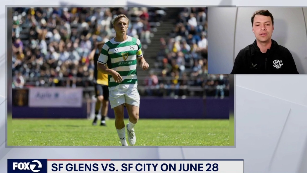
Local soccer club on U.S. success
Spokesperson for the San Francisco Glens soccer club talks about Team USA, and how youth members helped prepare the stadium for the FIFA World Cup.
Spokesperson for the San Francisco Glens soccer club talks about Team USA, and how youth members helped prepare the stadium for the FIFA World Cup.
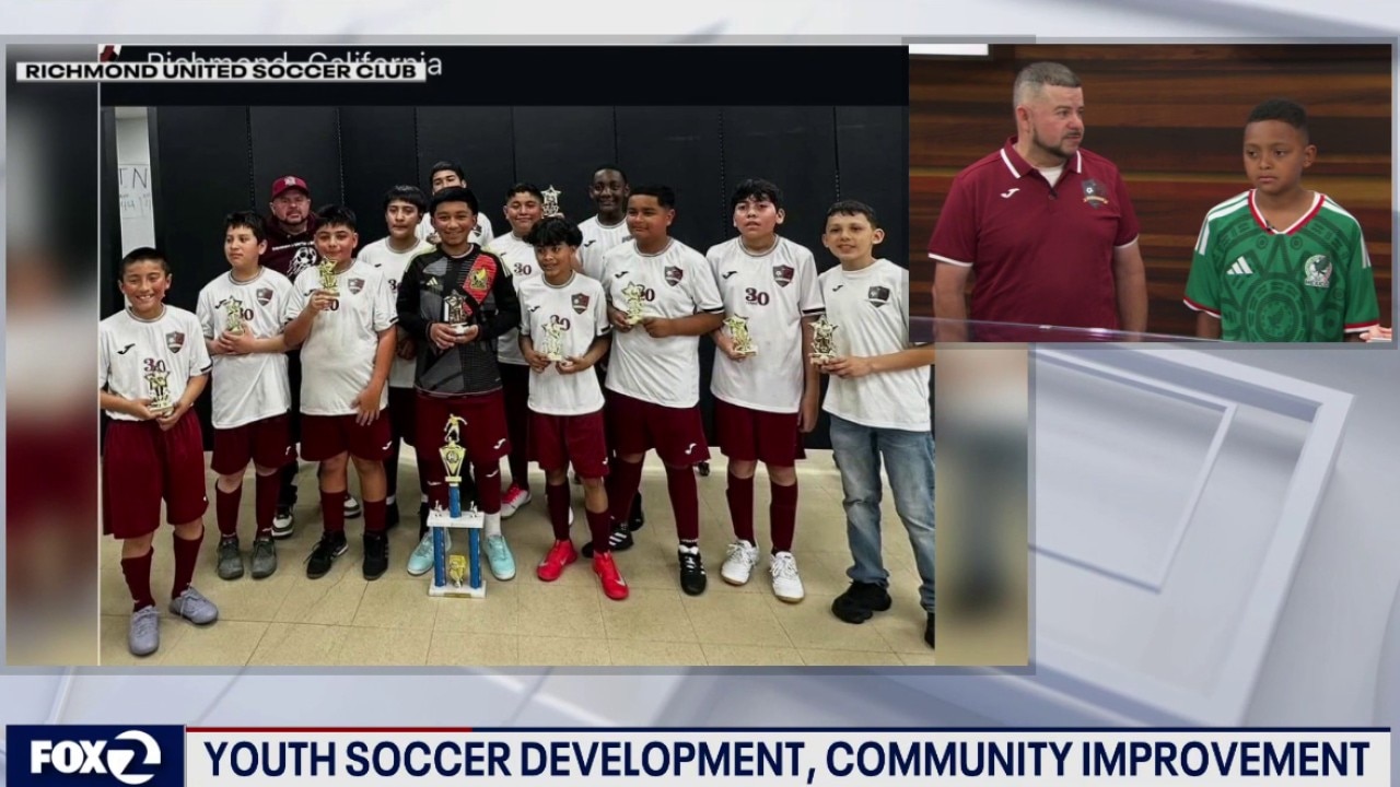
Youth soccer development in Richmond
Richmond United Soccer Club appeared on KTVU, to discusss its all-volunteer program to teach children about soccer at an affordable cost for the family.
Richmond United Soccer Club appeared on KTVU, to discusss its all-volunteer program to teach children about soccer at an affordable cost for the family.
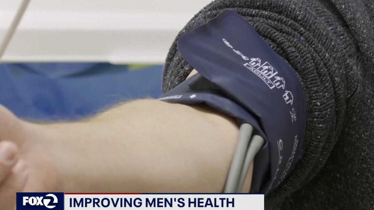
Improving men's health during Father's Day celebration
Kaiser Permanente San Jose's Dr. Nolan Lee discusses steps men need to take to improve their health, and live longer.
Kaiser Permanente San Jose's Dr. Nolan Lee discusses steps men need to take to improve their health, and live longer.
Summer arrives Sunday, but will it FEEL like it?
Tomorrow will be a near-carbon copy of today. Expect a cloudy morning with patchy coastal drizzle followed by slow clearing to the coast, keeping daytime temperatures below seasonal temperatures. A contrast between the cloudy coast and sunlit inland areas will spin up strong onshore winds. Expect widespread gusts of 20 to 30 mph, with gusts up to 40 mph. Highs will bank from low-mid 60s at the Coast to 81 inland. A Beach Hazards Statement remains active through early Sunday for sneaker waves and dangerous rip currents. Do NOT turn your back to the ocean and stay out of the water. The cooling upper trough will lose its grip as shortwave high pressure begins compressing the marine layer, starting a subtle warming trend on Father's Day and the first day of summer on Sunday.
Tomorrow will be a near-carbon copy of today. Expect a cloudy morning with patchy coastal drizzle followed by slow clearing to the coast, keeping daytime temperatures below seasonal temperatures. A contrast between the cloudy coast and sunlit inland areas will spin up strong onshore winds. Expect widespread gusts of 20 to 30 mph, with gusts up to 40 mph. Highs will bank from low-mid 60s at the Coast to 81 inland. A Beach Hazards Statement remains active through early Sunday for sneaker waves and dangerous rip currents. Do NOT turn your back to the ocean and stay out of the water. The cooling upper trough will lose its grip as shortwave high pressure begins compressing the marine layer, starting a subtle warming trend on Father's Day and the first day of summer on Sunday.


US advances to knockout round after 2-0 win over Australia
It's official; with today's win, the USMNT has clinched a spot in the World Cup knockout round.
It's official; with today's win, the USMNT has clinched a spot in the World Cup knockout round.

Injured SFPD officer released from hospital after line-of-duty shooting
San Francisco Police Officer Brittany Taylor was discharged from San Francisco General Hospital on Thursday afternoon after suffering life-threatening injuries in a shooting less than three weeks ago.
San Francisco Police Officer Brittany Taylor was discharged from San Francisco General Hospital on Thursday afternoon after suffering life-threatening injuries in a shooting less than three weeks ago.