

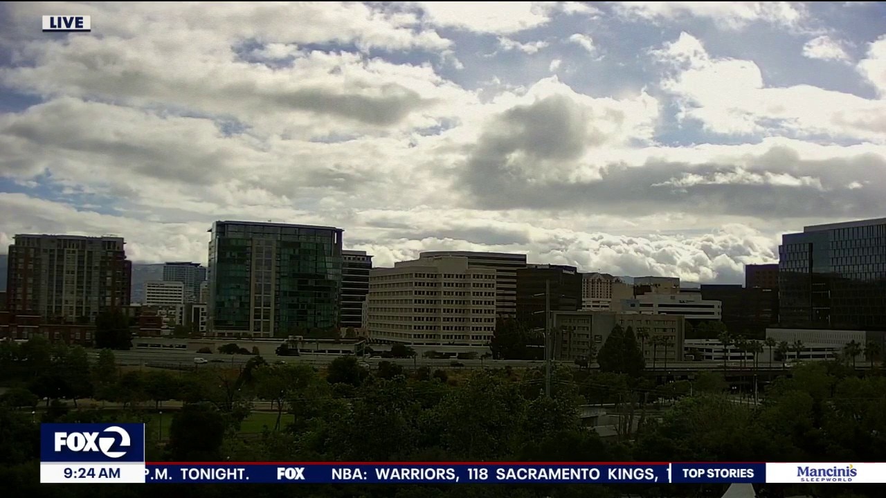
Severe weather threat arrives later today
The risk of severe weather including thunder, lightning, hail, and rotating storms arrives later today into tonight. Meanwhile in the Sierra, a Winter Storm Warning is in effect for the West Slope until Sunday night with 3+ feet f snow possible at the higher elevations.
The risk of severe weather including thunder, lightning, hail, and rotating storms arrives later today into tonight. Meanwhile in the Sierra, a Winter Storm Warning is in effect for the West Slope until Sunday night with 3+ feet f snow possible at the higher elevations.
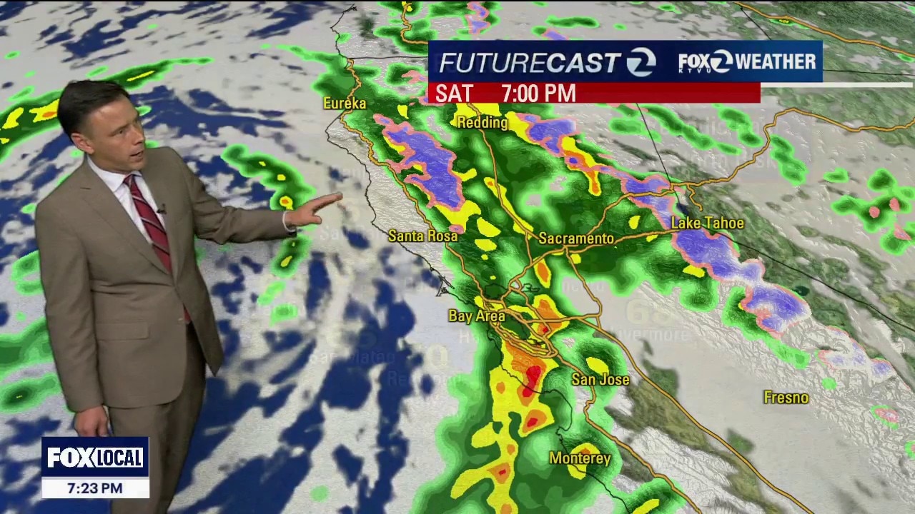
Stormy Saturday and unsettled Sunday
Heavy downpours with deteriorating conditions and a high risk of thunderstorms, hail and erratic winds by late Saturday afternoon into the early eveninghours. The unsettled weather will continue through Sunday with a chance of a dusting snow in iur local mountains.
Heavy downpours with deteriorating conditions and a high risk of thunderstorms, hail and erratic winds by late Saturday afternoon into the early eveninghours. The unsettled weather will continue through Sunday with a chance of a dusting snow in iur local mountains.
Heading back to winter
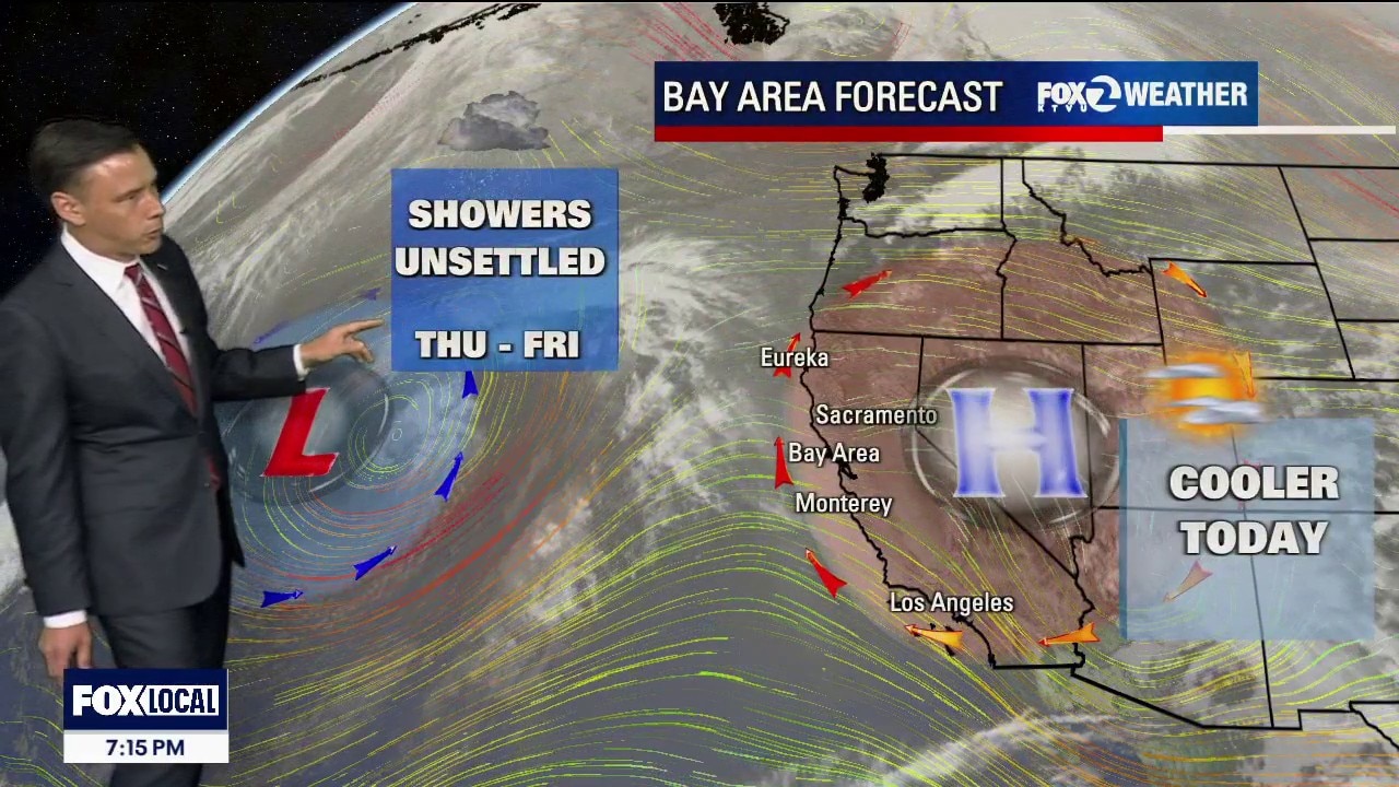
Our weather pattern is changing. We are still tracking 2 systems offshore. The first one will produce rain showers first thing Friday morning. There is also the chance of thunderstorms. The real storm of interest swings in Saturday. Rainfall rates will be increasing. There could also be more thunderstorms. The wet weather pattern remains in place through the weekend. Heaps of snow in the Sierra (over 2 feet) this weekend. A Winter Storm Warning will be in effect.
Our weather pattern is changing. We are still tracking 2 systems offshore. The first one will produce rain showers first thing Friday morning. There is also the chance of thunderstorms. The real storm of interest swings in Saturday. Rainfall rates will be increasing. There could also be more thunderstorms. The wet weather pattern remains in place through the weekend. Heaps of snow in the Sierra (over 2 feet) this weekend. A Winter Storm Warning will be in effect.
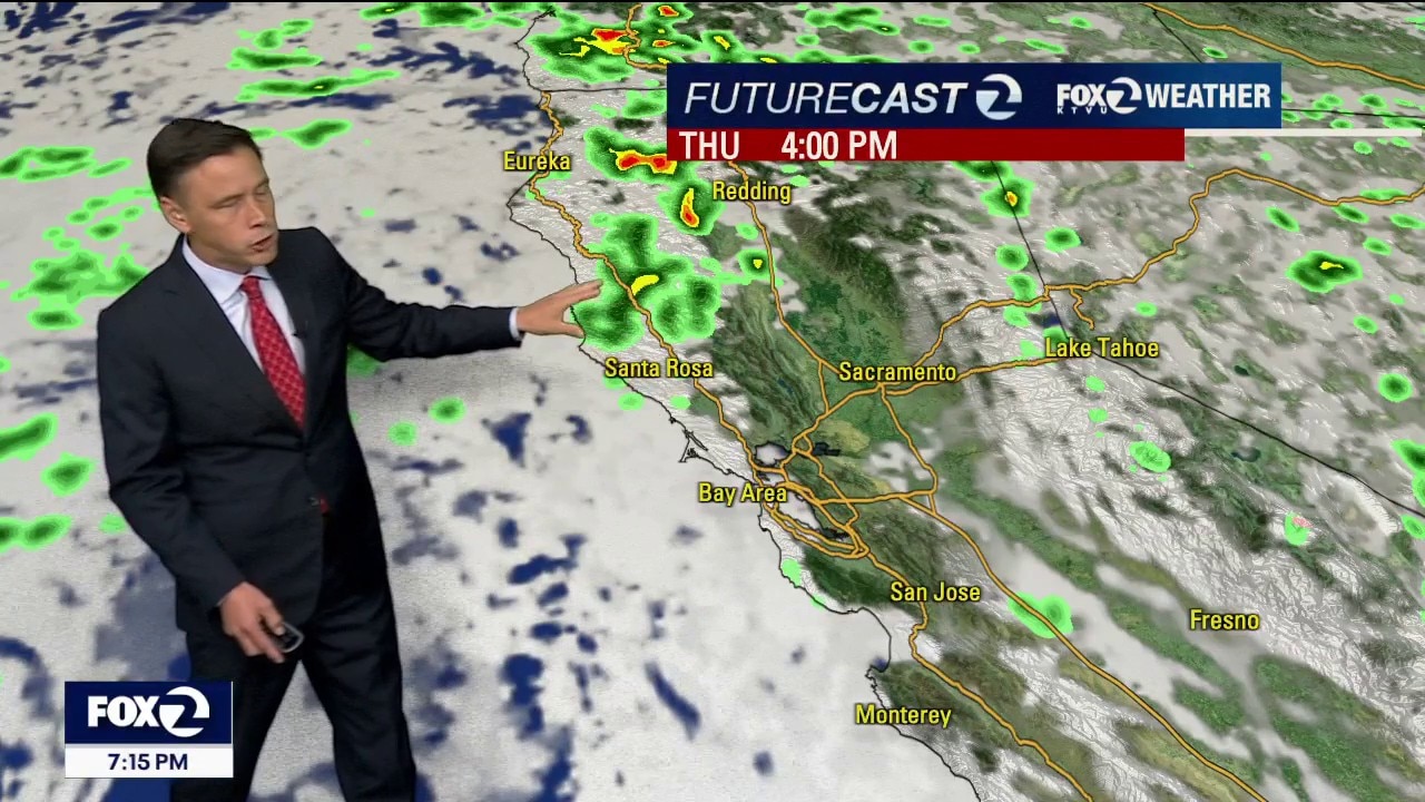
Rain on the way
BIG changes in our weather pattern. Two systems offshore will approach our coast for the remainder of the week. Your Thursday forecast features mostly cloudy skies with the chance of showers. The activity is expected to ramp up Friday through Saturday. Thunderstorm chances have also been added to the cooler weekend forecast. This storm will also affect the Sierra. Winter Storm Watches are in effect this weekend.
BIG changes in our weather pattern. Two systems offshore will approach our coast for the remainder of the week. Your Thursday forecast features mostly cloudy skies with the chance of showers. The activity is expected to ramp up Friday through Saturday. Thunderstorm chances have also been added to the cooler weekend forecast. This storm will also affect the Sierra. Winter Storm Watches are in effect this weekend.
Wonderful warmer Wednesday
Last day of above normal temperatures before cooler and rainy weather arrives.
Last day of above normal temperatures before cooler and rainy weather arrives.
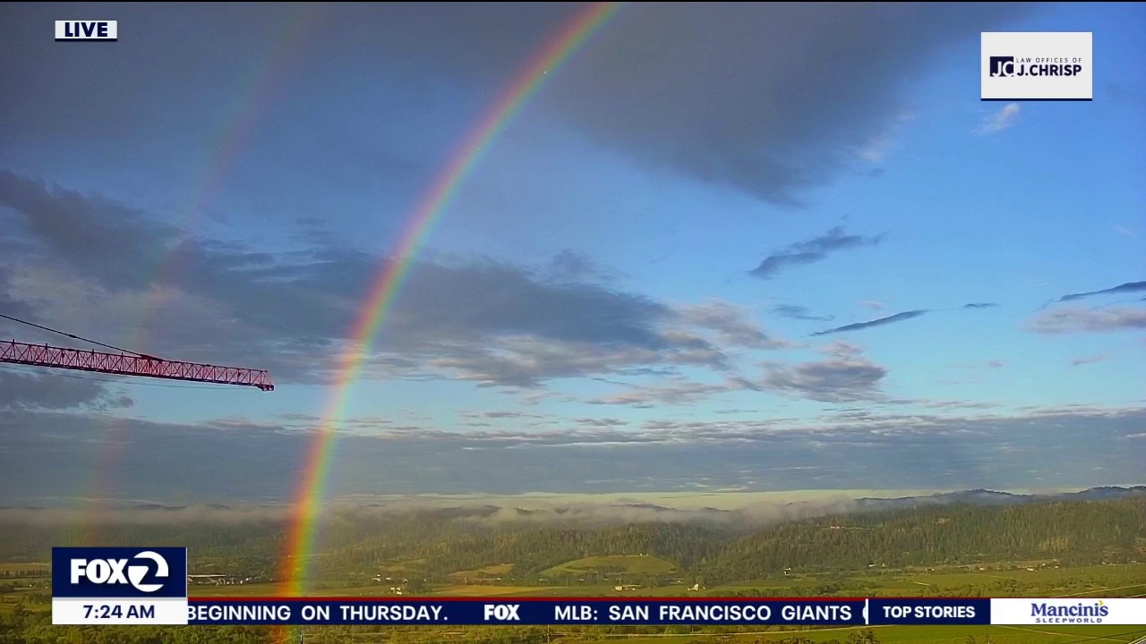
Double rainbow graces Bay Area
Another beautiful day for us with temps in the 70's.
Another beautiful day for us with temps in the 70's.
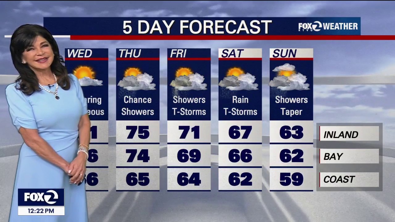
Minor changes today, major changes on the way
Our mostly cloudy skies will turn partly cloudy for the afternoon today with highs ranging from 60s at the coast to 70s inland. Spring showers and the risk of thunderstorms enter the forecast on Thursday.
Our mostly cloudy skies will turn partly cloudy for the afternoon today with highs ranging from 60s at the coast to 70s inland. Spring showers and the risk of thunderstorms enter the forecast on Thursday.
Changes on the way
Your Tuesday forecast features partly sunny skies. Highs should range from the low 60s to the mid 70s. The weather pattern will soon be changing! Shower chances will be going up later in the week.
Your Tuesday forecast features partly sunny skies. Highs should range from the low 60s to the mid 70s. The weather pattern will soon be changing! Shower chances will be going up later in the week.
Notable changes leading to a cool down today
The clouds and onshore breeze are back with afternoon highs dropping by 5-15 degrees today. Spring showers and the risk of thunderstorms enter the forecast Thursday and could last into the weekend.
The clouds and onshore breeze are back with afternoon highs dropping by 5-15 degrees today. Spring showers and the risk of thunderstorms enter the forecast Thursday and could last into the weekend.
Cooler forecast
Your Monday weather headlines revolve around cooler temperatures. We are expecting partly sunny skies. Highs should range from the mid 60s to the upper 70s. We are still tracking shower chances later in the week.
Your Monday weather headlines revolve around cooler temperatures. We are expecting partly sunny skies. Highs should range from the mid 60s to the upper 70s. We are still tracking shower chances later in the week.

Easter Sunday looking egg-stra bright and toasty
Heat peaks on Easter Sunday before cooler weather moves in on Monday and spring showers arrive mid-week.
Heat peaks on Easter Sunday before cooler weather moves in on Monday and spring showers arrive mid-week.
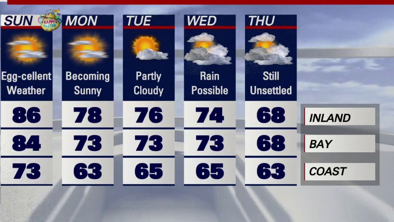
Mostly sunny skies for Easter
Meteorologist Roberta Gonzales is tracking egg-cellent weather around the Bay Area for Easter Sunday.
Meteorologist Roberta Gonzales is tracking egg-cellent weather around the Bay Area for Easter Sunday.
Hopping into Easter weekend with summer-like warmth
Mostly sunny, near record heat in store for Easter weekend festivities. Under partly cloudy skies and light winds, temps. will soar into the 70s and 80s. Simiarl set up for Sunday. Changes coming next week.
Mostly sunny, near record heat in store for Easter weekend festivities. Under partly cloudy skies and light winds, temps. will soar into the 70s and 80s. Simiarl set up for Sunday. Changes coming next week.
Good Friday sees clear skies, temps close to seasonal averages
The weekend is expected to remain clear and temperate, though there will be a chance of rain later next week.
The weekend is expected to remain clear and temperate, though there will be a chance of rain later next week.
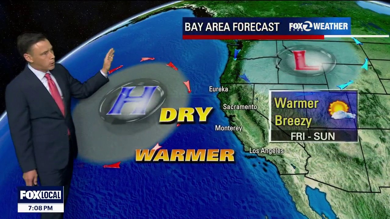
Warmer forecast
A warmer weather pattern will pay us a visit over the next few days. Winds could be gusting to over 30 mph in our local hills. Friday afternoon highs should range from the upper 60s to the upper 70s. The warm pattern sticks around this weekend, Rain chances may be going up next week.
A warmer weather pattern will pay us a visit over the next few days. Winds could be gusting to over 30 mph in our local hills. Friday afternoon highs should range from the upper 60s to the upper 70s. The warm pattern sticks around this weekend, Rain chances may be going up next week.
Slight haze and cool temps for the morning in the Bay
The rain is over for now, and conditions are expected to remain cool and clear for the weekend.
The rain is over for now, and conditions are expected to remain cool and clear for the weekend.
Rain is moving out
The second of 2 systems this week will move out of the Bay Area. Bundle up Thursday morning! Overnight lows will drop into the 30s and 40s. We are expecting more sunshine later in the day. Highs should range from the upper 50s to the upper 60s. Temperatures will rebound this weekend!
The second of 2 systems this week will move out of the Bay Area. Bundle up Thursday morning! Overnight lows will drop into the 30s and 40s. We are expecting more sunshine later in the day. Highs should range from the upper 50s to the upper 60s. Temperatures will rebound this weekend!
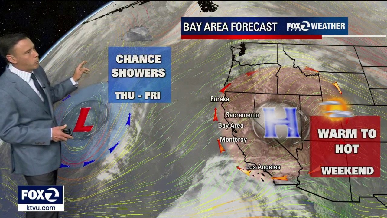
Shower chances going up
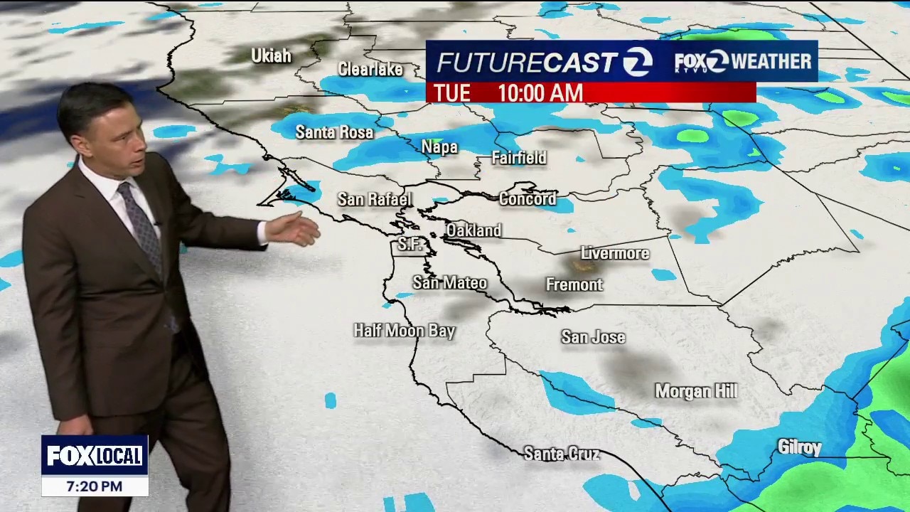
Our weather pattern continues to change. We are tracking 2 systems that will approach the Bay Area this week. System 1 could produce widely scattered showers in the Tuesday forecast. System 2 is cooler and could lead to another round of showers Wednesday. The Sierra may also pick up snow...especially above 7500 feet.
Our weather pattern continues to change. We are tracking 2 systems that will approach the Bay Area this week. System 1 could produce widely scattered showers in the Tuesday forecast. System 2 is cooler and could lead to another round of showers Wednesday. The Sierra may also pick up snow...especially above 7500 feet.
Cooler pattern moving in
After a warm to hot weekend, cooler temperatures will be moving into the Bay Area Monday. Highs should range from the mid 60s to the low 80s. More changes on the way. We are tracking 2 systems offshore. The first one could produce a few showers during the day on Tuesday. Shower chances will be increasing Wednesday.
After a warm to hot weekend, cooler temperatures will be moving into the Bay Area Monday. Highs should range from the mid 60s to the low 80s. More changes on the way. We are tracking 2 systems offshore. The first one could produce a few showers during the day on Tuesday. Shower chances will be increasing Wednesday.
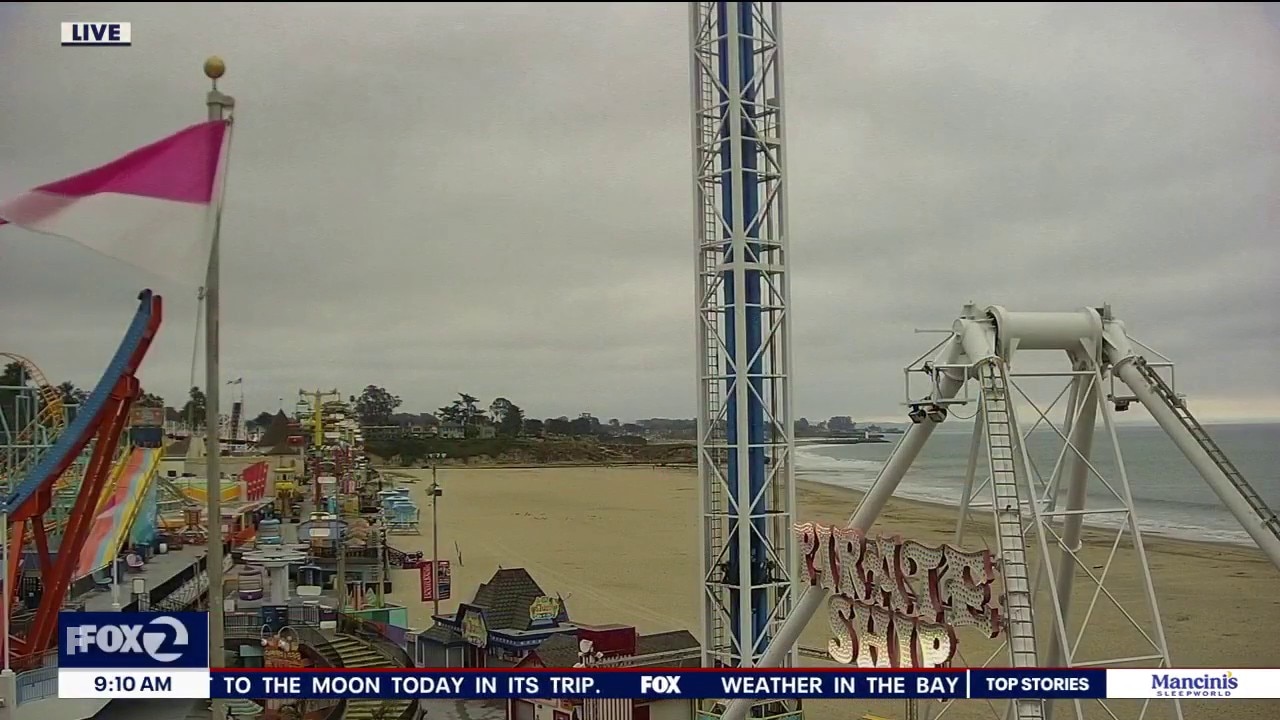
A little warmer today with wet, cooler changes on the way
Record setting warmth sticks around for one more day. Cooling begins on Monday with a chance of showers arriving Tuesday.
Record setting warmth sticks around for one more day. Cooling begins on Monday with a chance of showers arriving Tuesday.