

Weekend weather will range from spring chill to summer feel
A warm and sunny Mother’s Day weekend is ahead for inland communities. However, you may need a light jacket near the coast with cool to mild temps. expected near the shore. Afternoon highs today will range from low 60s at Pacifica to mid 70s in Redwood City to mid 80s in Antioch.
A warm and sunny Mother’s Day weekend is ahead for inland communities. However, you may need a light jacket near the coast with cool to mild temps. expected near the shore. Afternoon highs today will range from low 60s at Pacifica to mid 70s in Redwood City to mid 80s in Antioch.

Weekend weather will range from spring chill to summer feel
A warm and sunny Mother’s Day weekend is ahead for inland communities. However, you may need a light jacket near the coast with cool to mild temps. expected near the shore. Afternoon highs today will range from low 60s at Pacifica to mid 70s in Redwood City to mid 80s Antioch.
A warm and sunny Mother’s Day weekend is ahead for inland communities. However, you may need a light jacket near the coast with cool to mild temps. expected near the shore. Afternoon highs today will range from low 60s at Pacifica to mid 70s in Redwood City to mid 80s Antioch.
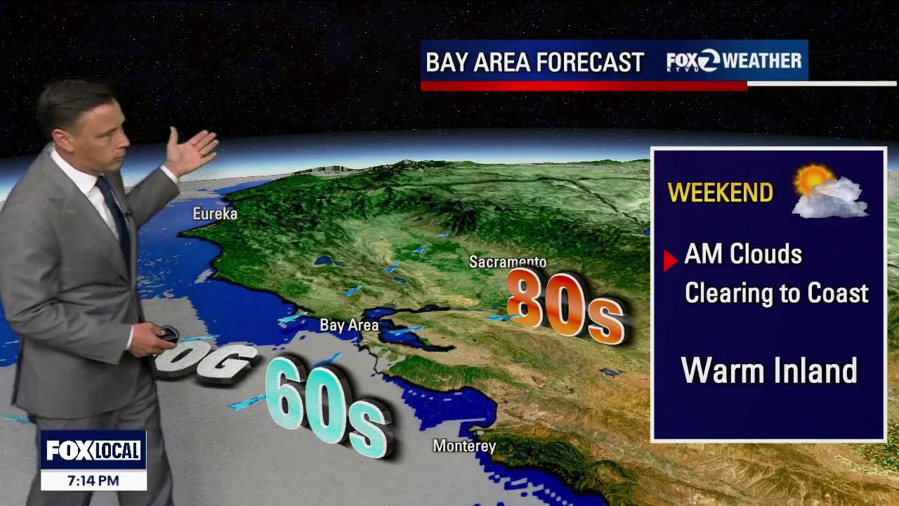
Warmer weekend forecast
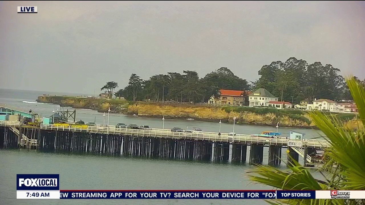
Low clouds will resurface near the coast and bay Saturday morning. The clouds will gradually clear back to near the coast later in the day. Warmer temperatures in the weekend forecast. Highs should range from the low 60s to the mid 80s. Monday will be the warmest day of the stretch. Happy Mother's Day! -Mark
Low clouds will resurface near the coast and bay Saturday morning. The clouds will gradually clear back to near the coast later in the day. Warmer temperatures in the weekend forecast. Highs should range from the low 60s to the mid 80s. Monday will be the warmest day of the stretch. Happy Mother's Day! -Mark
Warmer weekend forecast
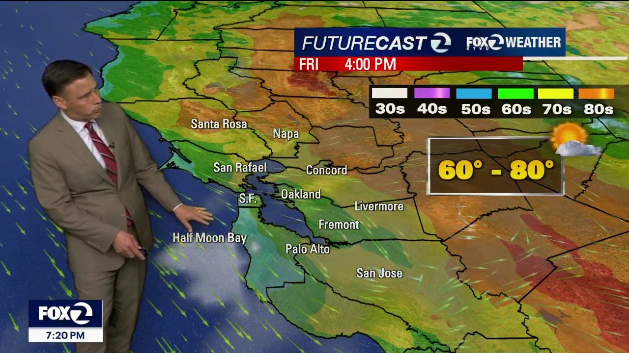
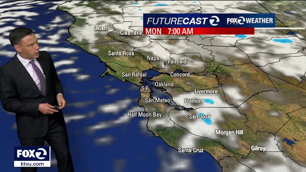
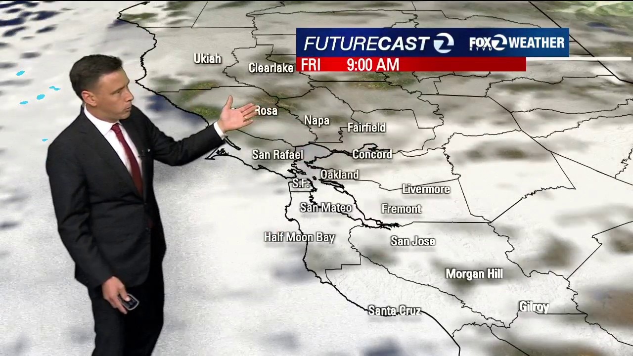
No big changes in the short term forecast. Low clouds and fog will resurface near the coast and bay Friday morning. The clouds should clear back to near the coast later in the day. Highs should range from the low 60s to the low 80s. We are expecting warmer temperatures this weekend. The real heat of interest moves in early next week. By Monday, inland areas will approach the mid 90s! There is moderate heat risk (level 2 of 4) for parts of the Bay Area.
No big changes in the short term forecast. Low clouds and fog will resurface near the coast and bay Friday morning. The clouds should clear back to near the coast later in the day. Highs should range from the low 60s to the low 80s. We are expecting warmer temperatures this weekend. The real heat of interest moves in early next week. By Monday, inland areas will approach the mid 90s! There is moderate heat risk (level 2 of 4) for parts of the Bay Area.
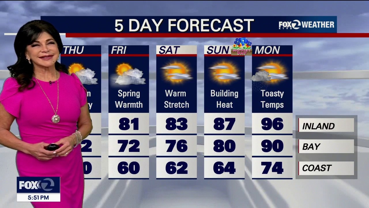
Pleasant warmth before the heat builds
Temperatures jumped 10 to 15 degrees in some neighborhoods today. Slight warming for Thursday before heat surges into the Bay Area by the end of the weekend.
Temperatures jumped 10 to 15 degrees in some neighborhoods today. Slight warming for Thursday before heat surges into the Bay Area by the end of the weekend.

Summer preview on the way
A massive ridge of high pressure is parking itself over California, which means we are in for a steady, major warm-up that will peak this weekend and early next week. Rest of the Work Week: Expect a gradual warm-up each day. The Weekend Peak: This is when things get serious. Temperatures will jump significantly on Saturday and Sunday. Heat Risk Levels: Saturday: Most of our region is under a "Minor Heat Risk." This means it’s warmer than usual, but mostly just a "don't forget your water" type of day. Sunday & Monday: Parts of the interior valleys move into "Moderate Heat Risk." This can be dangerous for sensitive groups (like the elderly or those working outdoors) if they don't take breaks and stay hydrated.
A massive ridge of high pressure is parking itself over California, which means we are in for a steady, major warm-up that will peak this weekend and early next week. Rest of the Work Week: Expect a gradual warm-up each day. The Weekend Peak: This is when things get serious. Temperatures will jump significantly on Saturday and Sunday. Heat Risk Levels: Saturday: Most of our region is under a "Minor Heat Risk." This means it’s warmer than usual, but mostly just a "don't forget your water" type of day. Sunday & Monday: Parts of the interior valleys move into "Moderate Heat Risk." This can be dangerous for sensitive groups (like the elderly or those working outdoors) if they don't take breaks and stay hydrated.
Lingering shower chances
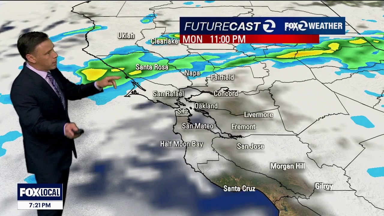
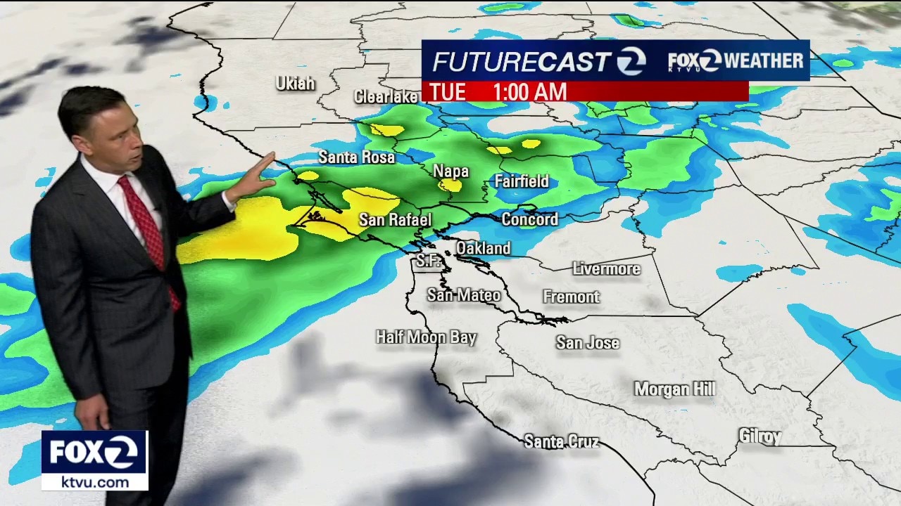
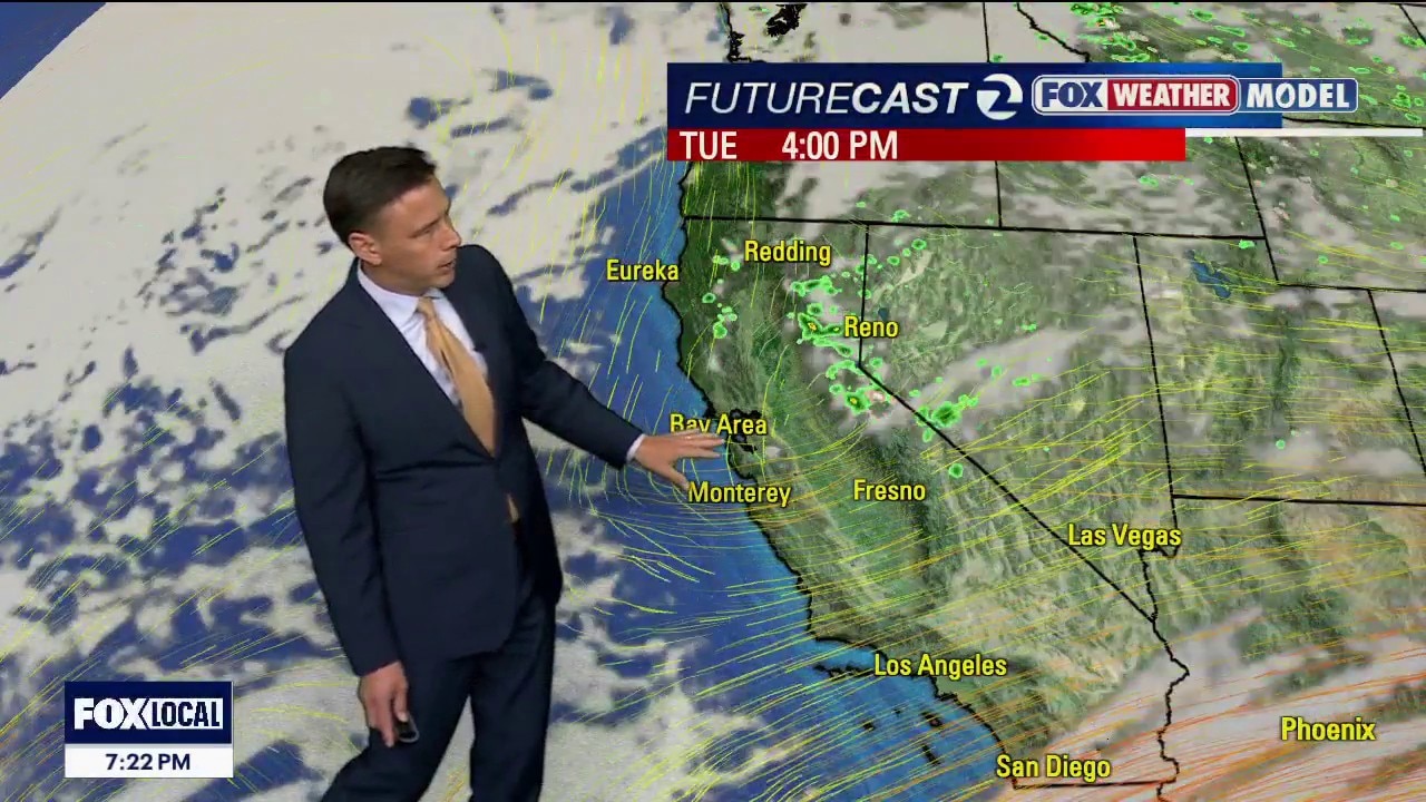
Our stubborn system will continue to produce some showers Monday night - Tuesday morning. Partly to mostly cloudy skies are expected later in the day. We are tracking a significant change in the weather pattern later in the week. Plan on warm to hot temperatures for the upcoming weekend.
Our stubborn system will continue to produce some showers Monday night - Tuesday morning. Partly to mostly cloudy skies are expected later in the day. We are tracking a significant change in the weather pattern later in the week. Plan on warm to hot temperatures for the upcoming weekend.
Shower chances linger
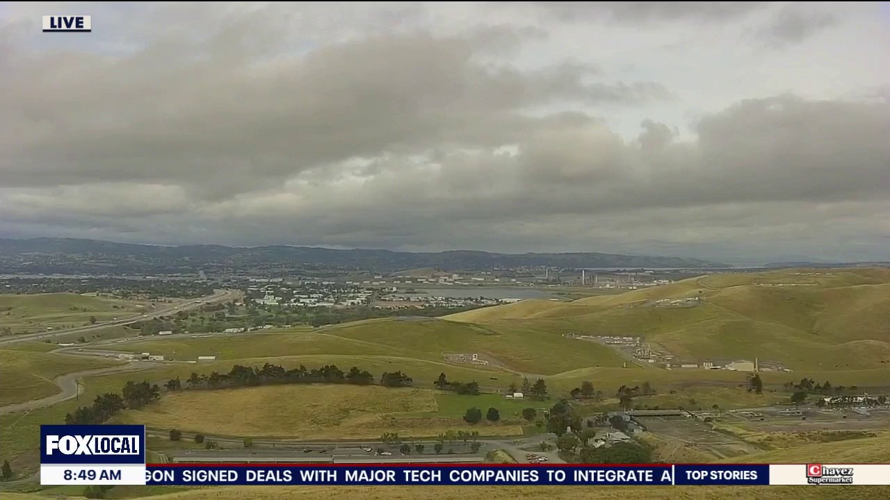
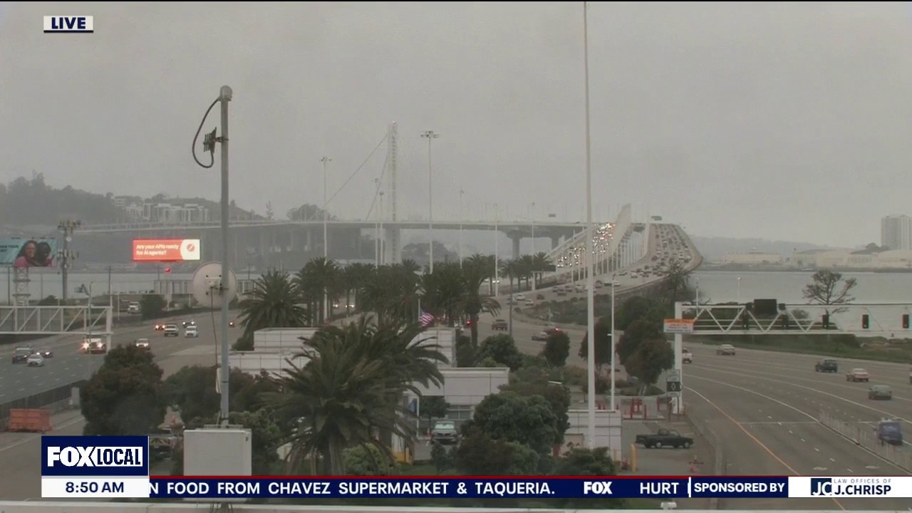
The cool, unsettled weather pattern will stick around. Your Monday forecast features mostly cloudy skies with the chance of drizzle. A band of showers is expected to sweep into the area Monday night - early Tuesday morning. Temperatures will rebound later in the week. The upcoming weekend will be warm to hot (80s and 90s).
The cool, unsettled weather pattern will stick around. Your Monday forecast features mostly cloudy skies with the chance of drizzle. A band of showers is expected to sweep into the area Monday night - early Tuesday morning. Temperatures will rebound later in the week. The upcoming weekend will be warm to hot (80s and 90s).
Mostly cloudy, cool, and damp today
Happy Sunday everyone. The cloudy, cool, drizzly pattern continues for your Bay Area Sunday. A chance of showers will increase on Monday and part of Tuesday before we dry out and warm up midweek.
Happy Sunday everyone. The cloudy, cool, drizzly pattern continues for your Bay Area Sunday. A chance of showers will increase on Monday and part of Tuesday before we dry out and warm up midweek.
Mostly cloudy and a little damp today
Happy Saturday everyone. A system dropping down the coast will bring cloudier, cooler weather, and even a chance of drizzle today through Monday.
Happy Saturday everyone. A system dropping down the coast will bring cloudier, cooler weather, and even a chance of drizzle today through Monday.
Cooler weather on the way for the weekend
A system skirting the coast this weekend will bring a drop in temps. and boost a chance of drizzle and sprinkles for the weekend. Unsettled weather is expected to continue into next week.
A system skirting the coast this weekend will bring a drop in temps. and boost a chance of drizzle and sprinkles for the weekend. Unsettled weather is expected to continue into next week.
Friday clouds
We are expecting another mild to warm day away from the coast. High clouds will be increasing throughout the day. Friday afternoon highs should range from the low 60s at the foggy coast to the low 80s well inland. The weekend forecast features more clouds and cooler temperatures. Drizzle could also return to the coast.
We are expecting another mild to warm day away from the coast. High clouds will be increasing throughout the day. Friday afternoon highs should range from the low 60s at the foggy coast to the low 80s well inland. The weekend forecast features more clouds and cooler temperatures. Drizzle could also return to the coast.
Mild to warm pattern
The mild to warm pattern continues. Patchy fog will resurface near the coast Thursday morning. Highs should range from the low 60s near the shoreline to the low 80s inland. Clouds will be moving in this weekend. Cooler temperatures are expected too.
The mild to warm pattern continues. Patchy fog will resurface near the coast Thursday morning. Highs should range from the low 60s near the shoreline to the low 80s inland. Clouds will be moving in this weekend. Cooler temperatures are expected too.
Warming trend
Our weather pattern is shifting around - more sunshine and a warming trend! Patchy fog will resurface Tuesday morning. The afternoon forecast features mostly sunny skies and warmer temperatures. Highs should range from the low 60s to the low 70s.
Our weather pattern is shifting around - more sunshine and a warming trend! Patchy fog will resurface Tuesday morning. The afternoon forecast features mostly sunny skies and warmer temperatures. Highs should range from the low 60s to the low 70s.
Dryer, warmer weather on the way
Happy Monday everyone. Despite a chance of drizzle lingering in our hills, a subtle warm up is expected for the afternoon today. The warming trend will continue into the final days of April with some areas eventually reaching 80 degrees.
Happy Monday everyone. Despite a chance of drizzle lingering in our hills, a subtle warm up is expected for the afternoon today. The warming trend will continue into the final days of April with some areas eventually reaching 80 degrees.
Warmer temps on the way
Lingering moisture will lead to another round of overcast Monday morning. There is also the chance of drizzle. Partly sunny skies will highlight the afternoon forecast. Highs should range from the upper 50s to the upper 60s. Sunshine and warmer temperatures will top our weather headlines by midweek. We get a break from the rain!
Lingering moisture will lead to another round of overcast Monday morning. There is also the chance of drizzle. Partly sunny skies will highlight the afternoon forecast. Highs should range from the upper 50s to the upper 60s. Sunshine and warmer temperatures will top our weather headlines by midweek. We get a break from the rain!
A bit more sunshine on the way
Happy Sunday everyone. Cloudy, cool and a little damp to start your day with areas of drizzle. We'll see a bit more sunshine this afternoon, but it stays breezy and temps. below normal. In the Sierra, snow levels drop to about 5500' with minor travel impacts. Warmer days on the way.
Happy Sunday everyone. Cloudy, cool and a little damp to start your day with areas of drizzle. We'll see a bit more sunshine this afternoon, but it stays breezy and temps. below normal. In the Sierra, snow levels drop to about 5500' with minor travel impacts. Warmer days on the way.
Cloudy, cool, drizzly weekend for most
Happy Saturday everyone. Keep a light jacket handy as cloudy, unseasonably cool weather will join us for most of the weekend with drizzle and spotty showers as well. Highs will range from low 60s at the coast to mid 60s inland.
Happy Saturday everyone. Keep a light jacket handy as cloudy, unseasonably cool weather will join us for most of the weekend with drizzle and spotty showers as well. Highs will range from low 60s at the coast to mid 60s inland.
Cooler, unsettled weather for the weekend
Mostly cloudy skies and drizzle will be how we start the mornings both Saturday and Sunday followed by partly sunny, unseasonably cool afternoons.
Mostly cloudy skies and drizzle will be how we start the mornings both Saturday and Sunday followed by partly sunny, unseasonably cool afternoons.
More clouds on the way
Looks like the clouds return Friday. We are also expecting cooler temperatures. Highs should range from the low 60s to the low 70s. The weekend forecast features partly to mostly cloudy skies with the slight chance of a few showers.
Looks like the clouds return Friday. We are also expecting cooler temperatures. Highs should range from the low 60s to the low 70s. The weekend forecast features partly to mostly cloudy skies with the slight chance of a few showers.